Month: June 2020

Jenkin Road

  • Jenkin Road
  • Length: 0.52 miles
  • Avg gradient: 11%
  • Peak gradient: 17.2% (the sign at the bottom says 33% but I don’t believe that)
  • Difficulty: 4/5
  • Likelihood of encountering unpleasant motor-vehicles: 3/5
  • Elevation gain: 310 ft
  • Strava

Something special for the 25th hill on sheffieldcyclingclimbs.com.

Many of Sheffield’s hills are fairly anonymous, some have a little local notoriety and some have enough of a reputation to feature in the Tour de France. Jenkin Road (or the Côte de Wincobank Hill as it was renamed for The Grande Départ in 2014) is one of those hills.
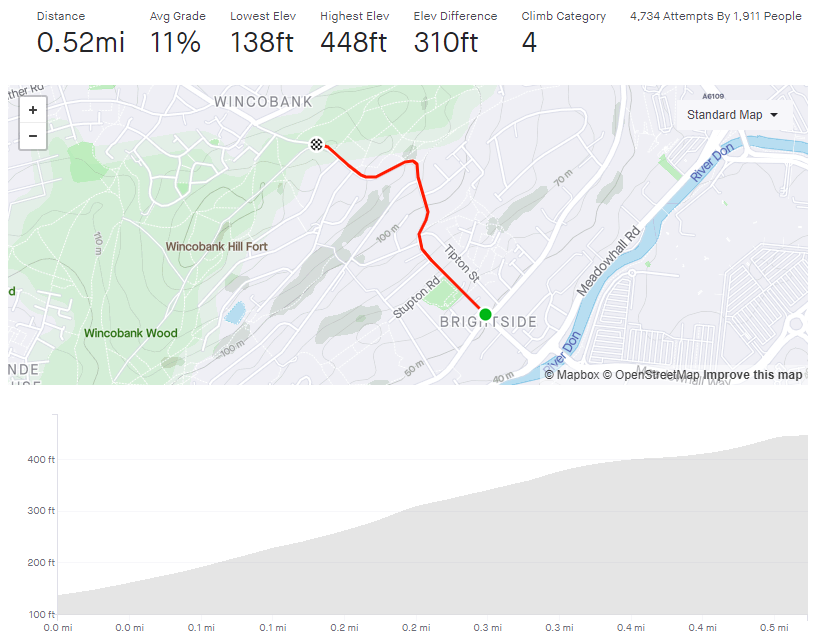
As a result of its reputation, I’d been putting off attempting this climb for some time but finally relented during lockdown, figuring that I’d be delaying fewer cars as I plodded upwards. The fact that I do every climb at least twice (once to do the climb and a second time to take photos) just added to the trepidation.
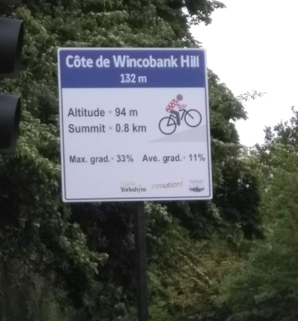
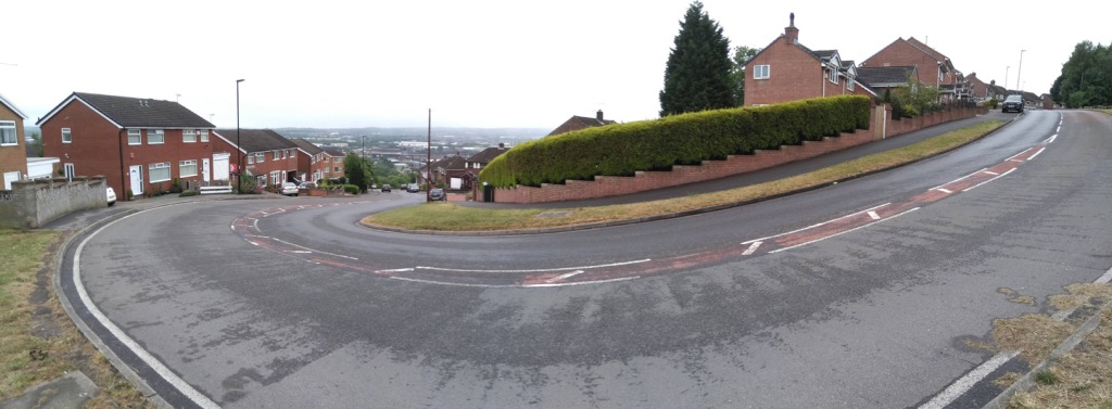
Starting from the junction with Holywell Road, you’re already at a disadvantage, having had to stop at the crossroads and therefore beginning from a standing start. It’s here that the sign, commemorating Jenkin Road’s role in the 2014 Tour, is placed. It states that the average gradient is a perfectly acceptable 11% but the maximum gradient is a formidable 33%. I think that’s an exaggeration and Strava and Veloviewer both agree, putting the peak gradient closer to 16.8%. Jenkin Road’s steepest segment is slightly wiggly, so maybe in a straight line it’s closer to 33%.
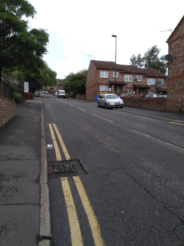
The hill begins at a fairly standard 10% as it stretches ahead of of you. With houses, playing fields and a church, there’s not much yet to mark this climb as distinct from the likes of Mertyle Road but, just after you pass the church, the road curves to the right, the gradient ramps up and, ahead of you, you can see why the hill made it into the Tour.

The road turns into a little S-bend here and the gradient hits 17.2% as it wiggles back and forth. Do your best here and don’t worry too much about any vehicles behind you, they’re as likely struggling up as much as you. As the hill relents a bit, down to about 12% as you pass Ridge View Road on your right, take a moment to regain a bit of strength (and have a look at the view behind you if you can) because you only about half way there.
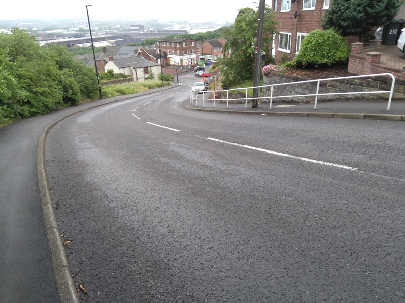
You’ll shortly reach a sweeping switchback, which starts easily enough but its a bit deceptive and you’ll notice the extra couple of percentage points on the gradient here. However, once you’re round the bend with Wincobank Common on your right, it’s the home stretch, even dropping down to a meagre 4.5% around the next corner. Once you’ve done that, you can see the final 9.5% hump approaching and shortly you’ll be at the top.  Well done.
You can see the pros on the 2014 Tour, climbing up the wiggly bit, below.

Now go and put on your yellow jersey and pretend you’ve just won the Tour De France.

Paradise Street

  • Paradise Street
  • Length: 0.04 miles
  • Avg gradient: 9%   Peak gradient: 9.2%
  • Difficulty: 1/5
  • Likelihood of encountering unpleasant motor-vehicles: 1/5
  • Elevation gain: 19 ft
  • Strava

A silly little climb in the city and a taste of the cobbled Paris Roubaix.

Recommended to me by a member of the CycleSheffield Chat forum, Paradise Street is a slightly ridiculous little cobbled hill just north of the cathedral.  Clocking in at a grand total of 0.04 miles, it’s not a foreboding challenge but don’t underestimate the impact of that cobbled surface and don’t get cocky like I did, try to sprint it, and end up more exhausted than climbing The Dale.

Starting at the junction of Queen Street, you can see the full extent of the consistent 9% hill in front of you. It’s not far. Normally, on short sharp hills you can blast it but the surface here really plays havoc with those plans. I’m glad that I’ve got suspension on mine, I can’t imagine what it’d be like on a fancy road bike. The only thing to be wary of is that, despite its single car width, Paradise Street is a two way road, so if you encounter a car coming the other direction, you’ll probably need to move out of the way. Still, it’s not far to return to the start and try again.

All you can really say for this road is head down, pedal away, see how quickly you can get up.

Whiteley Wood Road and Common Lane

  • Whiteley Woods Road and Common Lane
  • Length: 0.88 miles
  • Avg gradient: 6.6%   Peak gradient: 12%
  • Difficulty: 3/5
  • Likelihood of encountering unpleasant motor-vehicles: 3/5
  • Elevation gain: 308 ft
  • Strava

This is a utilitarian climb, in that it sole function is pretty much to get you out of suburbia, towards the Peak District. At the top, you’re on the edge of the countryside, ready to discover some absolutely lovely views.

The climb begins after a quick descent on Whitely Woods Road as it cuts through the woods themselves. The climb begins as you cross over the Porter Brook but it’s nothing serious here, as the gradient remains in the low single figures until you reach Wire Mill Dam. As the road curves left, the gradient creeps up but it still remains in single figures, where it stays for the short, straight section to the next bend.

The battle begins after you follow the road round the bend. It’s only 0.2 miles but it’s a slog. It gets slowly steeper as you grind up, hitting a peak of a 10.5% just before the cattery. However, the challenge here is more psychological than physical because the hill is so straight and with slightly boring fields either side there’s not much to look at on your way.

When you’re past the cattery, the road bends left once more and you’re well on your way to the apex as, shortly after, you turn onto Common Lane. From here, with every pedal, the gradient drops away and you find yourself at the start of Ringinglow Road, ready to get out to the Peaks.