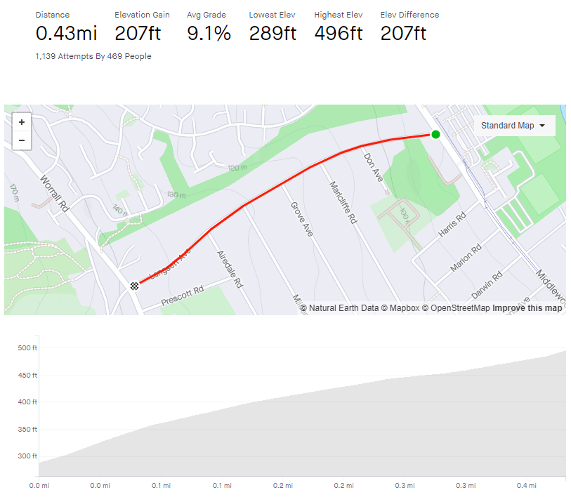
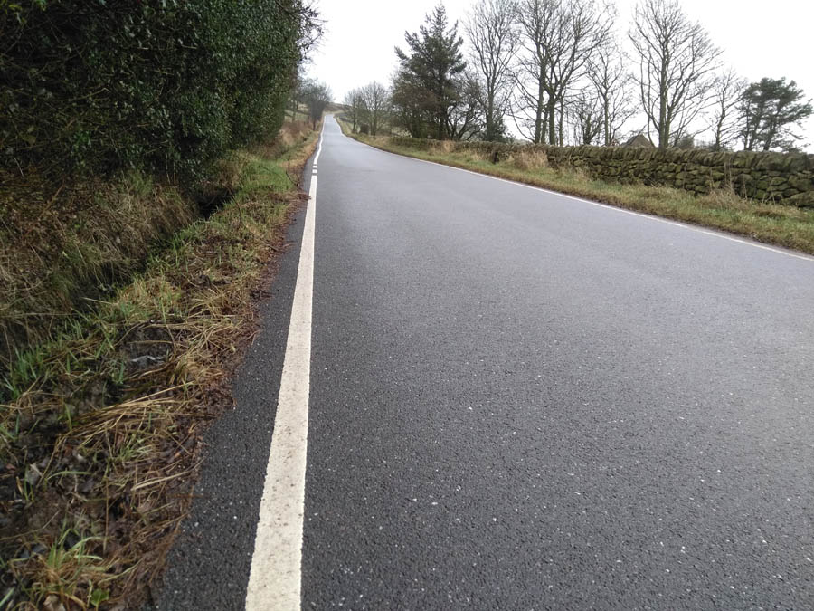
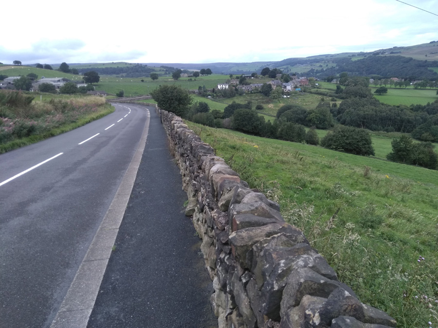
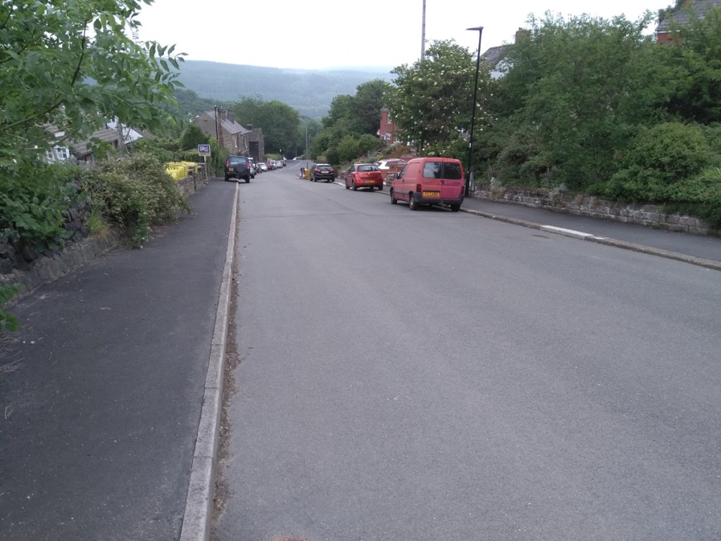
Middlewood Road, which you need to turn off to join Langsett Avenue, is horrible. Cars go far too fast and a the road is caked in tram tracks a bit further on. While the traffic might be slower and the trams non-existent, Langsett Avenue is still an arse of a hill.
Whichever direction you approach from, you’ll probably not be carrying much speed into the start of the climb, which is harsh because the opening is the steepest section. There is a big ‘20’ painted on the surface, which could be for the speed limit or just telling you what the gradient feels like at this point.
To be fair, the road doesn’t actually get as steep as 20%, instead the gradient floats around the 14% mark until you pass Don Avenue, at which point it eases off slightly, down to around 9-10%. You will notice the difference but it’s still a bit of a slog.
As you pass each side road, the hill feels progressively less challenging and by the time you’ve reached Airdale Road it’s down to 4%. With only 0.1 miles to go, you’re greeted with a brief 12% ramp before the segment finally ends at the junction.
However, for the fullest Langsett Avenue experience, cross over Worrall Road and add the 12.5% Well Lane to the end of the climb. Icing on the cake.
Pea Royd Lane is a fairly well known road, having been used for many hill climb races including the National Championships, so I’m sure there are far more authoritative and informative descriptions of this notorious cycle elsewhere on the internet but, since you’re here, make yourself comfortable.
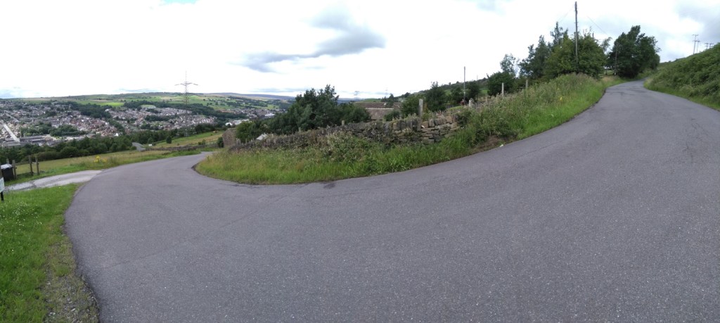
This climb begins before you even get to the start of Pea Royd Lane, requiring you to cycle for 0.2 miles up Hunshelf Road, at a not insignificant 7.7% average. Once you’re past the factories and the view begins to open out over Stocksbridge, you’ll see Croft House on your left and a switchback on your right: the beginning of Pea Royd Lane proper.
In Simon Warren’s 100 Greatest Cycling Climbs he says ‘the surface is terrible and gets worse’ but I think the road must have been resurfaced since then as it’s not too bad now, not that that makes the road any less steep. This section, up to the bridge, involves some of the steepest climbing, with the incline hovering around the upper teens, briefly breaking 20%.
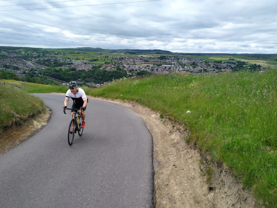
You’re given a short relent crossing the bridge but the hill is soon back to 15-16% on the approach to the next switchback. Take the bend as wide as you can (it is a quiet road but it’s not devoid of all traffic) and grab a look over your shoulder to appreciate how high you have come out of Stocksbridge. You’re now climbing at around 13-14% for 100 metres or so but this is the part I always find hardest as the end is still hiding from view.
The road shallows slightly as you pass a farm before picking right back up as you finally approach the apex, signified by black rocks jutting out of the hillside and which is hiding just around the corner.
Facing the far more difficult Kent Road, this is its own unique challenge, with both a higher average and peak gradient than its neighbour. At only 184 feet long, it’s not time consuming, just make sure you do it when there isn’t someone coming down the path.
At the start you will see two paths, make sure that you take the one on the left, as I think the right-hand one has a few steps. It’s cobbled, so you can pretend you’re in Belgium as you begin the 10% opening. As the path bends slightly, the gradient is up to 20% and continues increasing as you climb. Keep the momentum, as you pass some little mosaic bollards and you briefly touch a 30% incline. Then, like that, you’re at the top.
You can now tell all your mates that you cycled up a 30% gradient, just don’t tell them how long it was.
Likelihood of encountering unpleasant motor-vehicles: 0/5
Elevation gain: 83ft
Strava It won’t let me make one as it’s too short.
Possibly impossible?
Disclosure: I have never managed to climb this short hill to the end but I’m sure someone, somewhere can.
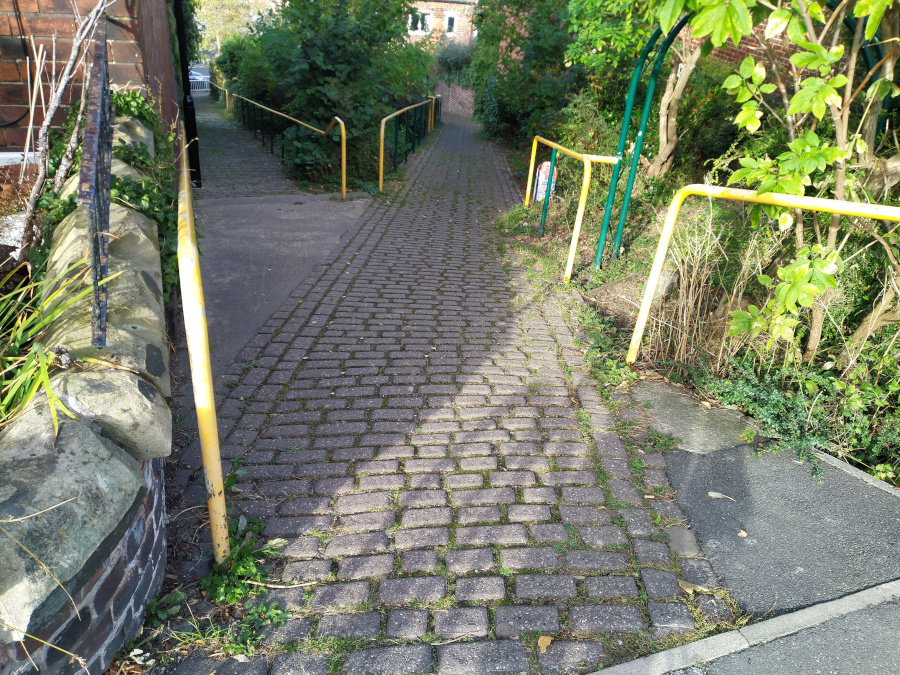
It’s probably a bit legally grey to cycle up here as, although it’s not actually signposted as a footpath, no reasonable cyclist would take their bike up here and I congratulate you if you even make it to the lamppost.
First of all, unless you can bunny hop three large steps into a metre-wide gennel, you’re starting from a standing stop on what RideWighGPS tells me is a 9% incline. Add to that, the surface is uneven cobbles and probably covered in leaves. It’s not an easy start. I found it hard enough to even begin but there is a handrail to help if you’re wobbling a bit too much. The path does a get a bit wider further up but your objective here is to get any momentum without hitting the sides.
If you manage to get going, well done, now just try not to ride into any stinging nettles, scrape a leg on the wall or skid on leaves, all while fighting with the very uneven surface that is slowly increasing, breaking double figures about 30 yards in. Travel about the same distance again you’ll see the lamppost where the path bends to the right, coinciding with the gradient reaching around 20%.
If that was the end, it would be an interesting little challenge (not to mention the potential hazard of someone walking down the path) but the final run to the end of the gennel is ridiculous. GPS recordings are wonky here because of all the tree cover but my GPS recordings puts it somewhere between 35-47%. 47% seems like an exaggeration but I wouldn’t be surprised if it is at least 40%. That’s approaching 1:1.
If you make it out of here, you are a cycle climb master.
In an area rich with challenging climbs (Jawbone Hill, Wheel Lane and Burnt Hill Lane, for example) this is slightly lower profile. Nestled on a quiet suburban street, it packs enough of a punch to warrant its inclusion in previous Magnificent 7 hill climb competitions.
Turning off the unpleasant Langsett Road onto Birch House Avenue, you’re immediately into a double-figure gradient for a dead straight 0.1 miles. This first quarter of the ride is fairly representative of the hill’s feel as a whole, so just plod on.
There’s a little relent as the road bends right and the gradient briefly drops to around 6% before picking right up again as you turn left on to Birks Wood Drive itself. You’re now on the steepest section of the climb, on the sweeping right hand bend, hitting a peak of almost 17%.
A short distance on, the houses drop away, revealing a pleasant view of Oughtibridge and the valley below. Appreciate it quickly before a line of trees hides it once more and you approach the final bend. The Strava segment says it’s only 10% but it looks steeper, not least as you’ll be taking the inside lane. Once you’re around the bend, though, it’s only a few more metres until the apex, and the option of dropping back into Oughtibridge to tackle a few of the other great climbs in the area.
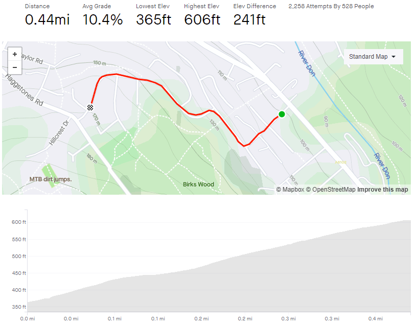
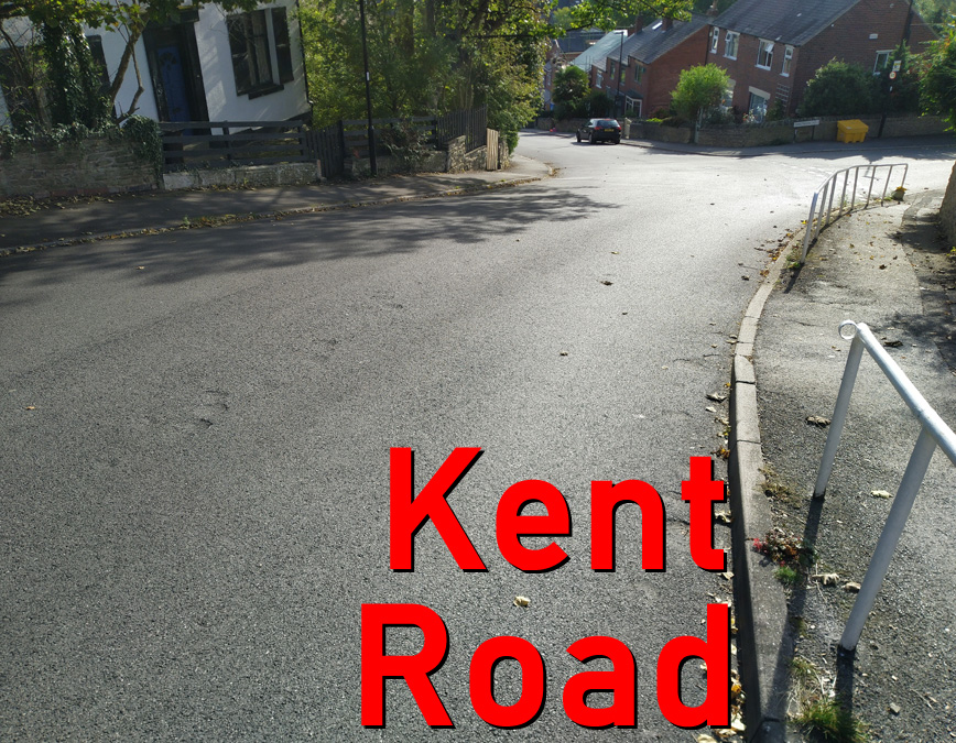
In any discussion about Sheffield’s steepest hills, there will be a few usual suspects; Hagg Hill, Jenkin Road and Blake Street, but it would be surprising if Kent Street didn’t also get a look in. Blake Street is often credited as Sheffield’s steepest but, despite being the same length, Kent Street has a slightly higher average gradient.
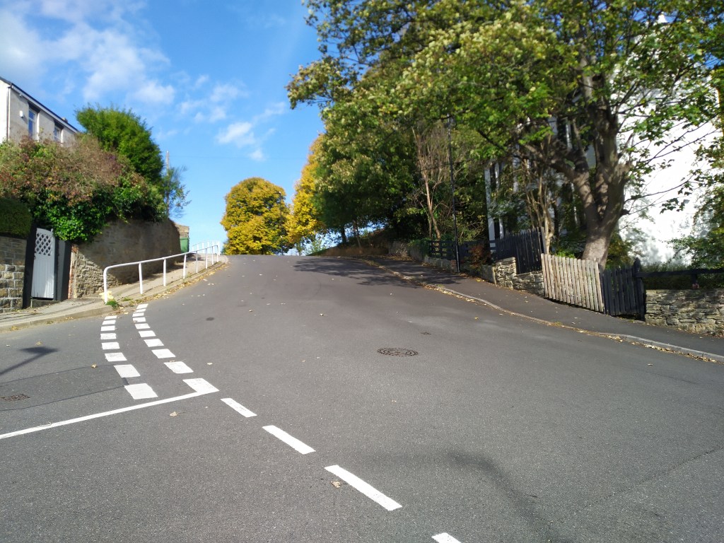
The start of the incline begins between Rushdale Avenue and Albert Road, facing north (there is an interesting footpath you can cycle up in the other direction but we’ll save that for another day). Unfortunately, Albert Road is a blind crossroads so, unless you can get a mate to stand there and give you the all clear, it’s safer to start at that junction (and also where the Strava segment begins).
You can see the handrail in the distance, that’s your target, where the road bends slightly to the right and kicks up steeply. Before that, you immediately begin on a 13.5% climb, and for every 15 metres or so, the gradient increases by about 1% (the maths here is very approximate but you get the idea) until you reach the railing.
It’s here that the hill breaks 20% for the final spike, which you’ll really feel as the apex slips into view. Well done, you can now arguably claim to have cycled up one of the city’s steepest hills.
It’s sweet but too short to be genuinely formidable.
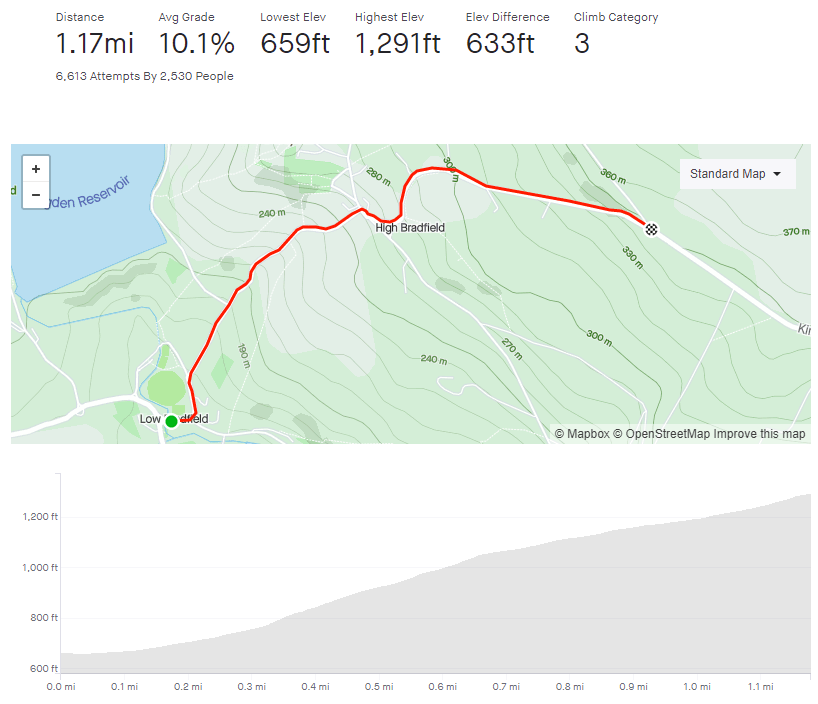
If you want to get from Low Bradfield to High Bradfield, unsurprisingly, it’s going to involve some climbing. The second half of this climb was one of the final climbs in Stage 2 of the 2014 Tour de France but, you’ll be glad to hear, the first section is much harder.
You begin in earnest in the quintessentially English village of Low Bradfield, with the cricket pitch behind you and the Post Office to your right (is that Mrs Goggins serving in there?). The start of the climb isn’t too foreboding at a steady 7% as it begins the ascent past houses and farm buildings towards the trees.
As you pass Smallfield Lane, you’ll notice a gradient increase into double figures, hitting the low 20s as the road wiggles under tree cover, soon hitting one of the most challenging bits of the climb. Photos of this section never capture how steep it really is. As you make it up a mild S-bend there is a bench to aim for (I had a sit down here the first time I attempted this hill) that I use as a mental marker for the climb easing off slightly (but only by about 5%). It’s relatively safe to zig-zag across the road here, if it helps, as most descending traffic is taking it cautiously and most ascending traffic is having as much difficultly getting up as you.
Once you’re around the right hand bend, you’ve got the (relative) ease of a section of 10-14%, so ease the pressure off the legs a bit before tackling the steep approach to the Old Horns Inn. There is a Strava segment saying that this bit is 31%, which I think is wrong but worth baring in mind for showing off to people who aren’t familiar with the road.
I think it is perfectly acceptable to take a couple of turns around the pub car park to get your breath back and legitimately claim that you didn’t stop on the climb before you tackle the ‘Côte de Bradfield’. Make sure Loxley Road is clear before crossing over on to Kirk Edge Road, where there’s a sign with some key stats, signifying the start of the Tour de France section. Although you have conquered the worst of this climb, the first blind bend in this section is a killer, just touching 20%, but feels harder as you need to stay on the inside to avoid any traffic coming the other way.
The landscape opens up here, with farmland stretching in all directions and you appreciate the 400 feet that you’ve already climbed. The remainder of the road is a steady, fairly straight climb, fluctuating around 10% (you might notice the occasional bit of faded Tour graffiti a la ‘Va Va Froome’ along the way) but feels harder because of what you’ve already achieved. Strava says the very end is only 13% but I’m sure it spikes closer to 20%. The first couple of times I did this hill, a sneaky little tailwind appeared just in time to push me to the summit. I hope you’re as fortunate as I was.
The reward for your efforts is one of the most fun, fast descents in the area. At almost 2 miles before you meet a junction, although slightly bumpy in places, riding down Kirk Edge Road makes the climb up Woodfall Lane and and the Côte de Bradfield worth the suffering.
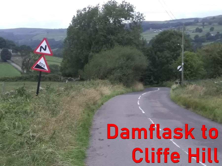
Don’t be lulled into a false sense of security when looking at the average gradient, this climb includes a chunk of descent and, at the very start, a couple of torturous turns.
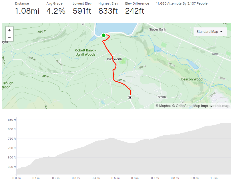
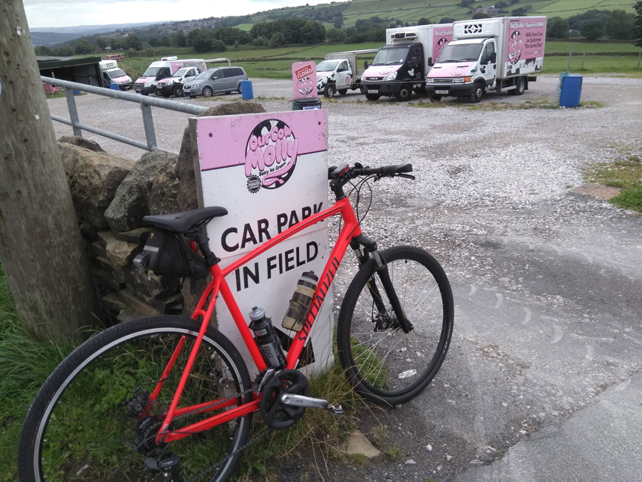
Begin at the south side of Damflask Reservoir, a body of water surrounded by numerous challenging cycle climbs. You could probably make a nice day trip to do them all in one go. The one we’re focusing on though probably has the hardest opening. Turning sharply on to Briers House Lane, the approach to the first switchback quickly reaches 9% before ramping up to 25% at the corner’s apex.
That’s the steepest bit of the climb over with quickly but you’ve still got about a mile to go before you reach Our Cow Molly and that ice cream you’ve been promised. It’s a similar distance to the next switchback but, this time, hovering around the 5% mark, so not so steep. Take glance to the right, looking out over the reservoir, to appreciate how high you have already climbed.
Strava says that the corner is only 12%, but it also says there is a little descent beforehand, so I think there must have been some GPS errors when this segment was made because there certainly isn’t a drop and I can’t believe that the second corner is any shallower than the first, especially as you need to be on the inside of this one.
The good news is that it’s a much gentler climb from here on. The straight section ahead fluctuates between 5-9%, and it was here, at the large stone marking the entrance to the hamlet of Dungworth, that I was originally going to end the climb entry but the hill does continue to ascend. So, carry onwards through the village and, as the road wiggles slightly, you’ll see an old phonebox (which now contains a defibrillator, I think) that marks the short descent before the final climb.
Stay on as the road bends around to the left and the view of the valley below really opens up. It’s a gentle climb, mostly staying in the low single figures, before you finally arrive in a place called, appropriately enough, ‘Hill Top’ and Our Cow Molly, with that ice cream you’ve been looking forward to.
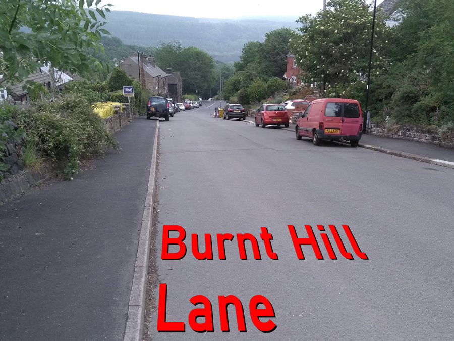
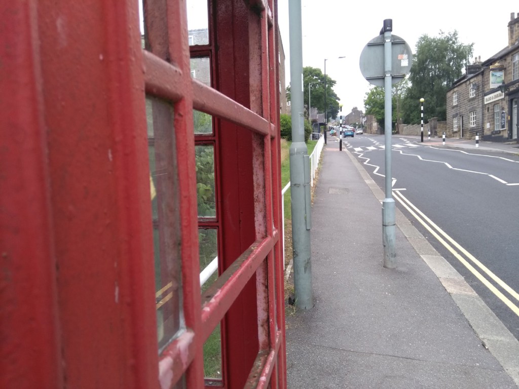
Starting from almost the same spot as Jawbone Hill, Burnt Hill Lane heads in the opposite direction and gives you a harder time than its more celebrated sibling.
You begin at the telephone box on Church Street, at one of Sheffield’s most dangerous junctions for cyclists (so take care on your way down)! Luckily you’re heading uphill and excess speed and momentum are not going to be troubling you much. You’re straight into it, as you head away from Oughtibridge, with a gradient fluctuating between 5 and 10%. The inconsistent gradient is a feature that Burnt Hill Lane retains for the entire climb.
Once you’ve passed the two churches the road mellows out for short period but, since there’s usually cars double parked all the way, the bigger challenge is going to be avoiding oncoming traffic or irate drivers behind you. I’ve been known to take a brief detour onto the pavement to allow cars to pass and if you do the same, since you’re going so slowly, you’ll not present a danger to any pedestrians.
The road bends to the left and the gradient picks up into double figures again, shortly passing the entrance to the excellent Wheel Lane on your right. The climb ramps up again as you pass Haggstones Road, holding around the 10% mark, and it’s here that you begin to cross into the countryside. Pedal on as the road begins to get more rural, much narrower and eventually surrounded on either side by fields. As you pass the third church of the climb, you hit the steepest 14.7% section: a blind and sharp 90° turn. Cross your fingers nothing is coming downhill!
The road eases off for about 300 metres, giving you a chance to appreciate the view, before ramping up to around 14% again, at the junction with Old Lane, a little track leading to a farm. There’s a bit of a false summit ahead but once you crown that, it’s single figures until you reach Coal Pit Lane and the end of the segment. You can either take Coal Pit Lane or continue straight on, both roads lead you to Kirk Edge Road and a couple of lovely descents.
It’s not as famous as the Cote de Oughtibridge and it’s harder but the pay off at the top is worth it. Just be careful descending, it can be quite hairy in places!
Cobnar Road is a residential street that begins innocently enough but it is truly lulling you into a false sense of security.
‘What’s going on here? This doesn’t seem too challenging and the gradient is only in single figures,’ you’ll think as you start the climb. Fair enough, Cobnar Road does begin unremarkably enough but what you might not notice straight away is how it gets progressively steeper, the further you progress.
When you pass Bingham Road, you might sense that the hill has sneaked into low double figures but nothing noteworthy. However, another 50 metres or so, at the junction with Wellcar Road and the ‘dead end’ road sign, the gradient suddenly spikes into the teens. It’s at this point that you realise how the start of the climb tricked you.
Looking up, all you can see the rising tarmac and what looks like an impenetrable wall of trees. Dig in here as the worst is yet to come. Luckily the road is fairly wide and quiet, so you’ve got wiggle room and few hazards as you wind your way up the hill. This is where the fun starts.
Keep your momentum and switch on to what looks like a footpath (it’s not labelled as such, so you’re not breaking any rules by cycling up it). The narrow path (featuring a handy handrail) disappears around a blind corner – so you’ll have to hope that you’re not going to meet anyone walking down the opposite direction – and ramps up to a gradient of 17 – 18%. It’s only for 100m or so but, because of the path’s width and probably being slippery with leaves, there’s no room for mistakes. The last time I did it, I very nearly came off the tarmac and into the little ditch next to the path.
I seriously put Cobnar Road on a par with Hagg Hill, which is the bar against which I judge all other hills. So, if you get to the top without stopping, take a moment to get your breath back and congratulate yourself on, not only defeating such a cheeky beast of a climb but probably one of the most challenging hills in Sheffield.
*GPS coverage is a bit wonky under the trees at the top, with both Strava and Veloviewer saying an incline of almost 40%. That seems excessive but I wouldn’t be surprised if it does briefly break 30% at the end.