Tag: 1-1.5 miles

Damflask to Cliffe Hill

  • Damflask to Cliffe Hill
  • Length: 1.08 miles
  • Avg gradient: 4.2%   Peak gradient: 25%
  • Difficulty: 3/5
  • Likelihood of encountering unpleasant motor-vehicles: 2/5
  • Elevation gain: 242ft
  • Strava

From the reservoir to the ice cream.

Don’t be lulled into a false sense of security when looking at the average gradient, this climb includes a chunk of descent and, at the very start, a couple of torturous turns.

Begin at the south side of Damflask Reservoir, a body of water surrounded by numerous challenging cycle climbs. You could probably make a nice day trip to do them all in one go. The one we’re focusing on though probably has the hardest opening. Turning sharply on to Briers House Lane, the approach to the first switchback quickly reaches 9% before ramping up to 25% at the corner’s apex.

That’s the steepest bit of the climb over with quickly but you’ve still got about a mile to go before you reach Our Cow Molly and that ice cream you’ve been promised. It’s a similar distance to the next switchback but, this time, hovering around the 5% mark, so not so steep. Take glance to the right, looking out over the reservoir, to appreciate how high you have already climbed.

Strava says that the corner is only 12%, but it also says there is a little descent beforehand, so I think there must have been some GPS errors when this segment was made because there certainly isn’t a drop and I can’t believe that the second corner is any shallower than the first, especially as you need to be on the inside of this one.

The good news is that it’s a much gentler climb from here on. The straight section ahead fluctuates between 5-9%, and it was here, at the large stone marking the entrance to the hamlet of Dungworth, that I was originally going to end the climb entry but the hill does continue to ascend. So, carry onwards through the village and, as the road wiggles slightly, you’ll see an old phonebox (which now contains a defibrillator, I think) that marks the short descent before the final climb.

Stay on as the road bends around to the left and the view of the valley below really opens up. It’s a gentle climb, mostly staying in the low single figures, before you finally arrive in a place called, appropriately enough, ‘Hill Top’ and Our Cow Molly, with that ice cream you’ve been looking forward to.

Burnt Hill Lane

  • Burnt Hill Lane
  • Length: 1.26 miles
  • Avg gradient: 8.7%   Peak gradient: 14.7%
  • Difficulty: 3/5
  • Likelihood of encountering unpleasant motor-vehicles: 3/5
  • Elevation gain: 583ft
  • Strava

Jawbone Hill’s evil twin.

Starting from almost the same spot as Jawbone Hill, Burnt Hill Lane heads in the opposite direction and gives you a harder time than its more celebrated sibling.

You begin at the telephone box on Church Street, at one of Sheffield’s most dangerous junctions for cyclists (so take care on your way down)! Luckily you’re heading uphill and excess speed and momentum are not going to be troubling you much. You’re straight into it, as you head away from Oughtibridge, with a gradient fluctuating between 5 and 10%. The inconsistent gradient is a feature that Burnt Hill Lane retains for the entire climb.

Once you’ve passed the two churches the road mellows out for short period but, since there’s usually cars double parked all the way, the bigger challenge is going to be avoiding oncoming traffic or irate drivers behind you. I’ve been known to take a brief detour onto the pavement to allow cars to pass and if you do the same, since you’re going so slowly, you’ll not present a danger to any pedestrians.

The road bends to the left and the gradient picks up into double figures again, shortly passing the entrance to the excellent Wheel Lane on your right. The climb ramps up again as you pass Haggstones Road, holding around the 10% mark, and it’s here that you begin to cross into the countryside. Pedal on as the road begins to get more rural, much narrower and eventually surrounded on either side by fields. As you pass the third church of the climb, you hit the steepest 14.7% section: a blind and sharp 90° turn. Cross your fingers nothing is coming downhill!

The road eases off for about 300 metres, giving you a chance to appreciate the view, before ramping up to around 14% again, at the junction with Old Lane, a little track leading to a farm. There’s a bit of a false summit ahead but once you crown that, it’s single figures until you reach Coal Pit Lane and the end of the segment. You can either take Coal Pit Lane or continue straight on, both roads lead you to Kirk Edge Road and a couple of lovely descents.

It’s not as famous as the Cote de Oughtibridge and it’s harder but the pay off at the top is worth it. Just be careful descending, it can be quite hairy in places!

Jawbone Hill / Cote De Oughtibridge

  • Jawbone Hill / Cote De Oughtibridge
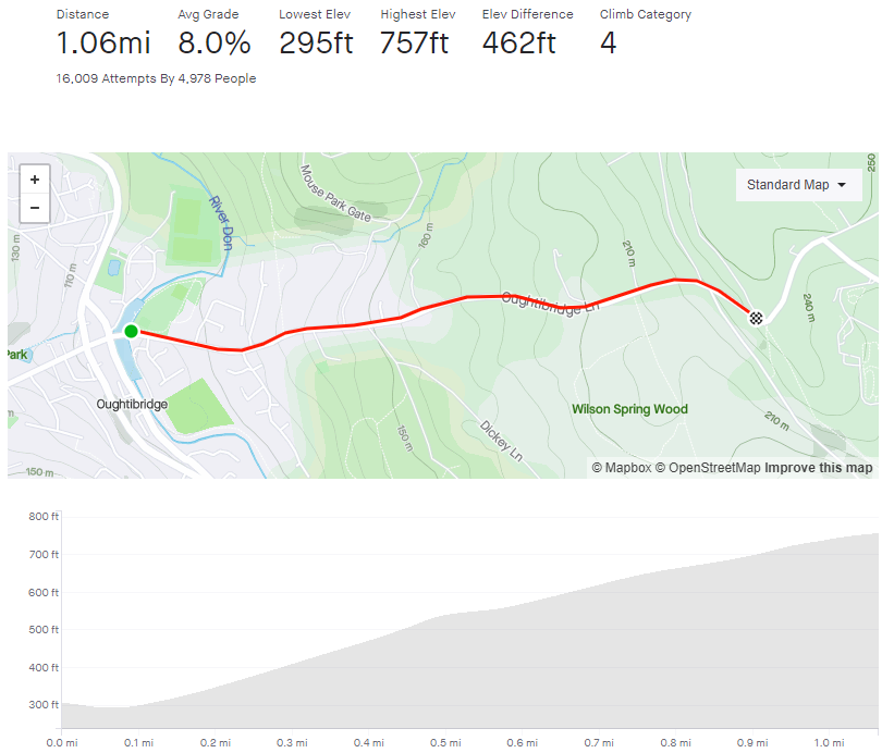
  • Length: 1.06 miles
  • Avg gradient: 8%   Peak gradient: 13%
  • Difficulty: 3/5
  • Likelihood of encountering unpleasant motor-vehicles: 4/5
  • Elevation gain: 462ft
  • Strava

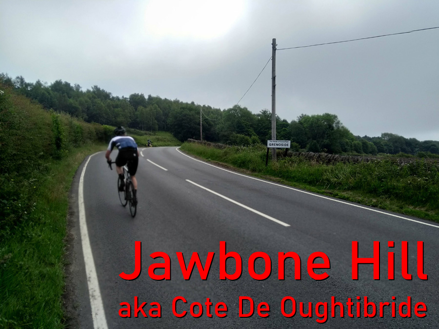
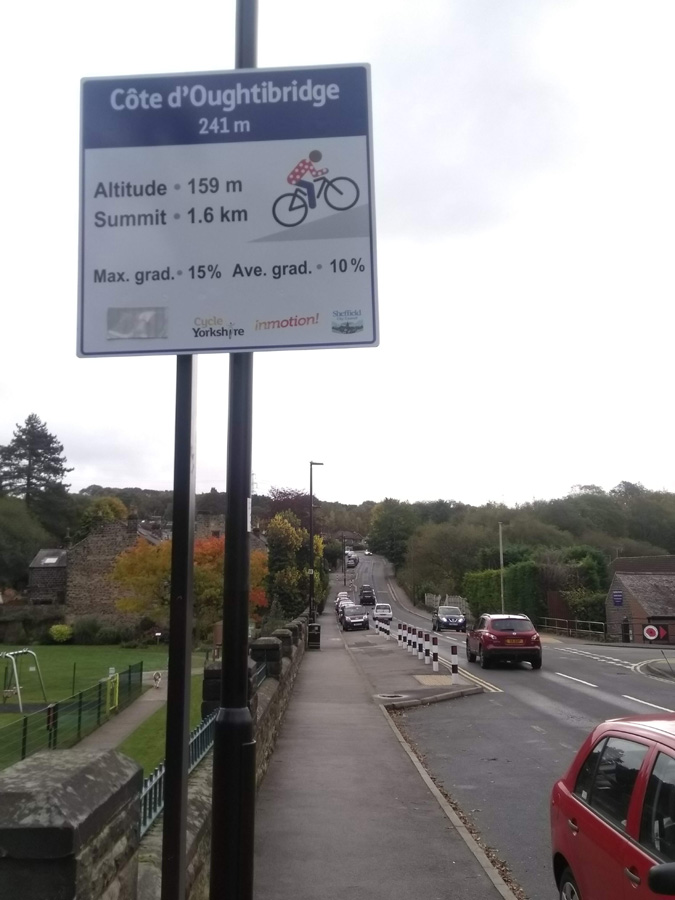
Described as possibly ‘the most decisive climb of the Tour De France’s visit to Yorkshire,’ The Cote De Oughtibridge (or Jawbone Hill to its friends) is a slog of a climb with a few false summits along the way.

The Strava segment starts at Grand Depart sign but it’s actually a short distance before the incline begins. Similarly, the segment ends at the Birley Stone, despite there being a few more feet to climb after that point.

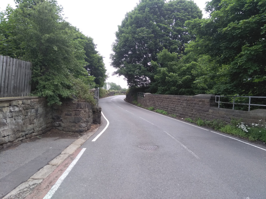
With the park on your left, the start doesn’t look too foreboding, at around 6%, but by the time you’re passing The Pheasant pub, the hill has already sneaked into double figures at 11%. A short way on from this you’ll find that the road narrows as you cross over a railway line. Plod on and hope that you’re not be being followed by an impatient motorist unable to overtake you.

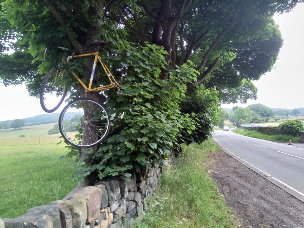
After the wiggle of the railway bridge, you’re onto the steepest 13% segment of the climb, which it roughly maintains until you reach Greenhead House Farm and The Little Sausage Shop. Rumour has it that somewhere on Jawbone Hill is a ‘Scotch Egg Shop’ but I suspect that, in reality, it’s this sausage shop they’re thinking of. Along here, on your left, you will spy the first of two reminders of the Tour De France’s visit: a yellow painted bike fixed to a metal ‘Shimrod’ sign, and shortly afterwards, opposite the farm, a battered old bike tied up in a tree.

Once you’re past the sausage shop, the gradient drops to a more palatable 5.5% but don’t be fooled, this is just the first false summit! The climb continues, slipping back up to 9.5% as the road bends to the right. You are well into the countryside now and while the steepness does relent a little, the hill is just playing with you. It’s got one last stinker in store.

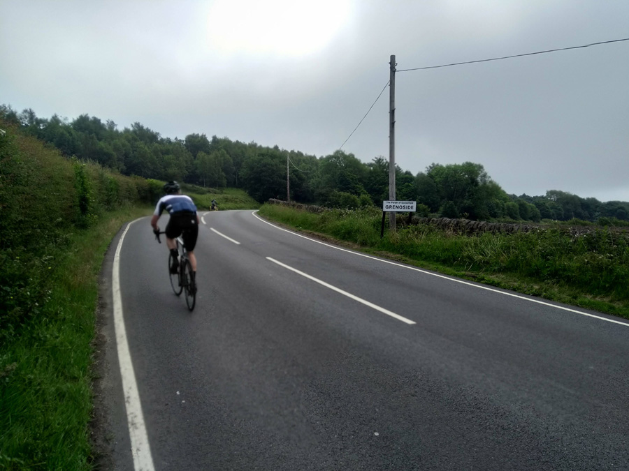
The road begins another right-hand bend and, as you pass the Grenoside sign, you feel that must be the apex…but not quite! Although it’s apparently only 6.5%, the final 150 yards up to the Birley Stone always feels much harder than it should.

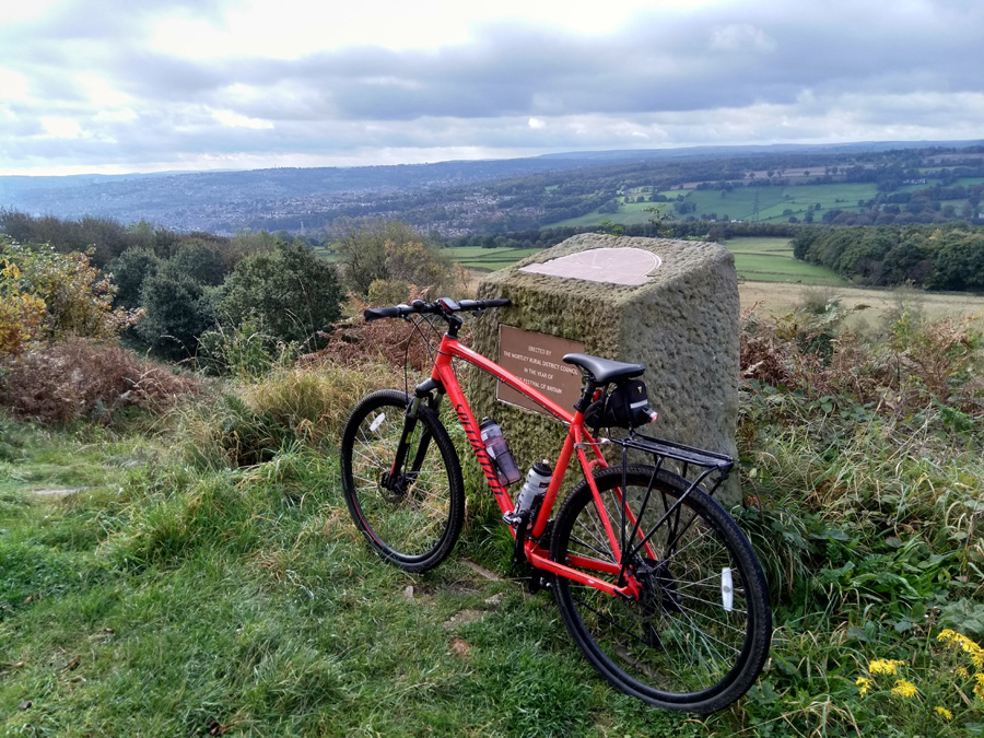
The end of the segment might not be the absolute top of the hill but it’s a great place to stop and take in the view over Sheffield. It’s also a great place to turn around and speed right back down to Oughtibridge.

Douse Croft Lane to the valley top

  • Douse Croft Lane to the valley top
  • Length: 1.12 miles
  • Avg gradient: 6%   Peak gradient: 14%
  • Difficulty: 3/5
  • Likelihood of encountering unpleasant motor-vehicles: 1/5
  • Elevation gain: 377 ft 
  • Strava

Situated out in the lovely Mayfield Valley, this hill is snuggled out amongst a wealth of winding country hills. It’s an area well worth exploring and never too far from civilisation.

You’ll approach this climb from either Brown Hills Lane or Harrison Lane, both of which send you down Gorse Lane. It’s quite a speedy drop with a sharp, blind bend just before you hit the climb. For safety’s sake you’ll need to pull on the brakes which unfortunately will cost you some momentum for the start of the climb.

One of the consolations of this hill is that the toughest parts are out of the way first, including the immediate sharp bend to the right at 14%. Once you’re around that, you can see the next bend approaching but the gradient only drops a few points here, and surprisingly, shows up as less steep around the switchback. It certainly doesn’t feel easier.

Wiggle your way up, as the Mayfield Valley opens up on your left, and around the next right hand bend, with the gradient remaining in the low double figures as you pass Harrop Lane on the left. You’ve now got a steady 6-7% climb for about 0.3 miles, returning to double figures as you approach the cottage and the junction to Fulwood Lane, where you turn right.

The hard bit is done now but it’s worth carrying on. The road floats around the low single figures and only once briefly touches 6% (it’s this section that has reduced the average gradient of the segment) but the views over the valley towards Sheffield are lovely. Once you’re reached the top you’ll be greeted with one of my favourite vistas of Sheffield.

Curbar Edge

  • Length: 1.1 miles
  • Avg gradient: 10%   Peak gradient: 15.2%
  • Difficulty: 4/5
  • Likelihood of encountering unpleasant motor-vehicles: 1/5
  • Elevation gain: 598 ft
  • Strava

There is pretty much nothing that I can say about Curbar Edge that hasn’t already been said in greater detail and with more authority elsewhere, not least Simon Warren’s 100 Greatest Cycling Climbs and James Allen’s 50 Classic Cycle Climbs but as it is what I’d consider a headline hill, it would be remiss of me to not include it here.

I’d driven up to Curbar Gap many times before, heading for family walks along the edge, so I was familiar with the hill, its two sweeping bends and the towering gritstone rocks that give the hill its character. It’s an even more impressive climb when you’re on a bike.

You start in the village of Curbar itself, next to All Saint’s Church, and it’s from here that you head up the innocuous looking Curbar Lane. As you pass The Old Vicarage on your right, the gradient is immediately into double figures, reaching 14.5% as the road bends to the right. This is the steepest section of the whole climb, which is a good thought to keep in mind as you progress up the hill, eventually passing a red telephone box at a crossroads.

The climb now drops to a more pleasant 6-7% for a straight section, lined with rather nice looking houses with big gardens. You’ve pretty much reached the halfway mark when you pass the national speed limit sign, which sees the gradient return to around 10-11% and, more impressively, the countryside open up and the appearance of Curbar Edge, loom ominously above you.

The steepness remains fairly consistent around the first sweeping bend and then reaches 11.5% as you head towards the second, sharper corner. The views from here more than make up for the additional challenge though. Just try not to focus on the ridge of Curbar Gap which, at this point, still seems very high up and very far away.

Grind on around the next bend and, once you’ve passed a gate into a field on your right, I always feel like you’re pretty much there. You still have to cycle 0.3 miles and climb 130 ft but it’s broadly straight with a gradient of less than 10% and the views alone will keep your legs powered until you reach the car park at the peak.

Curbar Edge is a beautiful climb worth travelling for.