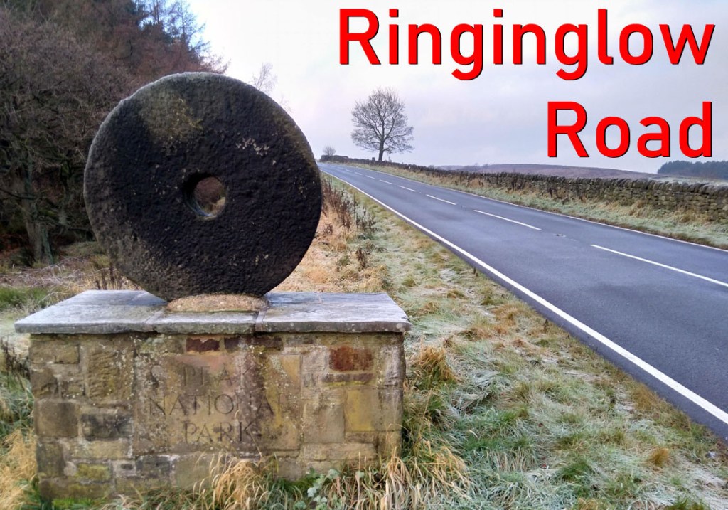
- Ringinglow Road (from Bents Green)
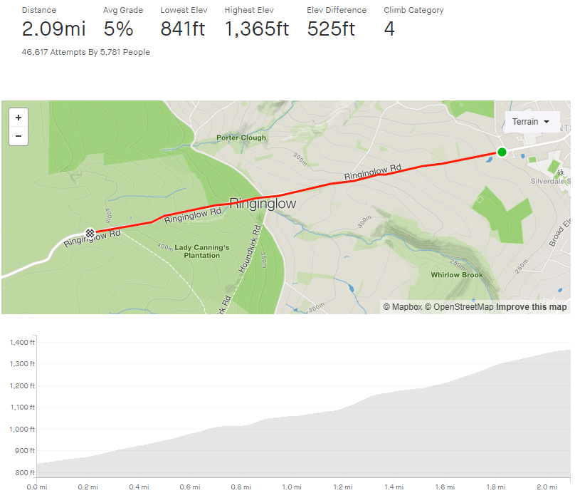
- Length: 2.09 miles
- Avg gradient: 5% Peak gradient: 10.6%
- Difficulty: 3/5
- Likelihood of encountering unpleasant motor-vehicles: 3/5 (It’s a 50/50 on driver attitude, despite plenty of available passing space).
- Strava
Ringinglow Road is a steady gateway into the Peak District. Leaving the suburbs of Bents Green behind, you’ll soon find yourself atop the world, on the edge of some of the most beautiful scenery in the country. While Ringinglow Road can feel a bit of a slog, with it’s arrow straight direction, each turn of the crank gets you closer to some stunning countryside (and extremely fun descents). Keep that in mind and you’ll be at the top in no time.
Starting at the junction of Common Lane, Ringinglow Road stretches ahead, well into the distance. Never appearing too steep, it does have a couple of sneaky lumps waiting for you. The hill’s first, tree-lined, half mile isn’t too strenuous, rarely touching 5% but just as the trees give way to reveal rolling countryside and you pass some farmhouses, a couple of cheeky spikes appear doing their best to pull up the average gradient.
The road briefly flattens out at Hangram Lane (which is a speedy descent) giving you a moment to recharge your legs and power on to the one mile mark and The Norfolk Arms pub. Ignore the turnings and head straight on. Once you’ve tackled a short 10.9% section you’ll soon be crossing into the Peak Distrct, marked by an iconic millstone. From here it’s a steady slog upwards with the Lady Cannings Plantation on your left and ever more sprawling moorland on your right. Shortly passing the byway to Houndkirk Moor (and Lady Cannings’ MTB trails) and you’re at the top of the segment.
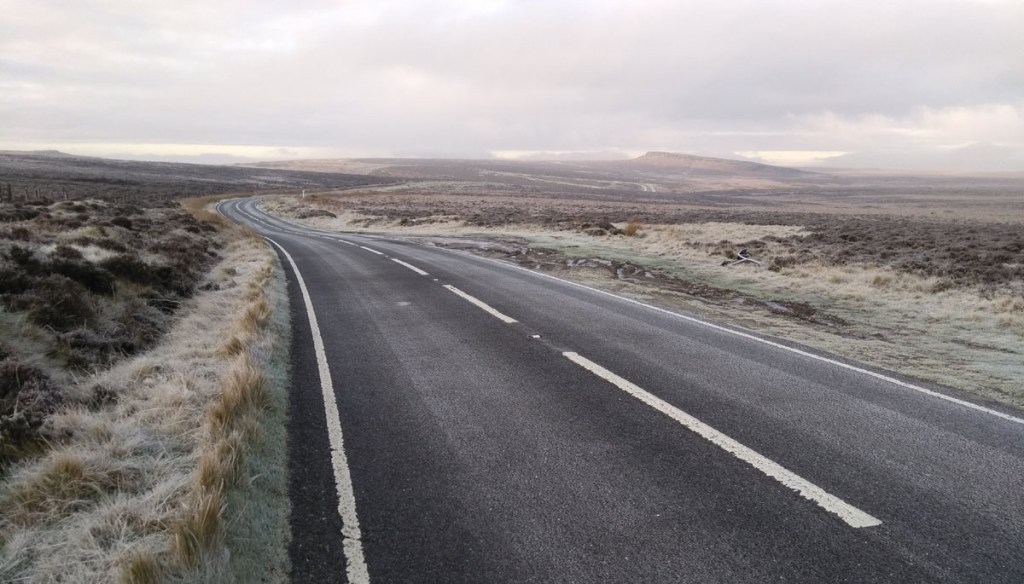
A little further on and you are presented with the glorious sight of Stanage Edge (above) in the distance and a couple of very enjoyable options downhill into Hathersage.
