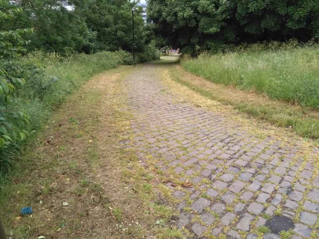
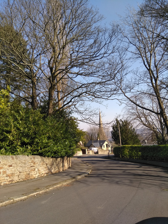
A recommendation from the CycleSheffield FB forum, this a little hill that I would never have come across otherwise and serves as a nice partner to Paradise Street. If you’re still craving the Belgian taste of cobbles, this is one to have a go at.
First off, look at the length. This is a sprint, not a marathon but, much like when I attempted Paradise Street and Blake Street before that, don’t try to show off and go in bigger than you can, as you may well find yourself embarrassingly panting, out of breath halfway up this rather short hill. Not that that happened to me, of course…
Bungay Street is out the back of the train station, a path cutting through Sheaf Valley Park and you can see the top from the bottom, so just blast onwards and upwards but watch out for pedestrians – I imagine it could be quite busy during commuter times. It commences at about 6.8% and the gradient steadily increases until you reach 12% at the top, where the path meets South Street and the climb concludes, with a great view across the city.
Just like Paradise Street, it’s head down, pedal away, see how quickly you can get up.
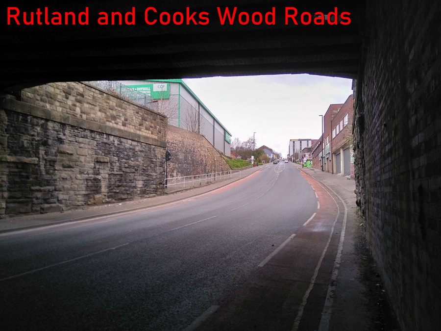
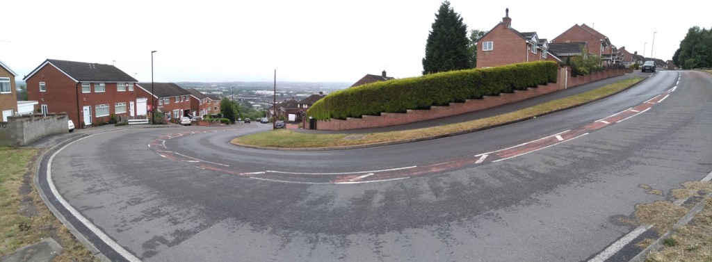
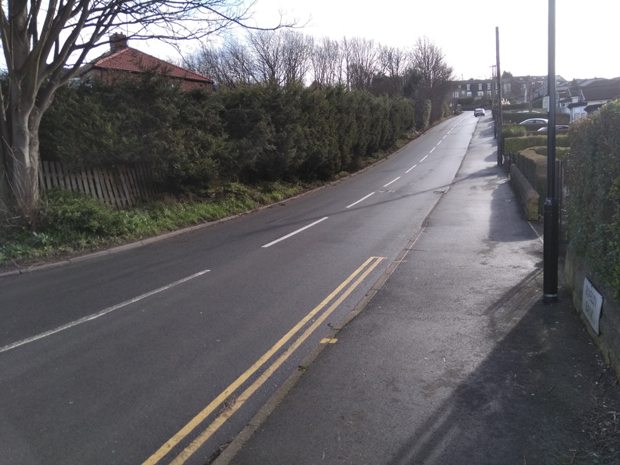
Pre-bike, I often used to commute this way, so Rutland Road was one of my earliest introductions to what Sheffield hills are like – even though I was in the car. As a consequence, this hill had a slightly foreboding reputation (in my head at least) and it was a while before I tackled it. When I finally did, and managed to beat it, it felt like a real achievement. However, it was a long time until I added Cooks Wood Road on the end.
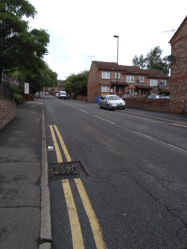
Starting under the railway bridge, the road stretches far up ahead of you, although you’ll probably not be able to see it for all the cars. This is not a quiet climb and you will get some form of aggressive motor vehicle pass you. The photos here were all taken at the start of the COVID-19 lockdown and I still got close-passed. You won’t ever see the road it as quiet at this otherwise.
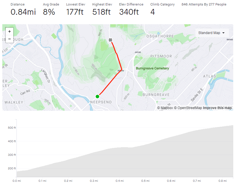
For the first third, it’s a fairly steady 9-10%, with not much to look at except a large variety of industrial units, so just head down and try not to get hit by a grumpy motorist. As you reach Parkwood Springs and the Sea Cadet Corps, on your right, the road flattens for a short run to the traffic lights.
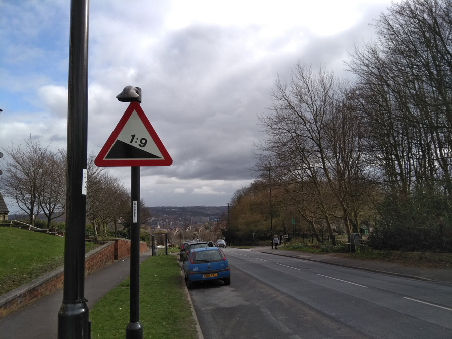
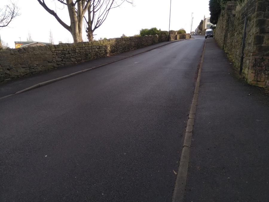
If you’re lucky, you’ll get a red and can have a legitimate breather before taking the left turn onto Cooks Wood Road. You’re straight into the climb again and although it never gets more than 2% steeper than Rutland, Cooks Wood Road feels a lot more challenging. There’s no obvious landmarks but near the bus stop, the road ramps up and you’ll need to drop into that lower gear for another 0.1 mile, until you pass the entrance for Parkwood Springs on your left (an old style 1:9 gradient sign still remains on the other side of the road). The Strava segment continues for another 350 yards or so but once you’re here, you’ve done the heavy lifting.
Hopefully you made it up in one piece and, if you fancy a change of tempo, you could always ride the Parkwood Springs MTB track back downhill.
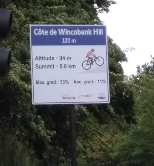
Many of Sheffield’s hills are fairly anonymous, some have a little local notoriety and some have enough of a reputation to feature in the Tour de France. Jenkin Road (or the Côte de Wincobank Hill as it was renamed for The Grande Départ in 2014) is one of those hills.
As a result of its reputation, I’d been putting off attempting this climb for some time but finally relented during lockdown, figuring that I’d be delaying fewer cars as I plodded upwards. The fact that I do every climb at least twice (once to do the climb and a second time to take photos) just added to the trepidation.
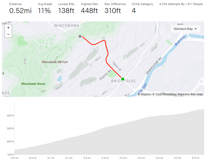
Starting from the junction with Holywell Road, you’re already at a disadvantage, having had to stop at the crossroads and therefore beginning from a standing start. It’s here that the sign, commemorating Jenkin Road’s role in the 2014 Tour, is placed. It states that the average gradient is a perfectly acceptable 11% but the maximum gradient is a formidable 33%. I think that’s an exaggeration and Strava and Veloviewer both agree, putting the peak gradient closer to 16.8%. Jenkin Road’s steepest segment is slightly wiggly, so maybe in a straight line it’s closer to 33%.
The hill begins at a fairly standard 10% as it stretches ahead of of you. With houses, playing fields and a church, there’s not much yet to mark this climb as distinct from the likes of Mertyle Road but, just after you pass the church, the road curves to the right, the gradient ramps up and, ahead of you, you can see why the hill made it into the Tour.
The road turns into a little S-bend here and the gradient hits 17.2% as it wiggles back and forth. Do your best here and don’t worry too much about any vehicles behind you, they’re as likely struggling up as much as you. As the hill relents a bit, down to about 12% as you pass Ridge View Road on your right, take a moment to regain a bit of strength (and have a look at the view behind you if you can) because you only about half way there.
You’ll shortly reach a sweeping switchback, which starts easily enough but its a bit deceptive and you’ll notice the extra couple of percentage points on the gradient here. However, once you’re round the bend with Wincobank Common on your right, it’s the home stretch, even dropping down to a meagre 4.5% around the next corner. Once you’ve done that, you can see the final 9.5% hump approaching and shortly you’ll be at the top. Well done.
You can see the pros on the 2014 Tour, climbing up the wiggly bit, below.
Now go and put on your yellow jersey and pretend you’ve just won the Tour De France.
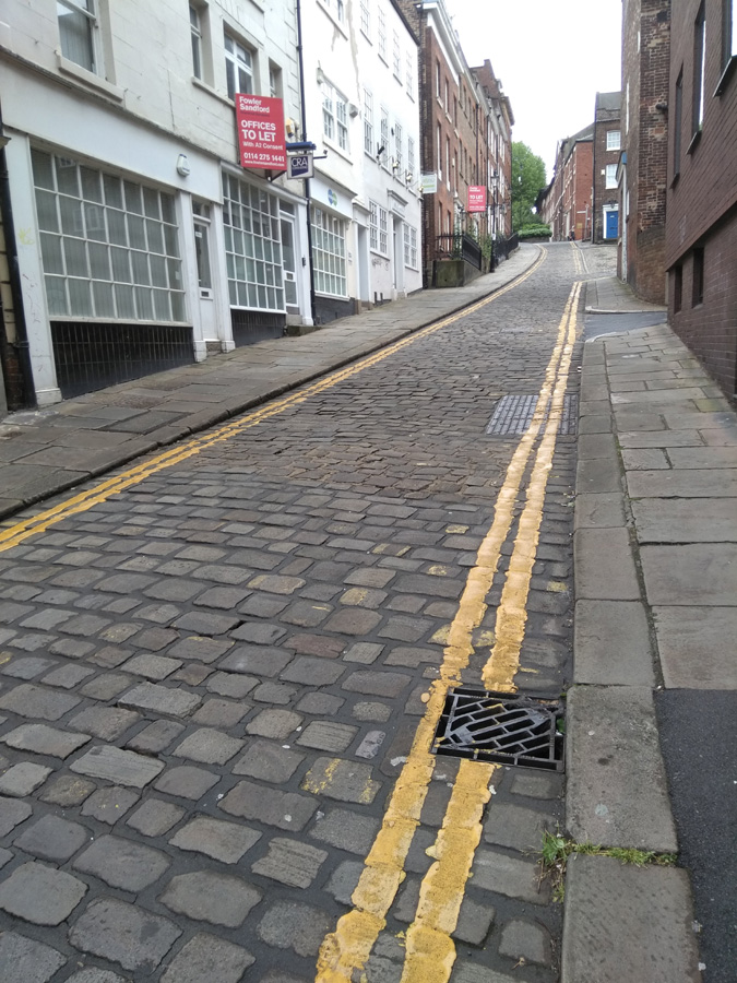
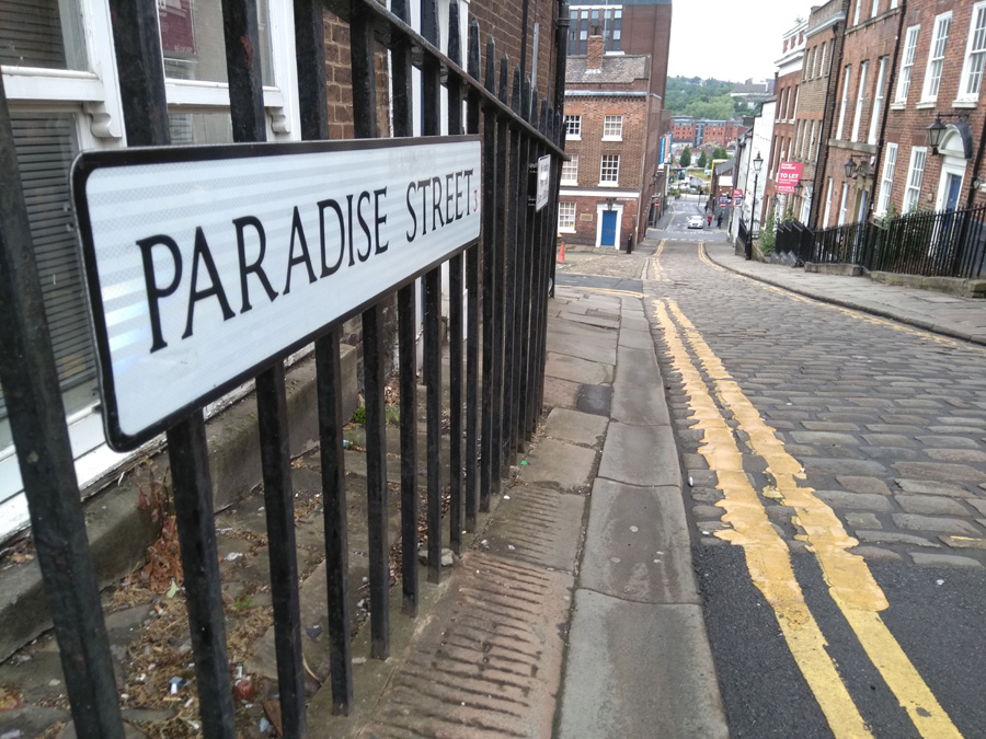
A silly little climb in the city and a taste of the cobbled Paris Roubaix.
Recommended to me by a member of the CycleSheffield Chat forum, Paradise Street is a slightly ridiculous little cobbled hill just north of the cathedral. Clocking in at a grand total of 0.04 miles, it’s not a foreboding challenge but don’t underestimate the impact of that cobbled surface and don’t get cocky like I did, try to sprint it, and end up more exhausted than climbing The Dale.
Starting at the junction of Queen Street, you can see the full extent of the consistent 9% hill in front of you. It’s not far. Normally, on short sharp hills you can blast it but the surface here really plays havoc with those plans. I’m glad that I’ve got suspension on mine, I can’t imagine what it’d be like on a fancy road bike. The only thing to be wary of is that, despite its single car width, Paradise Street is a two way road, so if you encounter a car coming the other direction, you’ll probably need to move out of the way. Still, it’s not far to return to the start and try again.
All you can really say for this road is head down, pedal away, see how quickly you can get up.
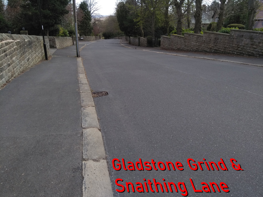
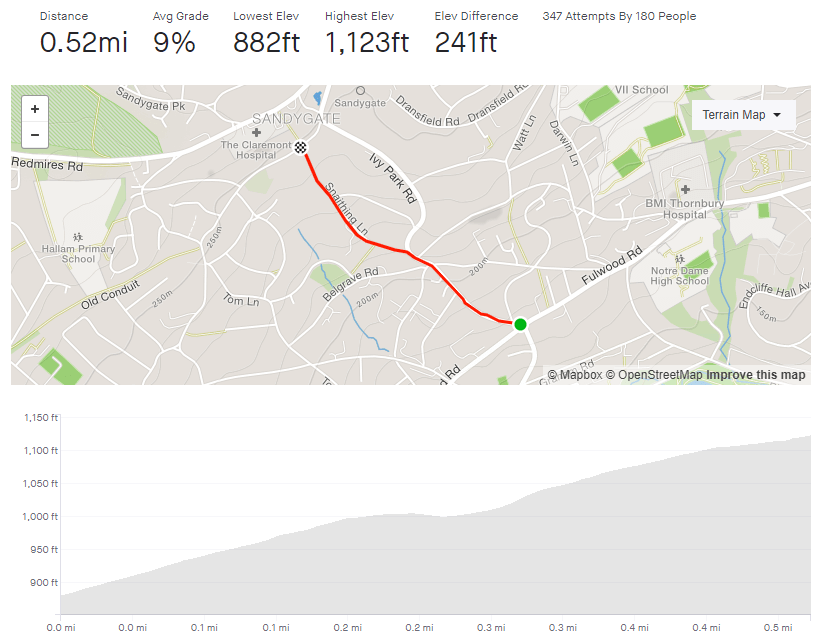
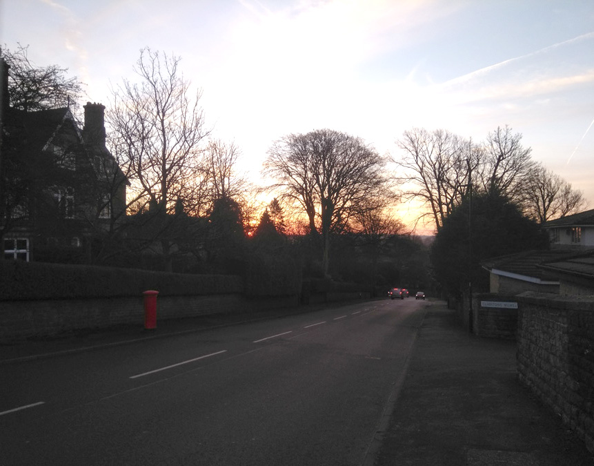
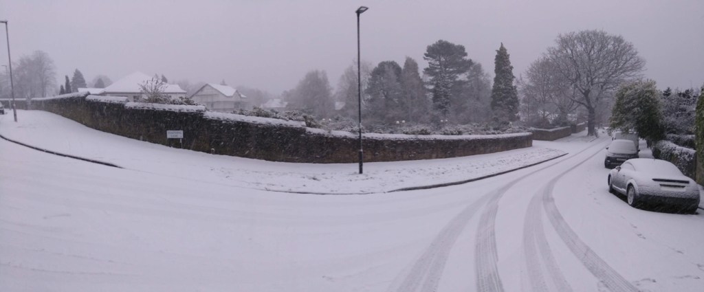
Starting and finishing in similar locations and running fairly parallel to each other, the Gladstone Grind / Snaithing Lane climb is similar to – but easier than – Tom Lane. They’re both suitable tasters for some of the hills in the Peak District that these roads lead you towards.
Begin at the crossroads with Fulwood Road (the segment could begin at the bottom of Hangingwater Road but I’ve never managed to reach this crossroads without the lights turning red) and the hill is straight into double figures, hovering around the 11% mark. It’s a tree-lined road with a broad right hand curve that seems to stretch on and on. If you’re lucky, the yappy dog at number seven will come charging down the driveway at you but he’s stuck behind a gate, so you can pedal on safely.
Shortly after the road straightens out, Graham Road joins from the left. It’s heads down here and grind on as I find that there is something about this section that feels a real slog. It’s probably as it’s just a straight 10% line, with just a postbox near the crest to aim for.
A short distance past the postbox, you’re gifted a very brief downhill as you swing left off Gladstone Road, onto Snaithing Lane. The 2020 Magnificent 7 race continued up Ivy Park Road at this point but I think Snaithing Lane is a more interesting challenge, so stick with that. The downhill respite is short lived however, as the road spikes up and bends to the right. As you pass the Kings Foundation, you’re on the steepest section of the hill at around 13.5%, but it does feel steeper.
You’ll soon pass a large white house with a fancy balcony, on your right. That’s the sign that you’re over the worst, and the road drops to a more manageable 7% for the final 0.1 mile. Once you’ve reached the top, if you fancy an additional silly little challenge, turn left, then take the first right up Carsick View Road. A cheeky little spike that was not quite close enough to include as part of this entry.
To cut to the chase, this is not a pleasant climb. There’s always parked cars reducing the carriageway width, it’s not picturesque and you’re going to encounter at least one obnoxious motorist on your way up. However, getting to the top is a great achievement.
I’ll be honest , I’ve only ridden up this hill twice: once at 9.30am on New Years Day, the other during the coronavirus lockdown. Both of those times I knew that it would be quiet enough to do without too much trouble. At any normal time however, you are going to get an impatient driver up your backside or attempt an uphill close pass. Be warned.
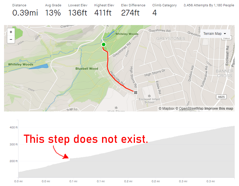
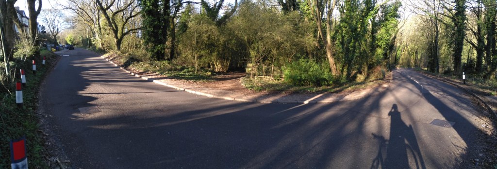
The climb begins as the road crosses the Porter Brook (much the same as Woodcliffe) and begins a steep S-bend. If you’re not on a road bike, you could avoid the carriageway and instead ride alongside the steps in the park. Be aware however, that’s actually steeper than the road itself. The Strava segment’s recording is a bit skew-whiff here but it probably averages about 10-12% on this bit, up to the junction with Greystones Road.
After that, the road can get clogged with parked cars, so there is nowhere for vehicles behind you to pass safely before the blind bend ahead. Be prepared to annoy some people as you slowly grind up this tree-lined section, which briefly pops above 20%.
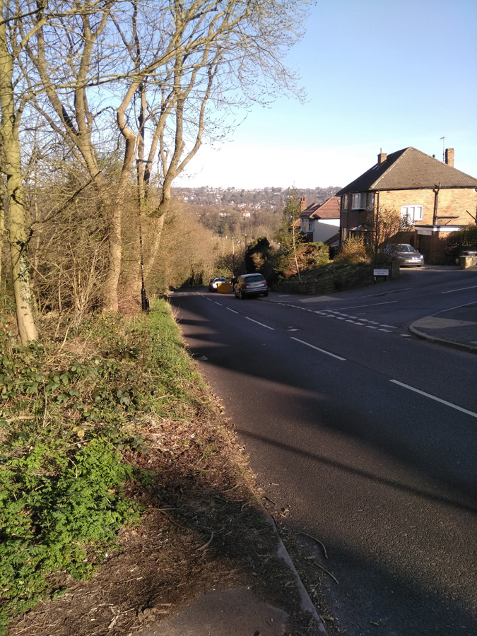
On the approach to the Highcliffe Drive junction the gradient does begin to reduce slightly but still remains in double figures. You can, at last, see the end of the climb though. You’ll find that all the vehicles are now parked on the opposite side of the road, creating a bit of a slalom for the line of traffic coming downhill. This is the one time it might be acceptable to ride on the pavement, if only to avoid the dirty stares from people waiting in their cars. Shortly after this you’ll be at the top of the hill, so well done for that but there are so many nicer hills to climb in the city. Go and find one of them instead.
A short, little hill that featured in the 2017 Magnificent 7. Because the road has a broad S-shape, it’s not as steep as some of the other roads in the area.
You begin the climb at the crossroads with Ranmoor Road. The road curves around the the left as the gradient creeps to around 10-11%. This corner isn’t too challenging and soon the road bends back to the right, as you ride up the steepest section, which is only a brief 11.3%.
Admire the big houses here, as the road straightens out and drops to around 6%. You can see the junction with Ranmoor Cliffe Road in the distance, marked by a postbox on the right. As you take the left turn at the junction, you’re back to an 11% climb for the final short stretch until Watt Lane.
A pleasant enough climb but it’s not the challenge I was expecting. If you fancy something nearby that’s a bit trickier, try Ranmoor Park Road. A far straighter climb with fewer bends easing the gradient. I’ll save that one for a later date.
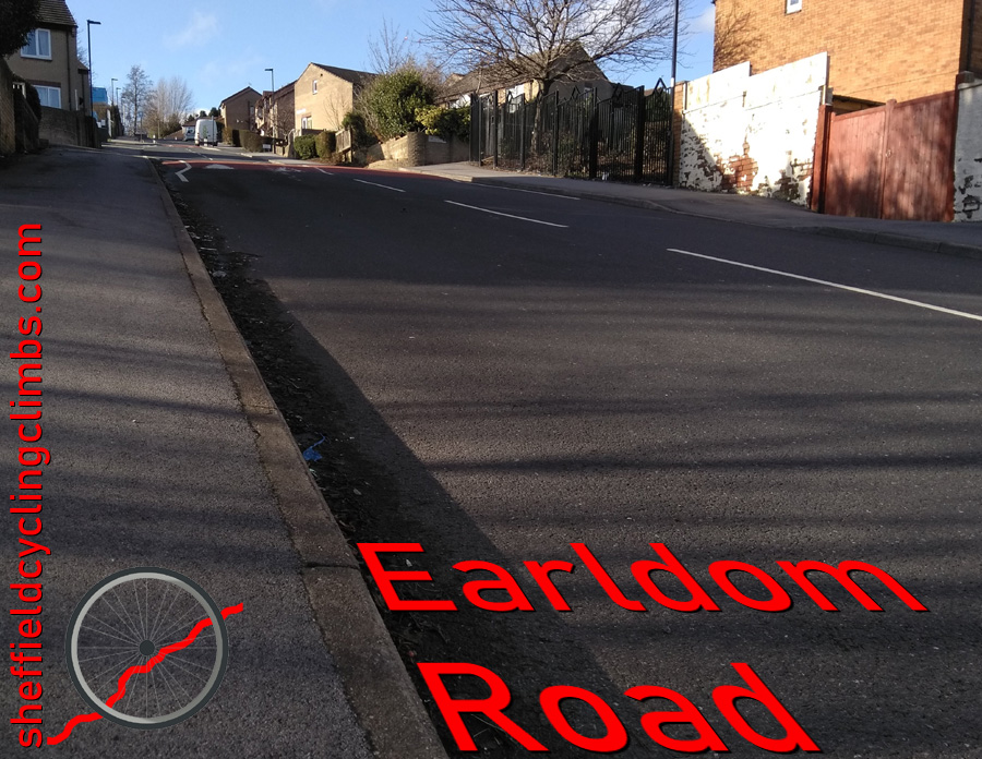
This is a very short blast up a very steep hill. Hidden in the suburbs of Burngreave lies this surprising little spike that will give your legs a bit of a testing.
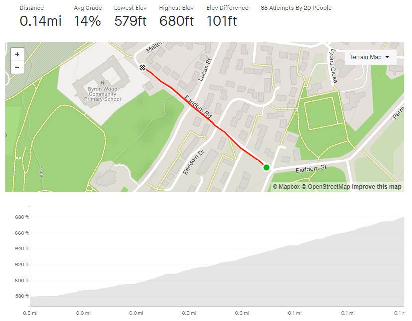
Earldom Road is only 0.14 miles long and you can see the apex from the outset so there’s no surprises in store. Just remember to get into the correct gear from the off, not like me on my last attempt where I thought I’d show off and blitz it up on a middle gear before I quickly ground to a halt, unable to pedal. Shamefaced, I dropped down to a low gear an made it to the top.
Earldom Road begins at about 6% as you join from Ellesmere Road. However, between the pub and Earldom Drive it ramps up to around 13%. Once you’re past that junction, the gradient steadily increases to 17.5% at the peak.
This hill is definitely a sprint, not a marathon, so just put your all into it and see how quickly you can get up it.
The first time I tackled this climb I didn’t really know where I was going and thought this might have been a more direct route home. I might have been correct about it being more direct but it certainly wasn’t flatter.
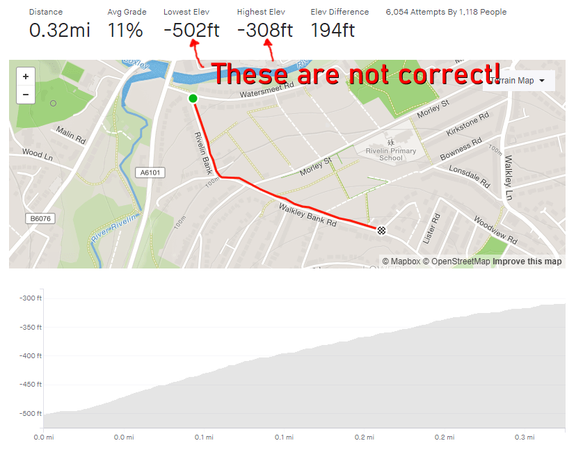
Rivelin Bank’s gradient is very quickly into double figures with an average of 13% until the bend to the left and the junction with Racker Way. It’s a dead straight section, so it’s all about putting your head down and grinding. The first time I did the hill and its steepness took me by surprise, I had to take a turn around an apartment’s parking lot about half way up, just to get my breath back without having to actually stop pedaling.
The approach to the bend is the steepest section and, once you’re around it, the gradient does ease off, dropping to around 10.5% for the second half of the climb. You’re now on Walkley Bank Road, with the allotments on your left and a high wall on your right. Once you pass the junction of Hawthorne Road the steepness begins to peter out, until you trundle to the apex at Walkley Bank Close.
This was by no means the end of my route home and, as you’ll find if you explore Walkley, by no means the only challenging hill in the area.
A nondescript, residential road in the leafier end of Sheffield, I was surprised to see that, statistically this hill is actually not that different from the far more imposing Lodge Lane. Tom Lane is not as hard as that but it does have a couple of spikes along the way and, for the sake of this segment, a surprising little twist in its tail. I’ve worked around here quite a bit and would regularly see a mum cycling up here with a child on the back of her bike. Strava kudos to her for that.
Tom Lane starts innocently enough, opposite the junior school, with a gradient fluctuating around the 4-5% mark, as you climb the first couple of bends. As you pass house number 74, however, the road straightens up, gets steeper and the hill’s first challenge is laid in front of you. The hill is now around 12% and you feel each percentage as you pedal up to a large stone cottage at the junction of Belgrave Drive. It is slightly less steep now but you’re still plodding upwards.
Follow the road, ignoring any junctions and continue round, first a left bend and then a right. This little section here, for me, feels the hardest part of the road section. There isn’t a significant increase in gradient but the approach to the right-hand bend – and the bend itself – really makes you feel like you’re dragging your bike.
You’ll soon reach a T-junction, turn right and continue upwards on what, once again, feels steeper than it is. Take the next left (the road you turn onto remains Tom Lane) and head up this narrower section of road, often with numerous parked cars on either side. You’ll shortly come to a brief section of 5% as you round a few more bends and pass Hillcote Close on your left. It’s here that you’re going to find that surprising twist in Tom Lane’s tail.
As you pass the steps with a handrail, on the left, instead of sticking to the road, wiggle round onto what looks like a footpath (there are no signs saying cycling in prohibited and it even has a Tom Lane road sign at the bottom so I’m sure it’s legal). It’s this brief bumpy section that pulls the average up and my recording of this part puts the gradient between 17-22%. However, your fancy road bike might not like the surface. It’s only short, though, and you’ll soon reach Redmires Road and the golf club.
Well done, you’ve just made it up a modest yet surprisingly challenging hill. Which is exactly what a Sheffield cycling climb should be.