54.7 miles, 4,729 ft.
Reunion is an excellent, bilingual 2025 ‘revenge drama’ written in both English and British Sign Language (BSL). Although never stated, the series is clearly set in Sheffield, featuring some of the city’s most famous landmarks, as well as wild expanses of countryside outside of the city.
At the time of writing, you can find it on iPlayer.
*Beware, this route contains spoilers for the series, so you’re best off watching it first, eh?*
You can find the route on RideWithGPS or Komoot.
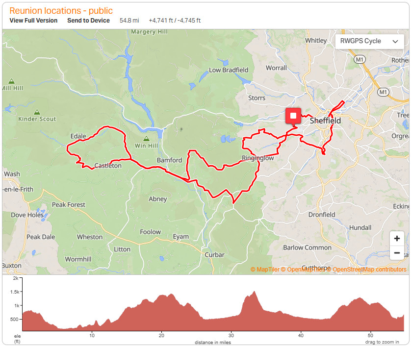
Disclaimer: Although this route starts in the city, you may prefer to do it in reverse, to complete the majority of the climbing (including Winnat’s Pass / Mam Nick), before visiting the rest of the city locations.
- The route starts, where all the drama began for Brennan, at the site of his old school, portrayed in Reunion by Tapton Hall.

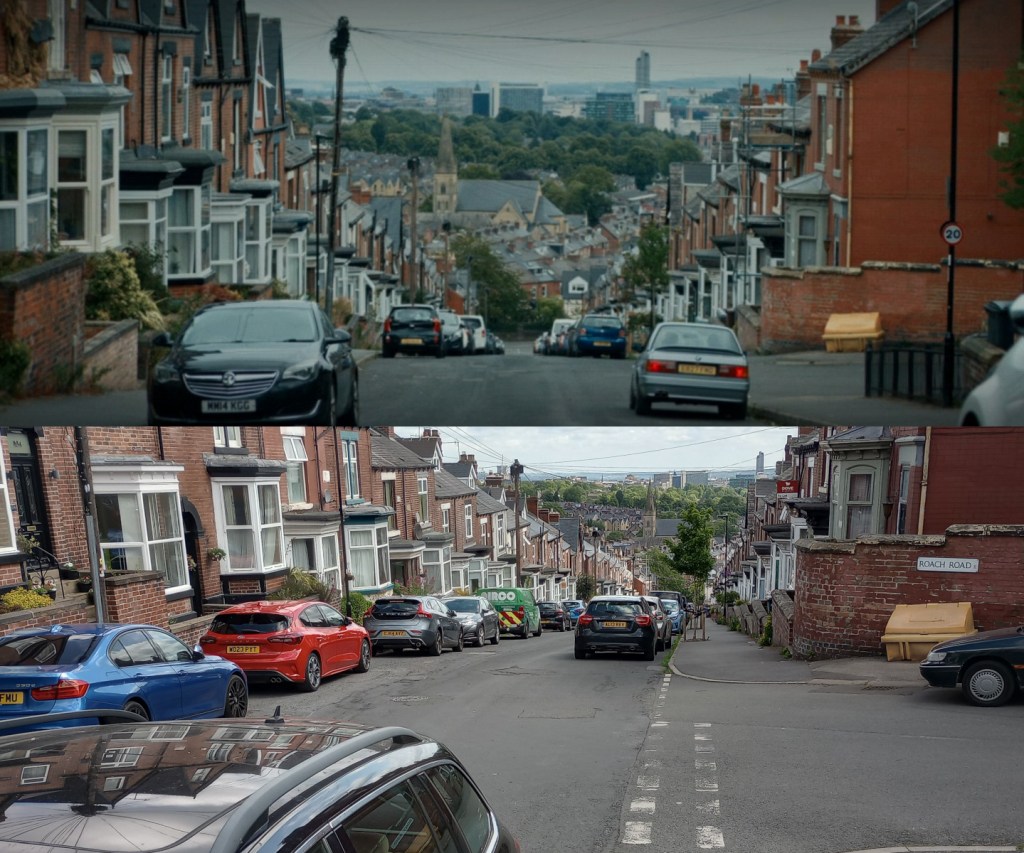
- Leaving Tapton Hall, turn left up the hill and head to Crosspool, along Manchester Road, before shortly wiggling through residential streets. You will pass the house used for Brennan’s family home on this section but as you don’t see the front of the house in the series, I’ve not included it on the ride, but a little bit of research of your own and you’ll work out which one it is.
- A short ride onwards leads you to Crookes Cemetary where Carly shows Brennan her mum’s grave. Be sure you check the cemetery’s opening times before setting off, otherwise you’ll have to re-route around it (which I may or may not have had to do on my test ride of the route) to get to Crookes and Bole Hills, where Brennan vents his frustrations at the night sky.
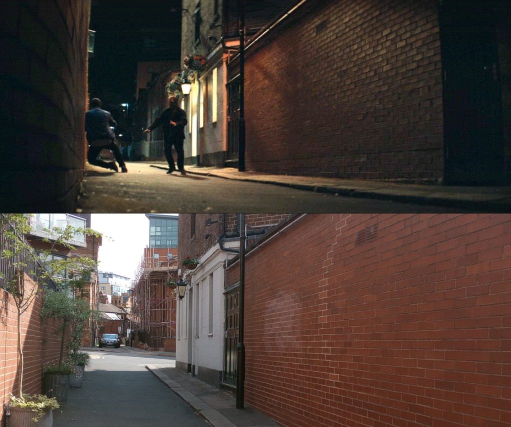
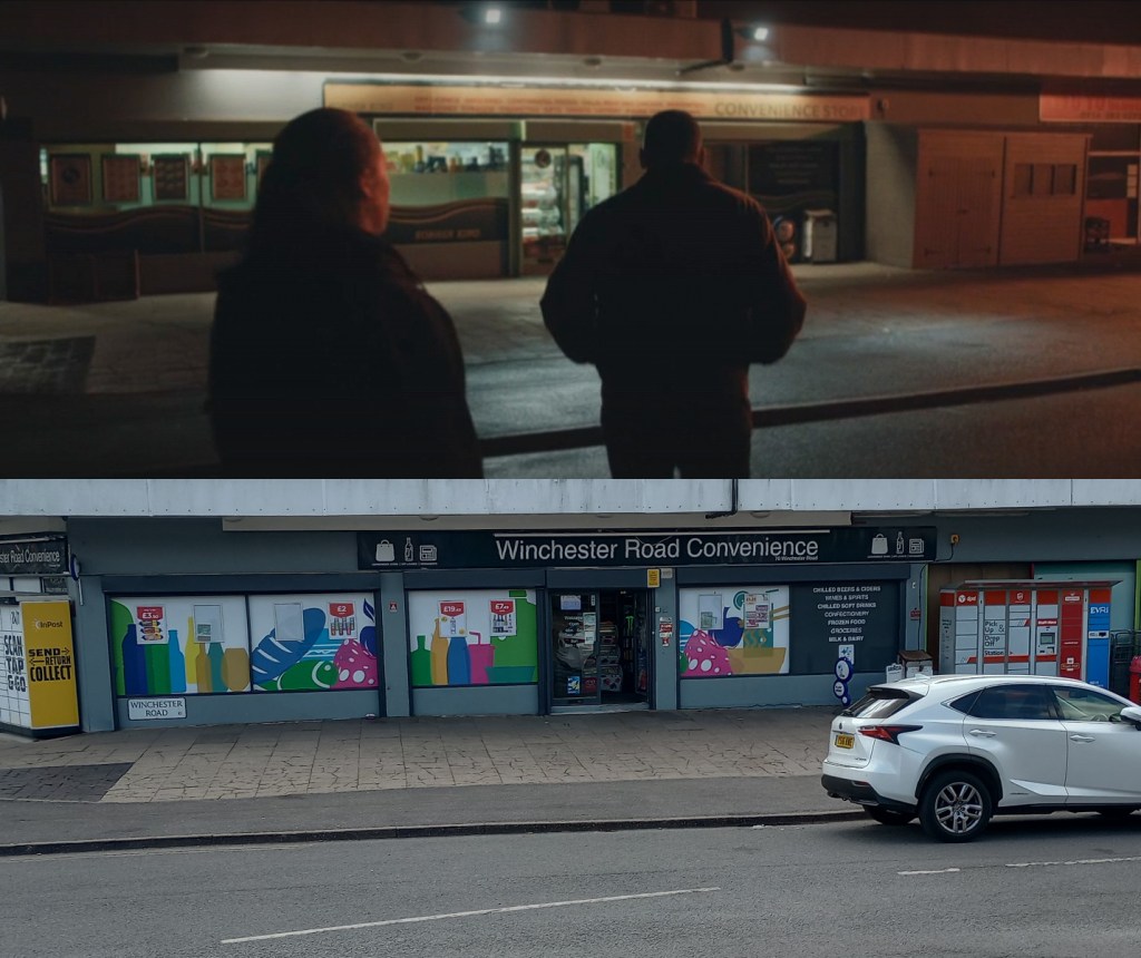
- You’ve got a nice downhill that will take you all the way to the scene of the crime: the alley next to the Bath Hotel.
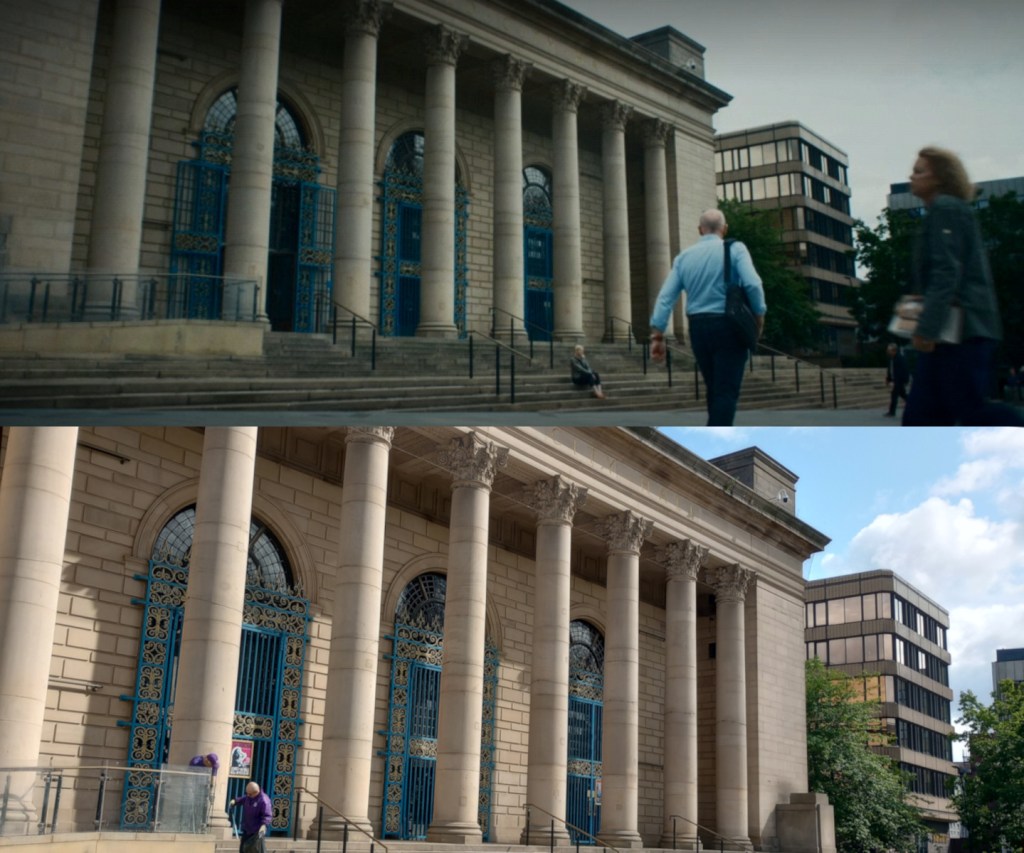
- A quick zip down Division Street leads you to the steps of City Hall, where Christine and Stephen share a heated exchange.
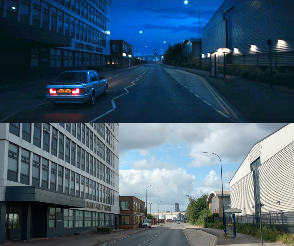
- Navigate through the cobbled streets and wend your way through The Wicker and down the busy Saville Street. On your right you will pass Don Valley House, which Brennan drives past at one point. It bugs me in the TV show because he drives the wrong way down this one-way street. Make sure you go the right way and follow the rules of the road.
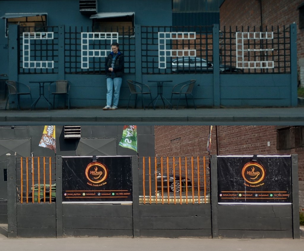
- You’re soon onto Carlisle Street East, where you will find the site of one of the cafes visited by Brennan and Carly. It’s been taken over and redecorated since it was on the tellybox though, so it looks very different.
- Heading back towards the city, remember to ride in the bus lane to cross Derek Dooley Way, otherwise you’ll find yourself heading out on the dual carriageway. Cross Park Square and arrive at Park Hill, were Carly lives. Sadly for Carly, the TV show stuck her flat in the now derelict block, not one of the swish trendy apartments that now populate the area.
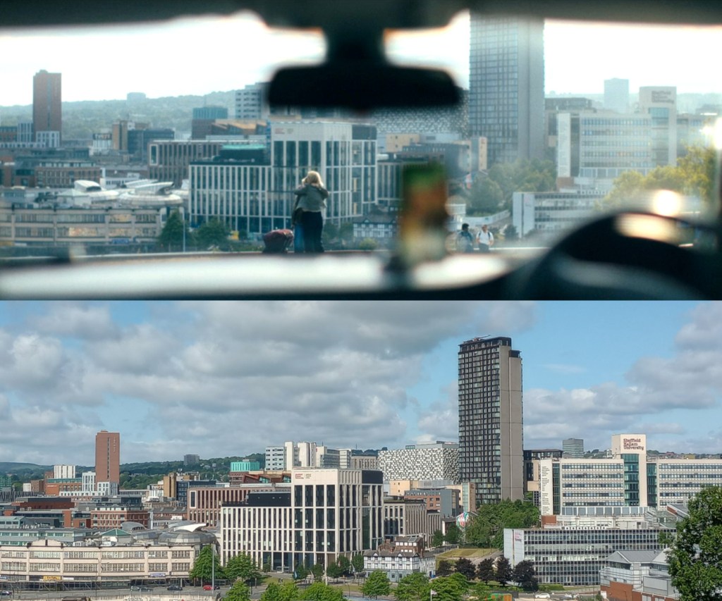
- Around the corner, you’ll reach the junction of Norfolk Road, overlooking South Street Park and an impressive vista of the city. This is were Christine greets Miri. Anyone who has navigated the station’s short stay or multistory car parks will appreciate why Christine chose to pick up her daughter here instead.
- Take care on the descent here, as it includes a short section with tram tracks before then taking the first turning off the gyratory on to Farm Road, where you will soon see Hell’s Kitchen Diner (Three Aces Diner on the telly).

- Ride through Heeley and you’ll soon arrive at the Brookyln Road entrance to Meersbrook Park and the first real climb of the day. It’s not long but it does max out at 20%, so engage your low gears to reach the top bench, where Brennan and Christine have a heart-to-heart.
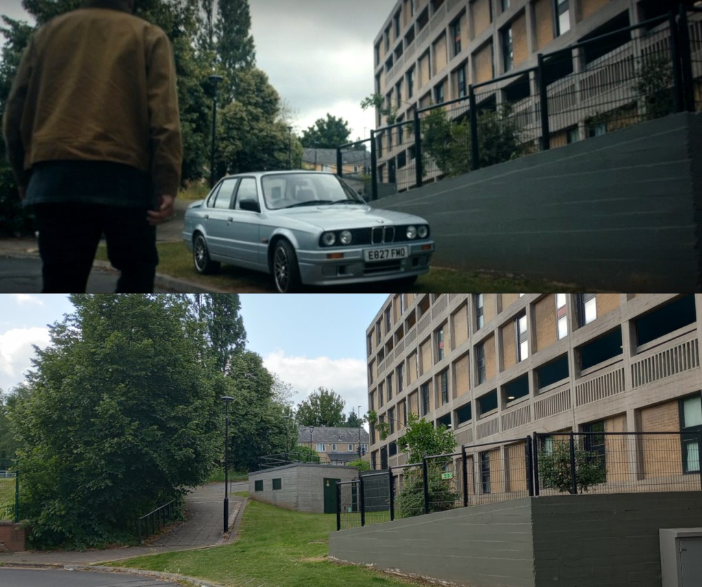
- Take care heading out of the park, as it’s steep and there will be pedestrians and children around. After navigating a couple of paths and the mild ascent through Brincliffe, you’ll find yourself atop Hunter House Road, where Sean lives.
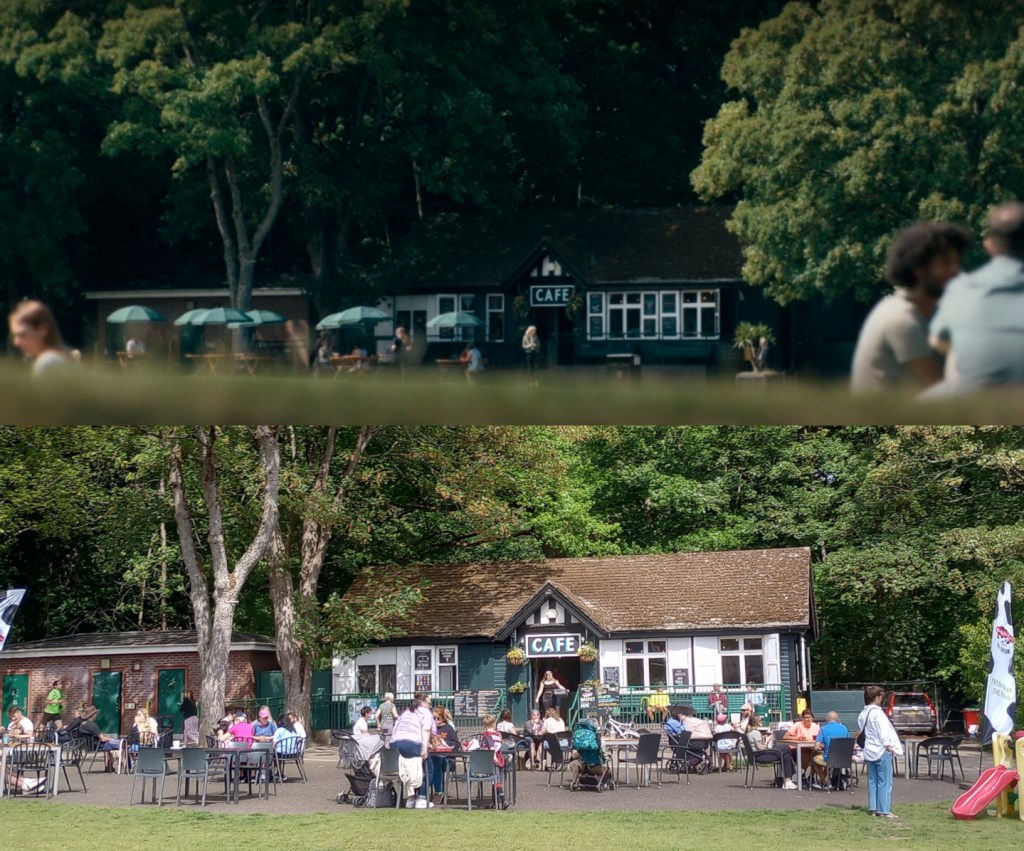
- Drop down and head through the park where you will find Endcliffe Park Independent Cafe where Christine and Stephen have a chat in the first episode.
- You’ll notice that the route’s real climbing now starts as you head up to Hallam and the supermarket where Brennan picks up the shotgun.
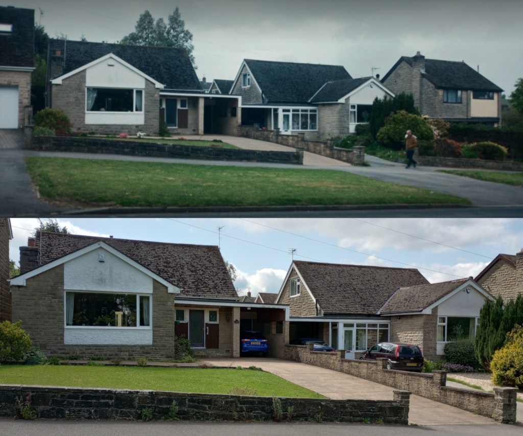
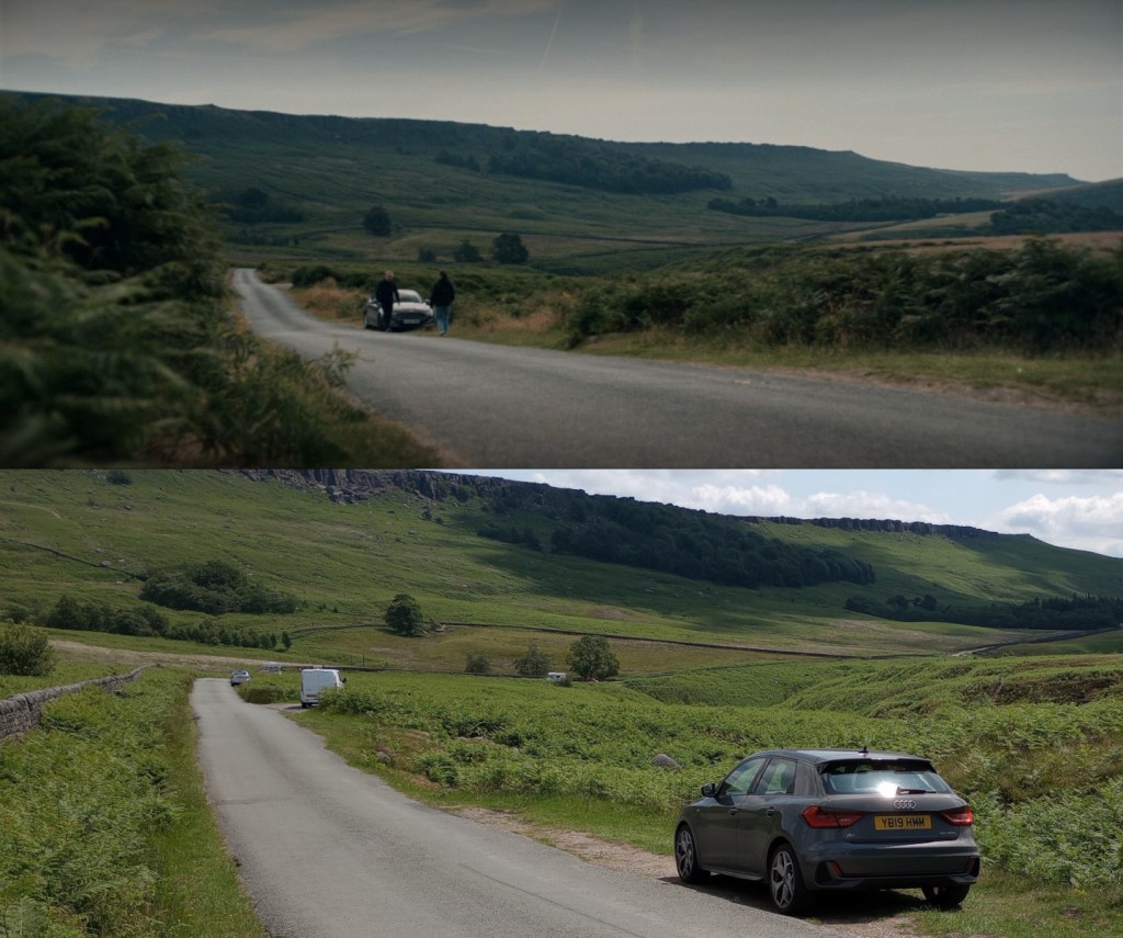
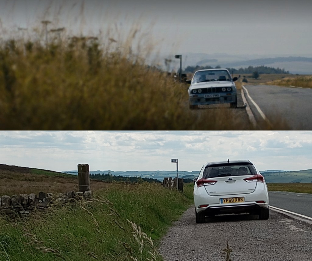
- A short distance further and you’ll reach Redmires Road, a scenic route alongside a golf course and some nice views across the valley. It is along here that you can find Brennan’s childhood home. This one does feature in the show but please remember that it is a private residence, so be respectful when having a passing look.
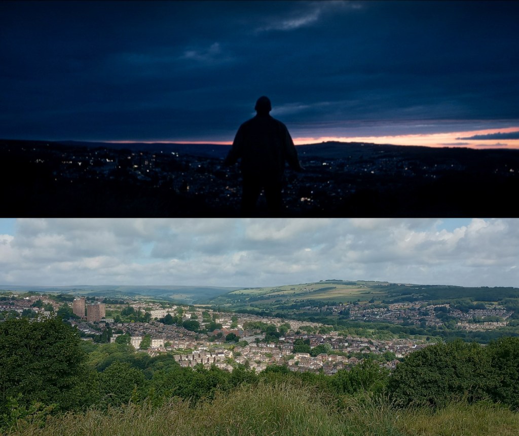
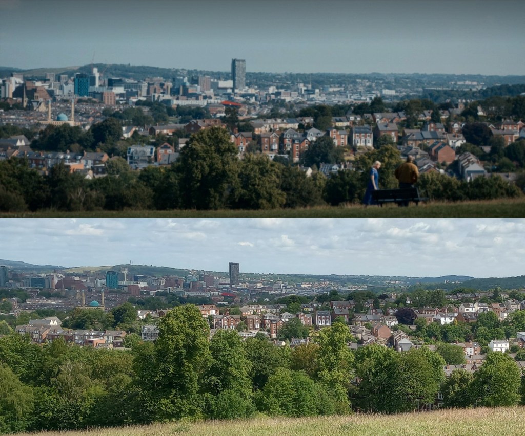
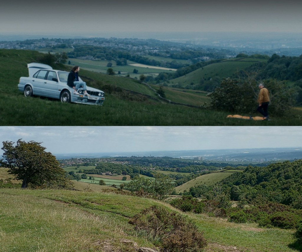
- You are about to experience some of Sheffield’s best cycling hills, so mentally prepare yourself, not least for the kick in the teeth that is Roper Hill. A sharp beast that will test you. At the top, you are greeted with a nice bit of flat and one of my favourite views across the city, just as the road bends left. It is here that Brennan and Carly set up camp for the first night.
- Continue onwards and upwards, past Burbage. Before the cattle grid and Higger Tor however, take the right hand junction to head down The Dale, a very steep, fast, fun descent. A couple of shots of this section were used at different points in the series.
- Make sure you take the sharp right, heading past the Hooks Carr and Hollin Bank car parks. Along this road, before the plantation of trees and Long Causeway, you can see the spot where Carly gets out of Stephen’s car, while the two search for her dad.
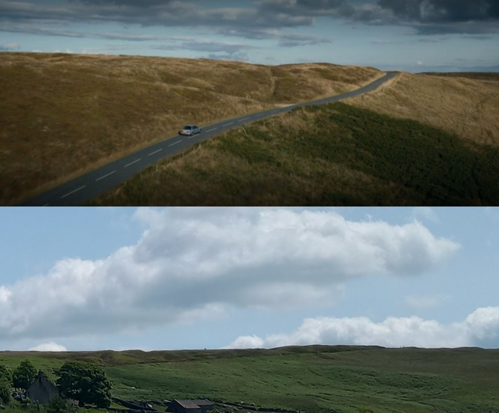
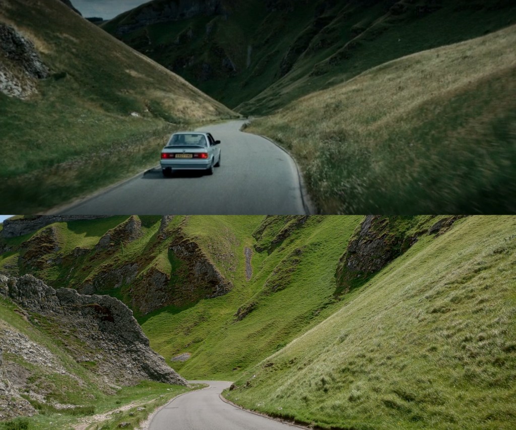
- There is now a very steep and narrow descent down to the Hope Valley. When you reach Hope itself, you have the choice to continue onwards to Winnat’s Pass or turn right and tackle the milder (but still challenging) Mam Nick. This route will assume you will be climbing Winnat’s Pass and descending mam Nick, so continue straight on, through Castleton, and up the imposing, iconic road. It is here, about two-thirds of the way up, that Brennan and Carly are seen driving down the road, en route to confront Monroe.
- Once at the top, it’s about 15 miles back along the Hope Valley, through Hathersage, up Surprise View and past the Longshaw Estate before you reach the final location on the tour: Stony Ridge Road. It actually features a number of times throughout the series, shot from different perspectives to make it appear as different locations. See how many times you can spot it in the series.
- From here, there are several different routes back into Sheffield but personally I enjoy the long, straight descent of Redmires Road, as used in the GPX file. It’s fast, with good visibility and you can get some decent speed down here but just be wary of dangerous motorists who also like to head down there at speed.
I’d love to hear how you got on in the comments.

Looking forward to trying this one!
LikeLike