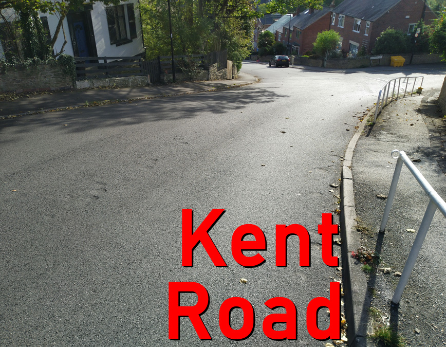
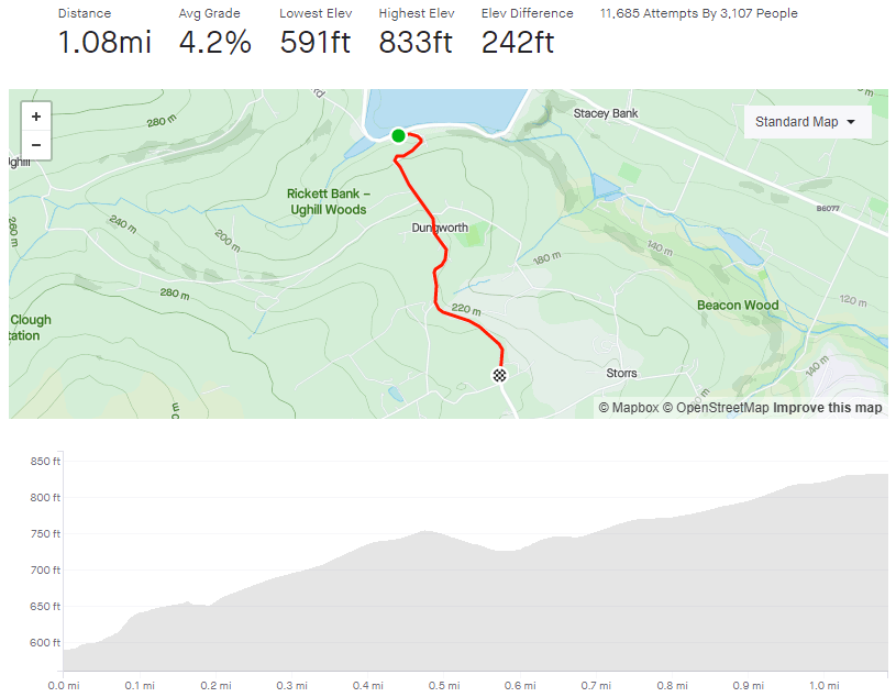
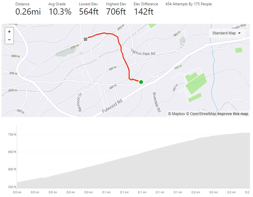
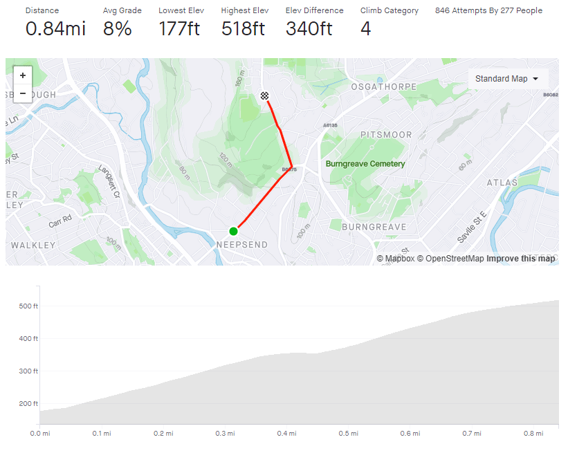
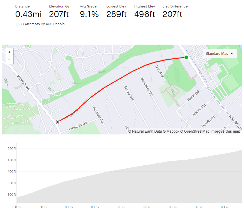
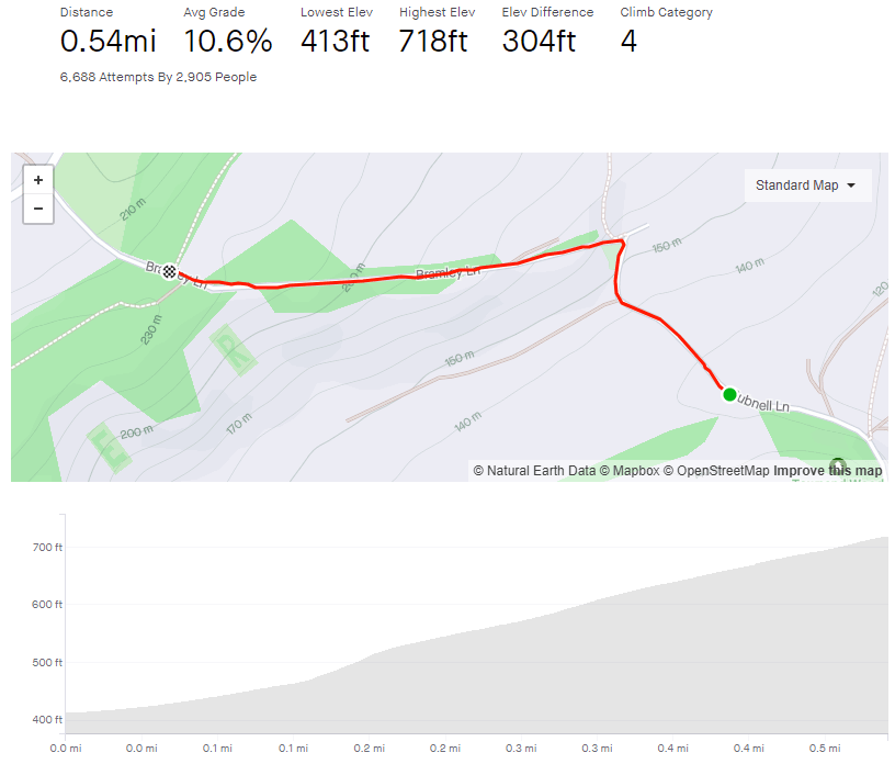
Tag: 3/5

Langsett Avenue

  • Langsett Avenue
  • Length: 0.43 miles
  • Avg gradient: 9.1%
  • Peak gradient: 14.6%
  • Difficulty: 3/5
  • Likelihood of encountering unpleasant motor-vehicles: 2/5
  • Elevation gain: 207ft
  • Strava

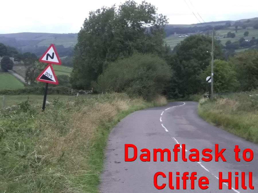
Is 20 the gradient or the speed limit?

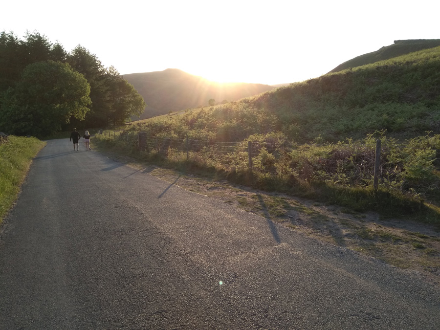
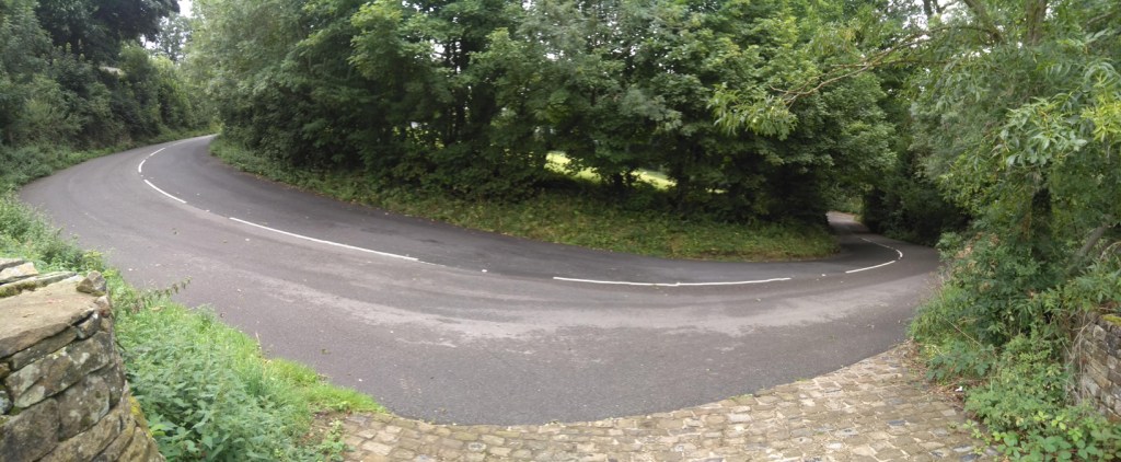
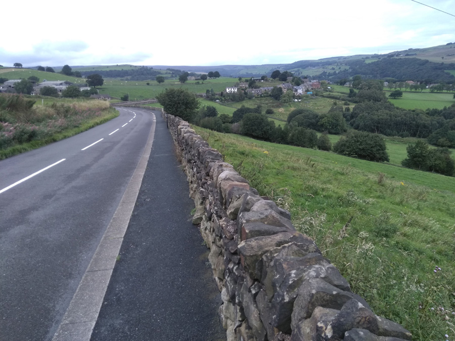
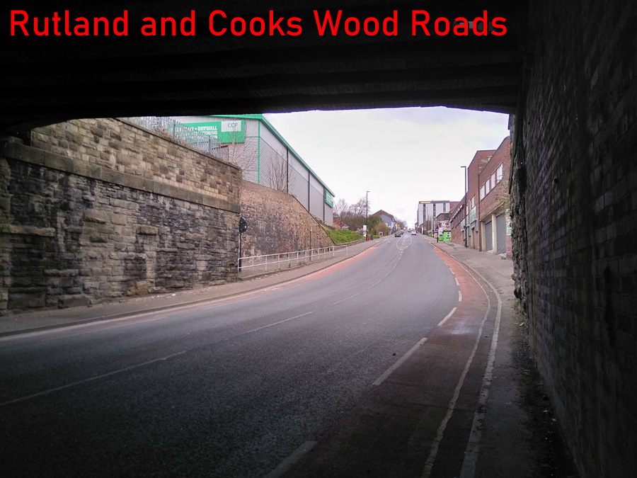
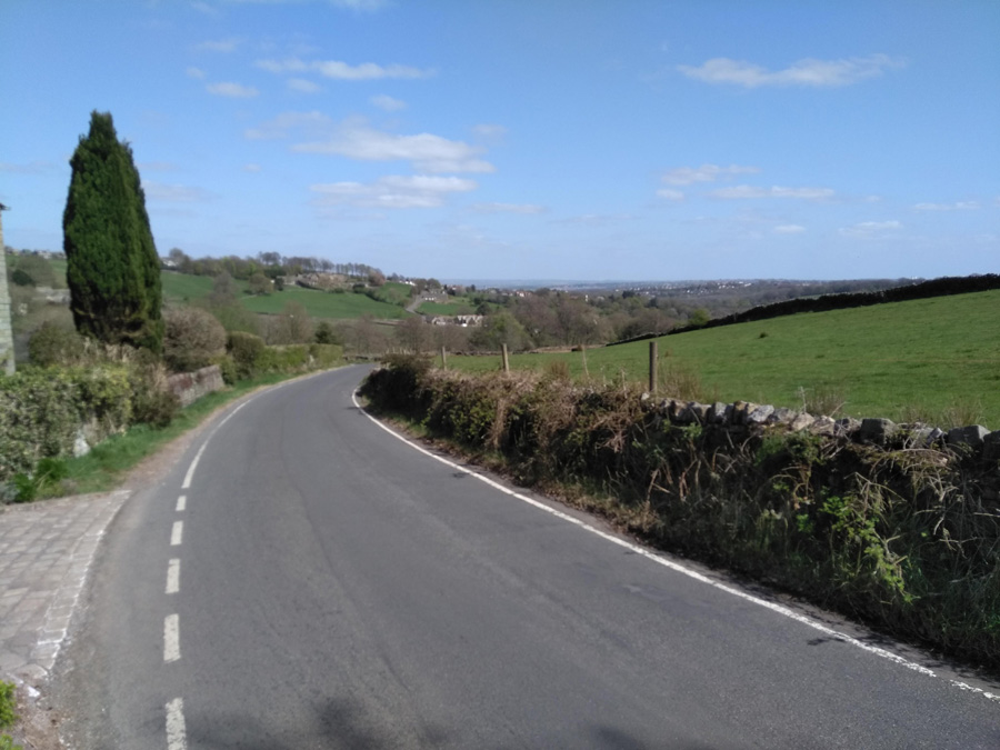
Middlewood Road, which you need to turn off to join Langsett Avenue, is horrible. Cars go far too fast and a the road is caked in tram tracks a bit further on. While the traffic might be slower and the trams non-existent, Langsett Avenue is still an arse of a hill.

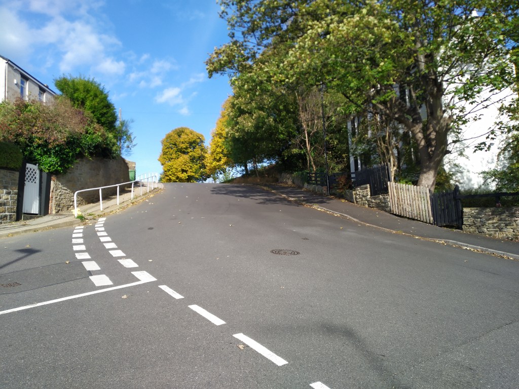
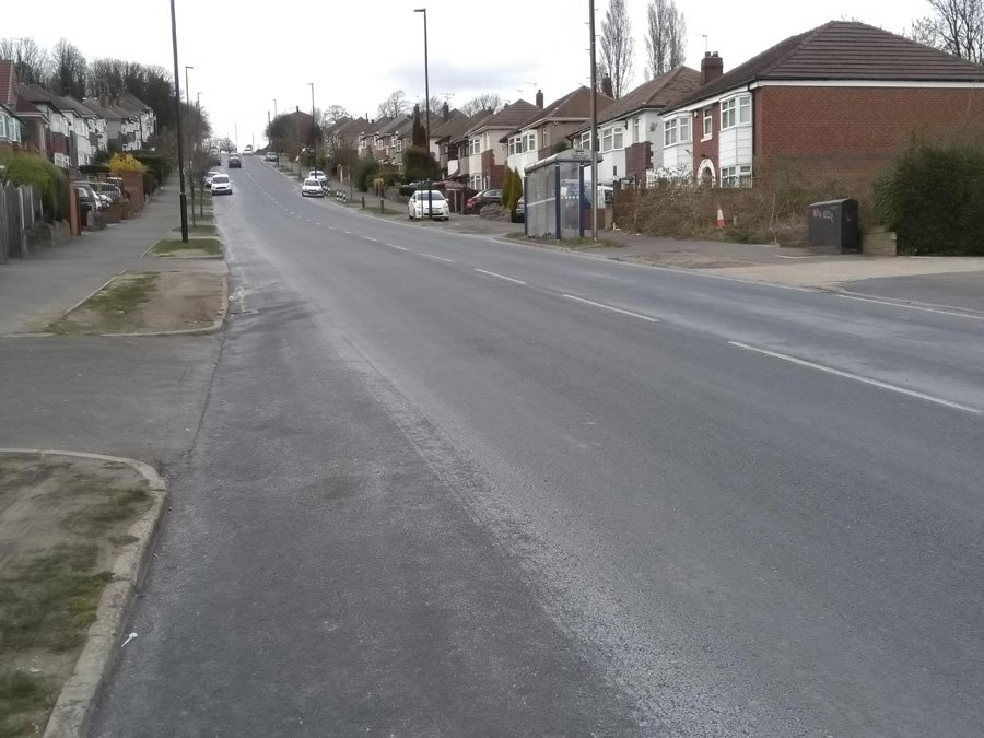
Whichever direction you approach from, you’ll probably not be carrying much speed into the start of the climb, which is harsh because the opening is the steepest section. There is a big ‘20’ painted on the surface, which could be for the speed limit or just telling you what the gradient feels like at this point.

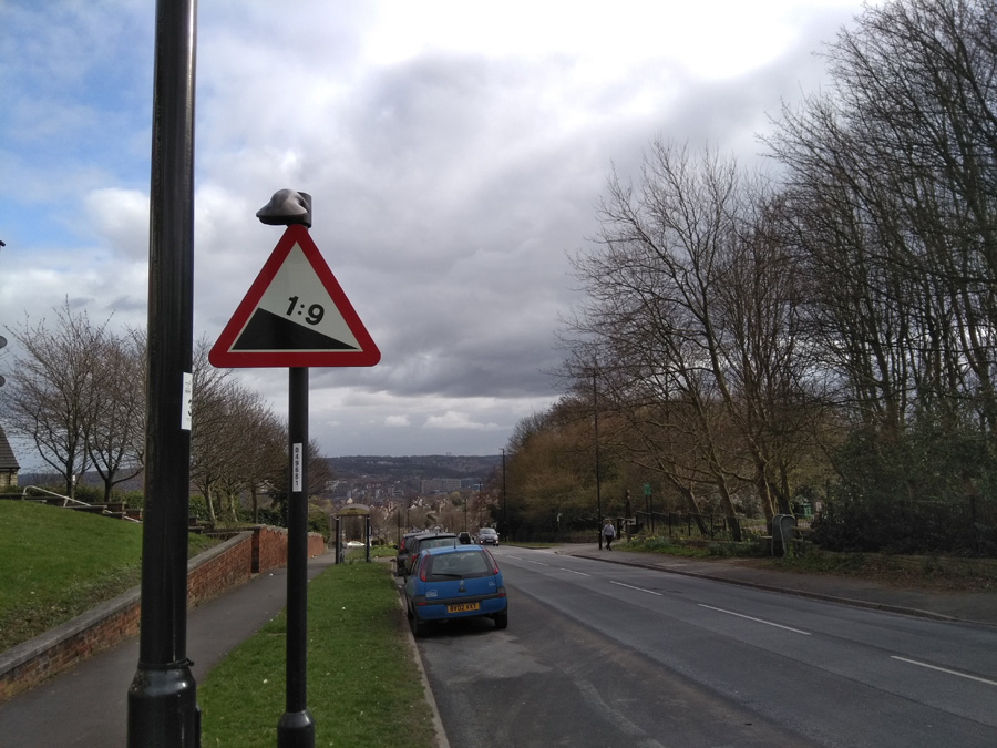
To be fair, the road doesn’t actually get as steep as 20%, instead the gradient floats around the 14% mark until you pass Don Avenue, at which point it eases off slightly, down to around 9-10%. You will notice the difference but it’s still a bit of a slog.

As you pass each side road, the hill feels progressively less challenging and by the time you’ve reached Airdale Road it’s down to 4%. With only 0.1 miles to go, you’re greeted with a brief 12% ramp before the segment finally ends at the junction.

However, for the fullest Langsett Avenue experience, cross over Worrall Road and add the 12.5% Well Lane to the end of the climb. Icing on the cake.

The Thunderpit

  • The Thunderpit
  • Length: 0.39 miles
  • Avg gradient: 12.5%
  • Peak gradient: 19.5%
  • Difficulty: 3/5
  • Likelihood of encountering unpleasant motor-vehicles: 1/5
  • Elevation gain: 258ft
  • Strava

A quiet lane with a surprise at the top.

Full disclosure: the road is actually called Farnsley Lane but at the top you reach the far more dramatic sounding Thunderpit Lane. Also, credit to The Digital Cyclist, whose website led me to this hill.

Keep you eyes peeled for the entrance to Farnsley Lane as it’s a blink and you’ll miss it turning but it will feel like a blessing after cycling along the horrible A623. No rest for the wicked though as you’re immediately into double figures, that steadily grow, as the road bends to right and you’re faced with a steady, slightly-wiggly, straight (is that an oxymoron?) up the hill.

The bend is the steepest section of the road, adding to the challenge of the slightly poor surface that is probably also covered in debris. The consolation you can take from the amount of detritus on the road is that it does suggest that motor vehicles are a rare sight up here.

There is not much to see as you’re enclosed by trees on either side but you should feel the gradient drop off slightly as you progress upwards, dropping to single figures as the road gently bends left.

The final 150m of the hill holds a steady 7.5% and, once you crest the hill, you’ll find yourself in the unexpected surroundings of the British Flurospar industrial mine. Don’t worry, it’s a public road so, despite feeling like a trespasser, you’re not breaking any rules cycling through here.

Please note, I’ve only ever been here on a Sunday when it was dead quiet. I suppose there is a real possibility that it might be quite busy with industrial machinery and lorries on a weekday.

Enjoy this? ❤ Support the site!

Bubnell Lane

  • Bubnell Lane
  • Length: 0.54 miles
  • Avg gradient: 10.6%
  • Peak gradient: 17.7%
  • Difficulty: 3/5
  • Likelihood of encountering unpleasant motor-vehicles: 1/5
  • Elevation gain: 272ft
  • Strava

Quiet and picturesque.

Turning off the main road though Baslow, you join Bubnell Lane after crossing the river, and before you reach the beginning of this picturesque climb, you’re gifted a pleasant totter alongside the Derwent. Not long after the river meanders away from the road, you’ll reach the start of the climb, marked by a gate on your left and, up the hill, a farmhouse and stables.

Within the first 0.1 mile, you’re hitting around 8% but you will feel the extra 2% as you ride around the bend in the road. You’ll shortly reach the stables and the switchback: at 17.7%, the steepest section of the climb. It’s a quiet road, so fairly safe to go wide and take a shallower line.

From here, it’s a steady, straight plod to the top, graced by trees on your right and a lovely Derbyshire vista on your left. The gradient fluctuates around 10%, so it’s never too challenging, it just seems long because the top is hidden just around that corner you can see in the distance.

Once you make it round the corner, the top is marked by a footpath post, followed by a speedy descent to Hassop Road and down to Calver.

Kent Road

  • Kent Road
  • Length: 0.11 miles
  • Avg gradient: 16.5%
  • Peak gradient: 20.5%
  • Difficulty: 3/5
  • Likelihood of encountering unpleasant motor-vehicles: 2/5
  • Elevation gain: 99ft
  • Strava

Arguably one of Sheffield’s steepest hills.

In any discussion about Sheffield’s steepest hills, there will be a few usual suspects; Hagg Hill, Jenkin Road and Blake Street, but it would be surprising if Kent Street didn’t also get a look in. Blake Street is often credited as Sheffield’s steepest but, despite being the same length, Kent Street has a slightly higher average gradient.

The start of the incline begins between Rushdale Avenue and Albert Road, facing north (there is an interesting footpath you can cycle up in the other direction but we’ll save that for another day). Unfortunately, Albert Road is a blind crossroads so, unless you can get a mate to stand there and give you the all clear, it’s safer to start at that junction (and also where the Strava segment begins).

You can see the handrail in the distance, that’s your target, where the road bends slightly to the right and kicks up steeply. Before that, you immediately begin on a 13.5% climb, and for every 15 metres or so, the gradient increases by about 1% (the maths here is very approximate but you get the idea) until you reach the railing.

It’s here that the hill breaks 20% for the final spike, which you’ll really feel as the apex slips into view. Well done, you can now arguably claim to have cycled up one of the city’s steepest hills.

It’s sweet but too short to be genuinely formidable.

New Road

  • New Road
  • Length: 1.57 miles
  • Avg gradient: 5.1%   Peak gradient: 10.5%
  • Difficulty: 3/5
  • Likelihood of encountering unpleasant motor-vehicles: 2/5
  • Elevation gain: 419ft
  • Strava

A beautiful Derbyshire climb.

If you’ve been out in the Hope Valley, but don’t fancy tackling Fiddler’s Elbow, Surprise View or The Dale on your return to Sheffield, the best option to get up over that big hill between you and the city is probably New Road, near Bamford.

Just south of Ladybower Reservoir you’ll find this rather picturesque climb that is never too hard but also never easy. As you turn off Ashopton Road, you’re straight into a 9% climb, so it’s heads down from the off. The gradient fluctuates between 5 – 10% for the next mile or so as you ascend the tree lined road. On your left, you’re presented with the imposing sight of Bamford Moor and, on your right, the view across the valley towards Thornhill and Shatton, the vista improving steadily as you make your way up New Road.

It’s a fairly straight line, with the biggest hazard being gangs of walkers or motorists descending a bit too quickly but it’s usually a relatively quiet ascent. One of the highlights happens around the 0.7 mile mark when, suddenly, the trees on your right drop away to reveal a most spectacular panorama across the valley. In the distance you might spy Shatton Mast, sitting atop Shatton Moor, the climb up to which I’d rate as a 5/5 (but we’ll save that for a later date).

The gradient sits around 5% here, so keep enjoying the view until you meet another line of trees and the road bends round to the left at what feels like its steepest section. You’ll shortly reach a summit, where there will likely be a few cars parked by local hikers, but you’re not at the end of the climb yet. The hill drops away into a fun and welcome descent but do take care, especially on the sharp right-hand bend which descends at -9%.


Try to keep your momentum here, as the gradient returns to almost 10% (but can feel greater), and you’ll soon reach the apex, where you’re greeted with a bench to sit on and one of the most beautiful views in the area.

Damflask to Cliffe Hill

  • Damflask to Cliffe Hill
  • Length: 1.08 miles
  • Avg gradient: 4.2%   Peak gradient: 25%
  • Difficulty: 3/5
  • Likelihood of encountering unpleasant motor-vehicles: 2/5
  • Elevation gain: 242ft
  • Strava

From the reservoir to the ice cream.

Don’t be lulled into a false sense of security when looking at the average gradient, this climb includes a chunk of descent and, at the very start, a couple of torturous turns.

Begin at the south side of Damflask Reservoir, a body of water surrounded by numerous challenging cycle climbs. You could probably make a nice day trip to do them all in one go. The one we’re focusing on though probably has the hardest opening. Turning sharply on to Briers House Lane, the approach to the first switchback quickly reaches 9% before ramping up to 25% at the corner’s apex.

That’s the steepest bit of the climb over with quickly but you’ve still got about a mile to go before you reach Our Cow Molly and that ice cream you’ve been promised. It’s a similar distance to the next switchback but, this time, hovering around the 5% mark, so not so steep. Take glance to the right, looking out over the reservoir, to appreciate how high you have already climbed.

Strava says that the corner is only 12%, but it also says there is a little descent beforehand, so I think there must have been some GPS errors when this segment was made because there certainly isn’t a drop and I can’t believe that the second corner is any shallower than the first, especially as you need to be on the inside of this one.

The good news is that it’s a much gentler climb from here on. The straight section ahead fluctuates between 5-9%, and it was here, at the large stone marking the entrance to the hamlet of Dungworth, that I was originally going to end the climb entry but the hill does continue to ascend. So, carry onwards through the village and, as the road wiggles slightly, you’ll see an old phonebox (which now contains a defibrillator, I think) that marks the short descent before the final climb.

Stay on as the road bends around to the left and the view of the valley below really opens up. It’s a gentle climb, mostly staying in the low single figures, before you finally arrive in a place called, appropriately enough, ‘Hill Top’ and Our Cow Molly, with that ice cream you’ve been looking forward to.

Ranmoor Park Road

  • Ranmoor Park Road
  • Length: 0.26 miles
  • Avg gradient: 10.3%   Peak gradient: 14%
  • Difficulty: 3/5
  • Likelihood of encountering unpleasant motor-vehicles: 1/5
  • Elevation gain: 142ft
  • Strava

It’s like the evil twin of the neighbouring Ranmoor Crescent. This road has all the climbing but none of the forgiving bends. It’s a straight up (literal and figurative) stinker.

You begin, just off Fulwood Road, by the Ranmoor Inn. As the road curves around the church you’re immediately into a dead straight 10% climb. To add insult to injury, as you slowly climb up the hill, the gradient gently increases, peaking out at about 14% as you pass Tapton Park Road. At this point, it definitely feels harder than you expect.

Keep on peddling and you’ll soon reach the sweeping left hand bend where the gradient drops down to 7.5%, and you pass Ranmoor Crescent. Grind on a short distance more until the end of the segment and then, when you reach it, ask yourself why you didn’t just ride up Ranmoor Crescent instead?

Rutland and Cooks Wood Roads

  • Rutland and Cooks Wood Roads
  • Length: 0.84 miles
  • Avg gradient: 7.7%   Peak gradient: 12.1%
  • Difficulty: 3/5
  • Likelihood of encountering unpleasant motor-vehicles: 5/5
  • Elevation gain: 340ft
  • Strava 

Pre-bike, I often used to commute this way, so Rutland Road was one of my earliest introductions to what Sheffield hills are like – even though I was in the car. As a consequence, this hill had a slightly foreboding reputation (in my head at least) and it was a while before I tackled it. When I finally did, and managed to beat it, it felt like a real achievement. However, it was a long time until I added Cooks Wood Road on the end.

Starting under the railway bridge, the road stretches far up ahead of you, although you’ll probably not be able to see it for all the cars. This is not a quiet climb and you will get some form of aggressive motor vehicle pass you. The photos here were all taken at the start of the COVID-19 lockdown and I still got close-passed. You won’t ever see the road it as quiet at this otherwise.

For the first third, it’s a fairly steady 9-10%, with not much to look at except a large variety of industrial units, so just head down and try not to get hit by a grumpy motorist. As you reach Parkwood Springs and the Sea Cadet Corps, on your right, the road flattens for a short run to the traffic lights.

If you’re lucky, you’ll get a red and can have a legitimate breather before taking the left turn onto Cooks Wood Road. You’re straight into the climb again and although it never gets more than 2% steeper than Rutland, Cooks Wood Road feels a lot more challenging. There’s no obvious landmarks but near the bus stop, the road ramps up and you’ll need to drop into that lower gear for another 0.1 mile, until you pass the entrance for Parkwood Springs on your left (an old style 1:9 gradient sign still remains on the other side of the road). The Strava segment continues for another 350 yards or so but once you’re here, you’ve done the heavy lifting.

Hopefully you made it up in one piece and, if you fancy a change of tempo, you could always ride the Parkwood Springs MTB track back downhill.

Douse Croft Lane to the valley top

  • Douse Croft Lane to the valley top
  • Length: 1.12 miles
  • Avg gradient: 6%   Peak gradient: 14%
  • Difficulty: 3/5
  • Likelihood of encountering unpleasant motor-vehicles: 1/5
  • Elevation gain: 377 ft 
  • Strava

Situated out in the lovely Mayfield Valley, this hill is snuggled out amongst a wealth of winding country hills. It’s an area well worth exploring and never too far from civilisation.

You’ll approach this climb from either Brown Hills Lane or Harrison Lane, both of which send you down Gorse Lane. It’s quite a speedy drop with a sharp, blind bend just before you hit the climb. For safety’s sake you’ll need to pull on the brakes which unfortunately will cost you some momentum for the start of the climb.

One of the consolations of this hill is that the toughest parts are out of the way first, including the immediate sharp bend to the right at 14%. Once you’re around that, you can see the next bend approaching but the gradient only drops a few points here, and surprisingly, shows up as less steep around the switchback. It certainly doesn’t feel easier.

Wiggle your way up, as the Mayfield Valley opens up on your left, and around the next right hand bend, with the gradient remaining in the low double figures as you pass Harrop Lane on the left. You’ve now got a steady 6-7% climb for about 0.3 miles, returning to double figures as you approach the cottage and the junction to Fulwood Lane, where you turn right.

The hard bit is done now but it’s worth carrying on. The road floats around the low single figures and only once briefly touches 6% (it’s this section that has reduced the average gradient of the segment) but the views over the valley towards Sheffield are lovely. Once you’re reached the top you’ll be greeted with one of my favourite vistas of Sheffield.

Whiteley Wood Road and Common Lane

  • Whiteley Woods Road and Common Lane
  • Length: 0.88 miles
  • Avg gradient: 6.6%   Peak gradient: 12%
  • Difficulty: 3/5
  • Likelihood of encountering unpleasant motor-vehicles: 3/5
  • Elevation gain: 308 ft
  • Strava

This is a utilitarian climb, in that it sole function is pretty much to get you out of suburbia, towards the Peak District. At the top, you’re on the edge of the countryside, ready to discover some absolutely lovely views.

The climb begins after a quick descent on Whitely Woods Road as it cuts through the woods themselves. The climb begins as you cross over the Porter Brook but it’s nothing serious here, as the gradient remains in the low single figures until you reach Wire Mill Dam. As the road curves left, the gradient creeps up but it still remains in single figures, where it stays for the short, straight section to the next bend.

The battle begins after you follow the road round the bend. It’s only 0.2 miles but it’s a slog. It gets slowly steeper as you grind up, hitting a peak of a 10.5% just before the cattery. However, the challenge here is more psychological than physical because the hill is so straight and with slightly boring fields either side there’s not much to look at on your way.

When you’re past the cattery, the road bends left once more and you’re well on your way to the apex as, shortly after, you turn onto Common Lane. From here, with every pedal, the gradient drops away and you find yourself at the start of Ringinglow Road, ready to get out to the Peaks.