Tag: 5-10%

Whiteley Wood Road and Common Lane

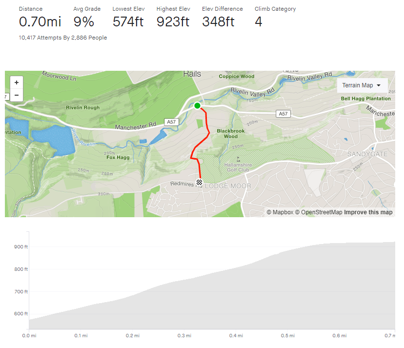
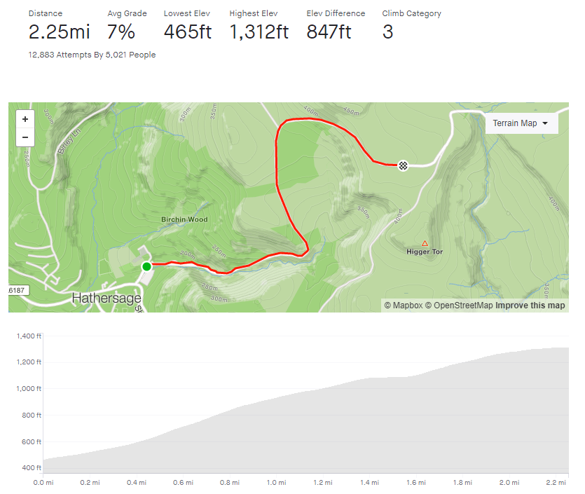
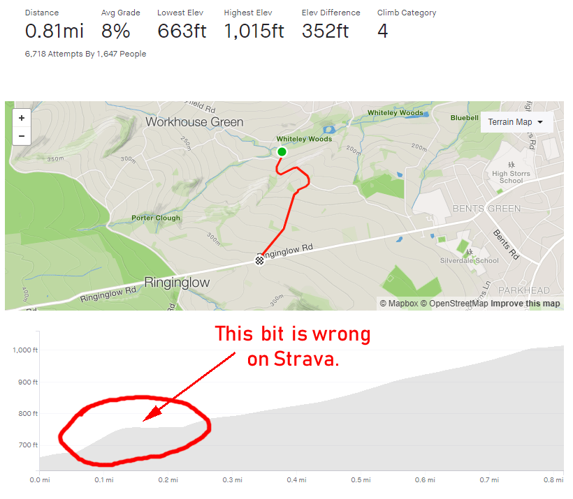
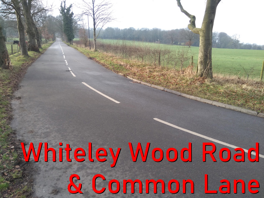
  • Whiteley Woods Road and Common Lane
  • Length: 0.88 miles
  • Avg gradient: 6.6%   Peak gradient: 12%
  • Difficulty: 3/5
  • Likelihood of encountering unpleasant motor-vehicles: 3/5
  • Elevation gain: 308 ft
  • Strava

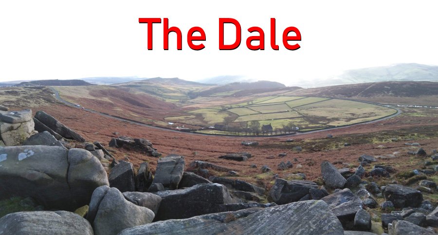
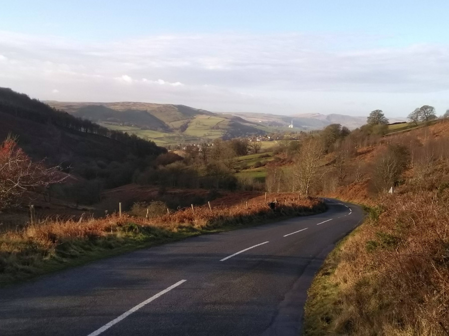
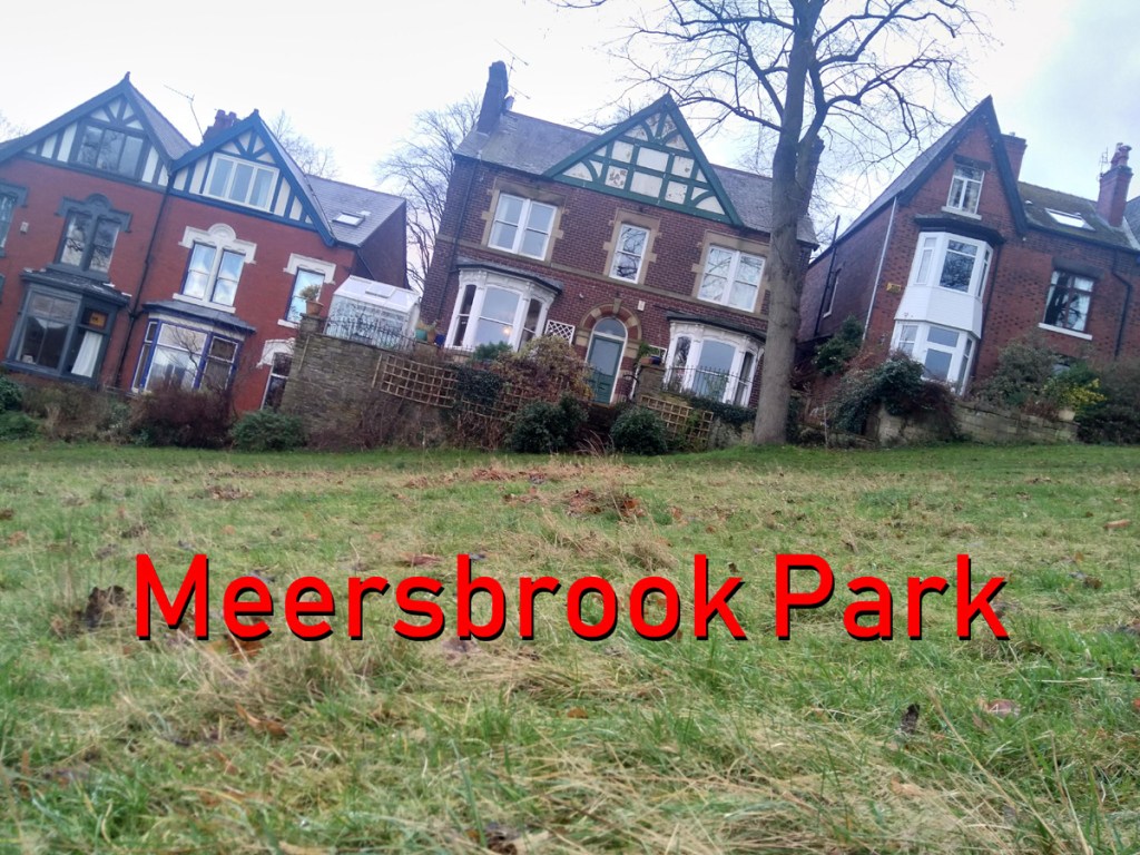
This is a utilitarian climb, in that it sole function is pretty much to get you out of suburbia, towards the Peak District. At the top, you’re on the edge of the countryside, ready to discover some absolutely lovely views.

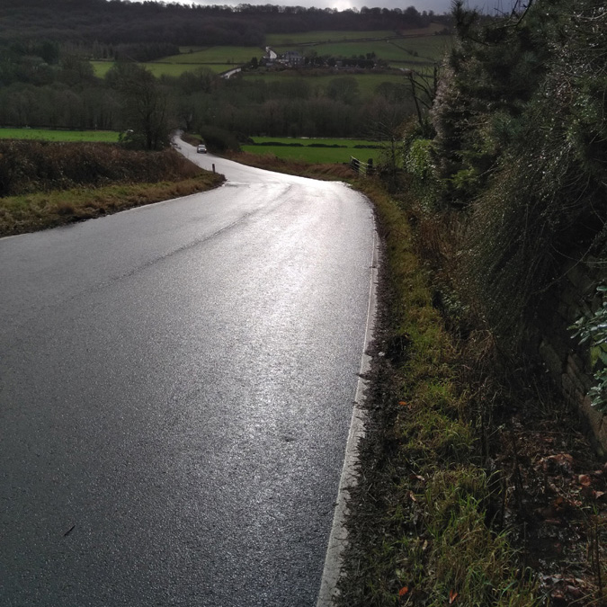
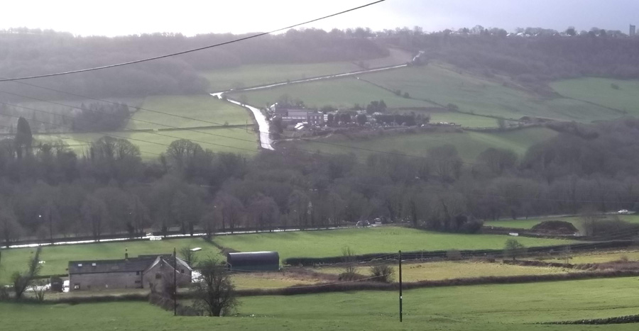
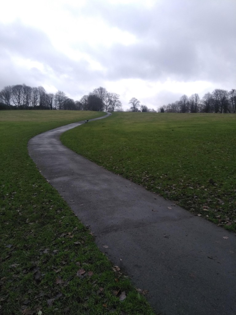
The climb begins after a quick descent on Whitely Woods Road as it cuts through the woods themselves. The climb begins as you cross over the Porter Brook but it’s nothing serious here, as the gradient remains in the low single figures until you reach Wire Mill Dam. As the road curves left, the gradient creeps up but it still remains in single figures, where it stays for the short, straight section to the next bend.

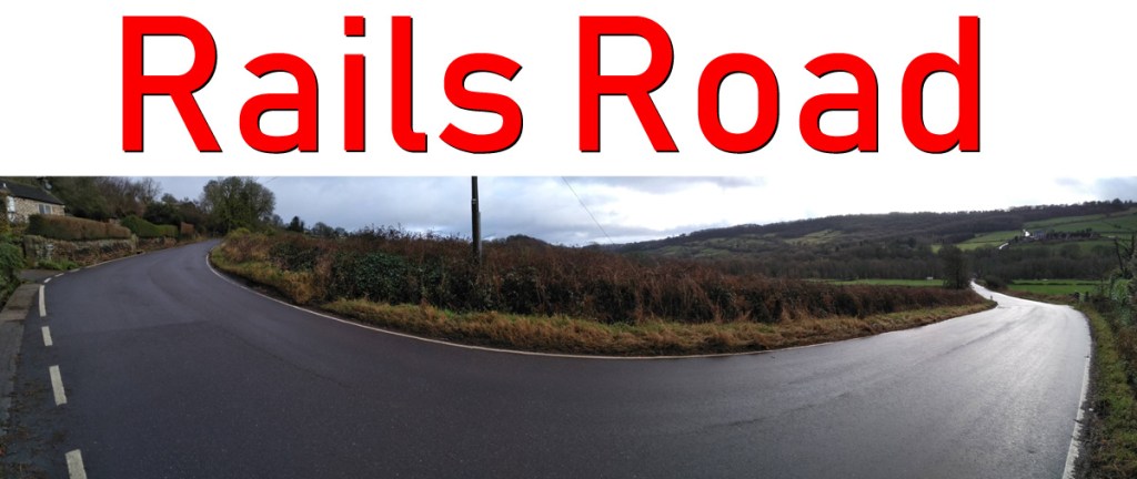
The battle begins after you follow the road round the bend. It’s only 0.2 miles but it’s a slog. It gets slowly steeper as you grind up, hitting a peak of a 10.5% just before the cattery. However, the challenge here is more psychological than physical because the hill is so straight and with slightly boring fields either side there’s not much to look at on your way.

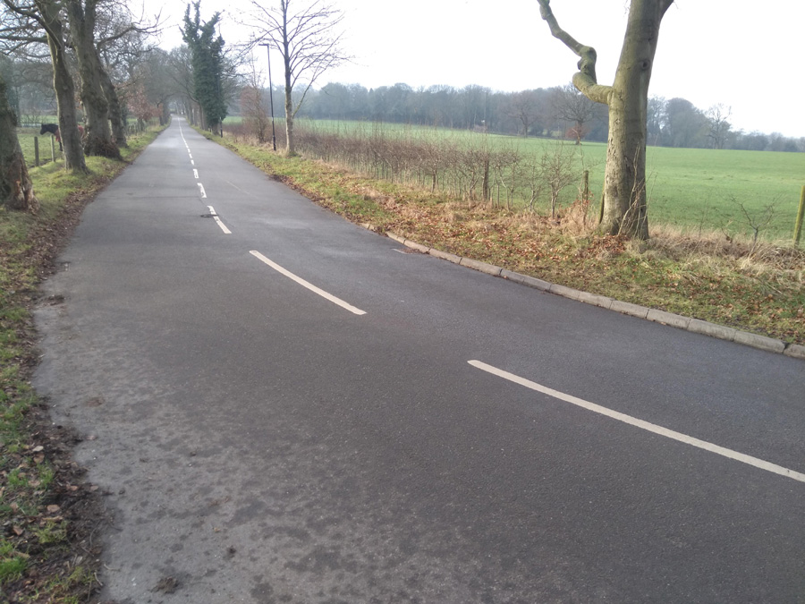
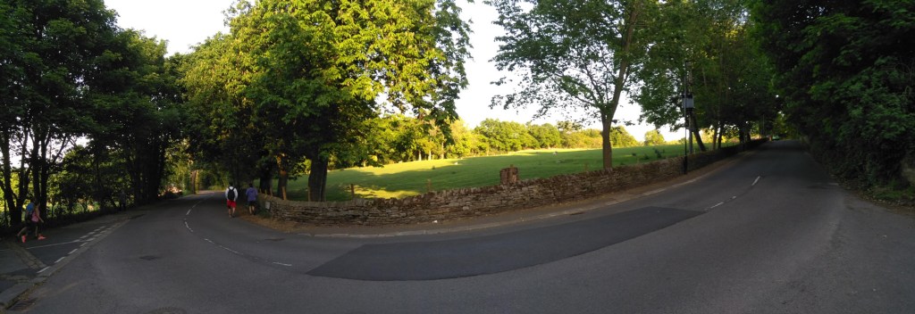
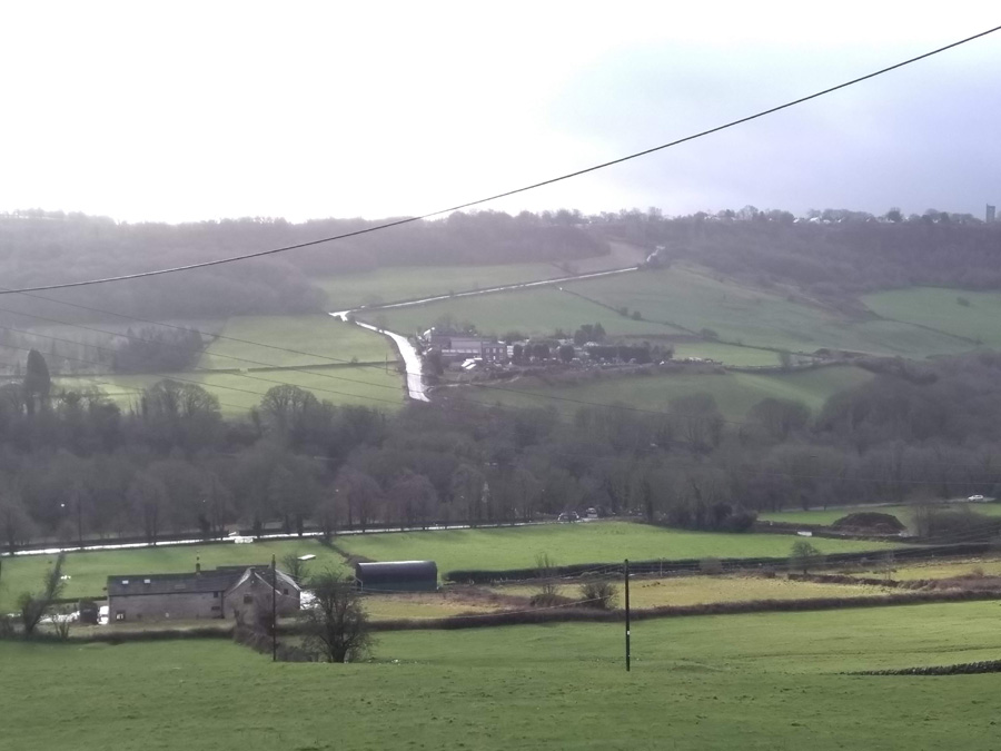
When you’re past the cattery, the road bends left once more and you’re well on your way to the apex as, shortly after, you turn onto Common Lane. From here, with every pedal, the gradient drops away and you find yourself at the start of Ringinglow Road, ready to get out to the Peaks.

Ranmoor Crescent

  • Ranmmor Crescent
  • Length: 0.25 miles
  • Avg gradient: 9%   Peak gradient: 11.3%
  • Difficulty: 2/5
  • Likelihood of encountering unpleasant motor-vehicles: 1/5
  • Elevation gain: 124 ft
  • Strava

A short, little hill that featured in the 2017 Magnificent 7. Because the road has a broad S-shape, it’s not as steep as some of the other roads in the area.

You begin the climb at the crossroads with Ranmoor Road. The road curves around the the left as the gradient creeps to around 10-11%. This corner isn’t too challenging and soon the road bends back to the right, as you ride up the steepest section, which is only a brief 11.3%.

Admire the big houses here, as the road straightens out and drops to around 6%. You can see the junction with Ranmoor Cliffe Road in the distance, marked by a postbox on the right. As you take the left turn at the junction, you’re back to an 11% climb for the final short stretch until Watt Lane.

A pleasant enough climb but it’s not the challenge I was expecting. If you fancy something nearby that’s a bit trickier, try Ranmoor Park Road. A far straighter climb with fewer bends easing the gradient. I’ll save that one for a later date.

Rails Road

  • Rails Road
  • Length: 0.42 miles 
  • Avg gradient: 8.5%   Peak gradient: 14.7%
  • Difficulty: 3/5
  • Likelihood of encountering unpleasant motor-vehicles: 2/5
  • Strava

If Lodge Lane is the bad cop, the Rails Road is the good cop. It might be slightly easier on you but you’re still in trouble.

Sitting practically opposite Lodge Lane, Rails Road takes you up towards Stannington and to the cusp of some absolutely beautiful country cycling. You’re immediately on a gradient of 5-7% as you pull away from the nasty main road and in the distance you can see your main target: the sweeping right-hand bend.  There’s not many distinguishing features to pick out from the fields either side of you at this point but passing a large gate on your left is the signal for the road to ramp up into double figures.

The gradient continues to increase the closer you get to the bend, hitting a peak of 14.7% (although Strava claims 18.2%) just before you turn. You’re on the left, so it’s not quite as tricky as it could be but you’re still feeling the effort. Once you’re around the bend, you’ll run alongside a trickling culvert, which feels like it’s taunting you on a hot, sweaty day and shortly pass a footpath on your left which is where the Strava segment incorrectly shows a short, flat section. Let’s be clear: there is no short, flat section on his hill. It’s a GPS anomaly.

There is a slight relent in steepness as you reach Woodbank Road (and a great alternative route to the countryside) but carry straight on. The ride is getting easier with every pedal now and soon flattens out as you pass farmhouses on either side of the road and a gorgeous view across the Rivelin Valley.

Lodge Lane, seen from Rails Road

You can either continue on to Stannington (after another bonus bump) and head out into the Peaks towards Dungworth and Bradfield, or zoom back down the hill and tackle Rails Road’s evil twin: Lodge Lane.

Tom Lane

  • Tom Lane
  • Length: 0.76 miles 
  • Avg gradient: 8%   Peak gradient: 12.9%
  • Difficulty: 3/5
  • Likelihood of encountering unpleasant motor-vehicles: 1/5
  • Strava 

A nondescript, residential road in the leafier end of Sheffield, I was surprised to see that, statistically this hill is actually not that different from the far more imposing Lodge Lane.  Tom Lane is not as hard as that but it does have a couple of spikes along the way and, for the sake of this segment, a surprising little twist in its tail.  I’ve worked around here quite a bit and would regularly see a mum cycling up here with a child on the back of her bike.  Strava kudos to her for that.

Tom Lane starts innocently enough, opposite the junior school, with a gradient fluctuating around the 4-5% mark, as you climb the first couple of bends.  As you pass house number 74, however, the road straightens up, gets steeper and the hill’s first challenge is laid in front of you.  The hill is now around 12% and you feel each percentage as you pedal up to a large stone cottage at the junction of Belgrave Drive.  It is slightly less steep now but you’re still plodding upwards.

Follow the road, ignoring any junctions and continue round, first a left bend and then a right.  This little section here, for me, feels the hardest part of the road section.  There isn’t a significant increase in gradient but the approach to the right-hand bend – and the bend itself – really makes you feel like you’re dragging your bike.

You’ll soon reach a T-junction, turn right and continue upwards on what, once again, feels steeper than it is.  Take the next left (the road you turn onto remains Tom Lane) and head up this narrower section of road, often with numerous parked cars on either side.  You’ll shortly come to a brief section of 5% as you round a few more bends and pass Hillcote Close on your left. It’s here that you’re going to find that surprising twist in Tom Lane’s tail.

As you pass the steps with a handrail, on the left, instead of sticking to the road, wiggle round onto what looks like a footpath (there are no signs saying cycling in prohibited and it even has a Tom Lane road sign at the bottom so I’m sure it’s legal).  It’s this brief bumpy section that pulls the average up and my recording of this part puts the gradient between 17-22%. However, your fancy road bike might not like the surface.  It’s only short, though, and you’ll soon reach Redmires Road and the golf club.

Well done, you’ve just made it up a modest yet surprisingly challenging hill. Which is exactly what a Sheffield cycling climb should be.

Lodge Lane

  • Lodge Lane
  • Length: 0.7 miles 
  • Avg gradient: 9.3%   Peak gradient: 15%
  • Difficulty: 4/5
  • Likelihood of encountering unpleasant motor-vehicles: 2/5
  • Strava

A few miles westward, out of the city, along the fairy nasty A57 Manchester Road you’ll find a couple of cheeky challenging climbs, escalating either side of the Rivelin Valley: Rails Road and Lodge Lane.  Rails Road will take you north up to Stannington, and Lodge Lane, south, to the green and pleasant lands of Lodge Moor.

Like many of the roads that climb the Rivelin valley wall (see also: Hagg Hill), unless you’re lucky with oncoming traffic, you’re pretty much going to lose all of your momentum turning 90 degrees onto the hill.  Lodge Lane isn’t quite as a brutal start as Hagg Hill but you are straight into a 10% incline and a sharp left corner to begin.  The steepness gradually increases as you follow the road round a right-hand bend and are presented with a straight stretch open in front of you.

As you pass the campsite, the incline drops to around 7%, which feels comparatively flat, so use this section to ease off a bit before you prepare to dig in again. As the road heads to the next bend the gradient is back in double figures and although it’s only 0.1 mile I find this part tough because I know what’s around the next corner.  Since you’re now well above the valley with some lovely views towards the Peaks, it’s tempting to think you’re almost at the top.  You are not.

As the tree line returns and you round the next bend, I always expect to see the top of the hill, when all Lodge Lane offers you is more of the same.  In the distance, it’s not the end of the hill you can see but, at 15%, the hardest of the climb’s numerous bends. If you get round that, once you reach the roadside bollards you’ve made it and just need to pant on a few more feet to the end.

Now turn around, drop down at speed, and tackle Rails Road on the other side of the valley.

The Dale

  • The Dale
  • Length: 2.25 miles 
  • Avg gradient: 7%   Peak gradient: 12.9%
  • Difficulty: 4/5
  • Likelihood of encountering unpleasant motor-vehicles: 1/5
  • Strava

If you’re heading back to Sheffield from Hathersage there is the small matter of how you are going to get over the massive hill between the two places.  If you’re cycling on the road you’ve got three likely choices: The Dale, Fiddler’s Elbow and Surprise View.  All three are different in character and The Dale is definitely the steepest and most challenging.  The pay-off is that it’s also the quietest.

Having ridden down The Dale many times I was well aware of how steep it is and I was not surprised to discover how equally challenging it is to climb. The reward for your efforts, however, is some absolutely stunning scenery and an extraordinary sense of accomplishment.

As you leave Hathersage towards Sheffield, turn on to School Lane and follow the road past The Scotsmans Pack where the climb begins in earnest. For the first third of a mile, as you pass various quaint houses, the gradient fluctuates around the 5% mark.  Once you’re past those, and as the road bends round to the left, the gradient dramatically jumps into the teens.  The real fight starts here as you tackle The Dale’s steepest section but do hold something in reserve as you’ve still got a way to go.

As the tree cover gives way, revealing the valley that you’re carving up through, you just need to keep your head down and keep on pushing. You will eventually reach a sweeping left turn, where the gradient drops down to single figures (its still 8-9%, don’t go thinking it’s much of a relent) and your first sighting of the majestic Higger Tor.

You are now well past the hardest section of The Dale but you do still have over half the climb to do.  Luckily, the next section to Hook’s Carr car park (marked by a cattle grid) is far more manageable and, according to Strava, even drops to 0% at one point. Use that softening to recharge your legs in preparation for your attack on the last third of the hill.

Your final blast is where it all pays off.  The climb never goes above 11.4% for the last 0.8 miles yet you are gifted some absolutely stunning views as well as being able to look down into the Hope Valley and appreciate just how well you’ve done to get where you are.

A truly stunning Peak District cycling climb.

Smithy Wood Crescent

  • Smithy Wood Crescent
  • Length: 0.18 miles 
  • Avg gradient: 3% on the Strava segment but closer to 6%
  • Peak gradient: 10%
  • Difficulty: 2/5
  • Likelihood of encountering unpleasant motor-vehicles: 1/5
  • Strava

With its 180° curve, Smithy Wood Crescent is almost like one of the switchbacks on the Alpe d’Huez.  Almost.  This is a road I’d driven up many, many times and it always felt like it would be a formidable challenge to ride up on a bike. I was wrong.

First of all, in the hill’s defence, the Strava segment includes a bit of downhill at the start, which scuppers the average gradient.  It says 3% but I think it’s closer to 6% and it does reach double figures at the very end.

Whatever the actual stats, use the little downhill from Woodseats Road to get some speed then blast away as the road begins to climb for the first bend and then holds its steepness for a short straight stretch before you do that switchback.  Feeling like you’re cruising up the Alps, the gradient actually drops off a bit as you round the corner and approach the tree-lined final spike before joining Chesterfield Road. A quick blast.

I’m not sure why I thought this would be such a tough climb when it really isn’t much of a challenge at all.  I guess it’s included because ever since moving to the city, Smithy Wood Crescent felt like the typical Sheffield hill: short, steep and sitting in the middle of suburbia with no fanfare, when if it was anywhere else it would have a far more impressive reputation.

Woodcliffe & Hangram Lane

  • Woodcliffe & Hangram Lane
  • Length: 0.81 miles
  • Avg gradient: 8%   Peak gradient: 22.8%
  • Difficulty: 3/5 (steep but not too long)
  • Likelihood of encountering unpleasant motor-vehicles: 2/5
  • Strava  (Strava gets the hill’s topography incorrect. It appears as if there is a far longer flat stretch between the two climbs than there really is).

Woodcliffe and Hangram Lane is another route out of the suburbs to the edge of the Peak District but I was surprised to learn that it’s only 0.8 miles, as it feels much longer.  At its peak, you’ll join Ringinglow Road, about half-way up.  However, that hill will seem like a walk in the park once you’ve climbed this one.

The hill begins gently as the road crosses the Porter Brook but immediately picks up as it passes Clough Lane and curves around to the left. This is the hardest part of the climb and where the gradient quickly slips into double figures.  Do your best to dig in here, as this short straight section maintains its steepness until the next corner where the gradient touches the low 20s.

There is a brief blast of flat terrain before you turn right, onto Hangram Lane, where the road begins to climb once more.  You’ll pass a couple of houses before the the trees begin to drop away, revealing open farmland on either side.

Even though you’ve done the steepest bit and here the road is only averaging 7-9%, I always find this section more challenging as it feels more relentless.  Once you’re past the farm shop though, the end is in sight and you’ll shortly reach Ringinglow Road, where you can head downhill into Sheffield or upwards out into the Peak District.

Meersbrook Park

  • Meersbook Park
  • Length: 0.3 miles
  • Avg gradient: 9.5%   Peak gradient: 20%
  • Difficulty: 2/5 (steep but not long)
  • Likelihood of encountering unpleasant motor-vehicles: 0/5
  • Strava

A very hilly park, a couple of miles south of the city centre. My introduction to Meersbrook Park was cycling downhill through it at great speed.  It made me wonder what it would be like to tackle it in the opposite direction. There are several routes – all looking steep – through the park but, for the sake of this, I did (with some extension) the Strava segment labelled ‘Meersbrook Grind’.

You’ll enter the park from the direction of Brooklyn Road and the house with the attractive bird mural by Faunagraphic.  The path starts easily enough as you pass the tennis courts on your right.  Looking left, through the trees, you can see what you’re about to tackle.  Follow the path and begin the climb in earnest.  It’s here the the Strava segment begins.

The path is smooth with a gentle curve and you can pretty much see where you’re headed the whole time but it is a bit unrelenting, hitting the peak gradients about halfway up. Different sources disagree about the steepest point of the hill, varying from 17% to almost 22%.  Whatever the reality, you get some idea of how steep the hill is from the angle of the houses in the photo.

If you can, glance behind you, as you climb higher and higher you get an ever more impressive panorama of Sheffield.  Eventually you’ll reach small play trail as the hill begins to peter out.  Shortly after, you’ll reach the 16th century Bishops House and the top of Meersbrook Park.  A short but sweet Sheffield hill climb.

Armthorpe Road

  • Armthorpe Road
  • Length: 661 feet
  • Avg gradient: 8.7%   Peak gradient: 11.6%
  • Difficulty: 1/5 (it’s steep but very short)
  • Likelihood of encountering unpleasant motor-vehicles: 2/5
  • Strava:  So short that it doesn’t even have its own segment.  How sad.

Armthorpe Road is a fairly innocuous hill climb in that the only reason that you’d ever find it is if you know someone who lives there.  The road itself just loops around, beginning and ending on Hangingwater Road but it’s a short sharp shock.  I once did a long and hilly Peak District ride, thought I’d do Armthorpe Road as I was passing on my way home, and it turned out to be the most challenging of the day.

Start by the red house on the corner and head full pelt into this quiet, residential street.  It’s not a long hill so you don’t need to keep any reserves but you’ll find that the incline picks up immediately, hitting 9.4% at the junction with Bramwith Road.  This is where the hill gets tough, though.

The road bends sharply to the left and, ideally, you’d be able to move over to the right hand side to reduce the impact of the 11.6% turn but it’s a blind bend and you’ve no idea if there’s a car coming so you’ll need to stay left.  Once you’re around that corner the gradient eases off as a high stone wall appears on your right.  Catch your breath and roll back round to rejoin Hangingwater Road.