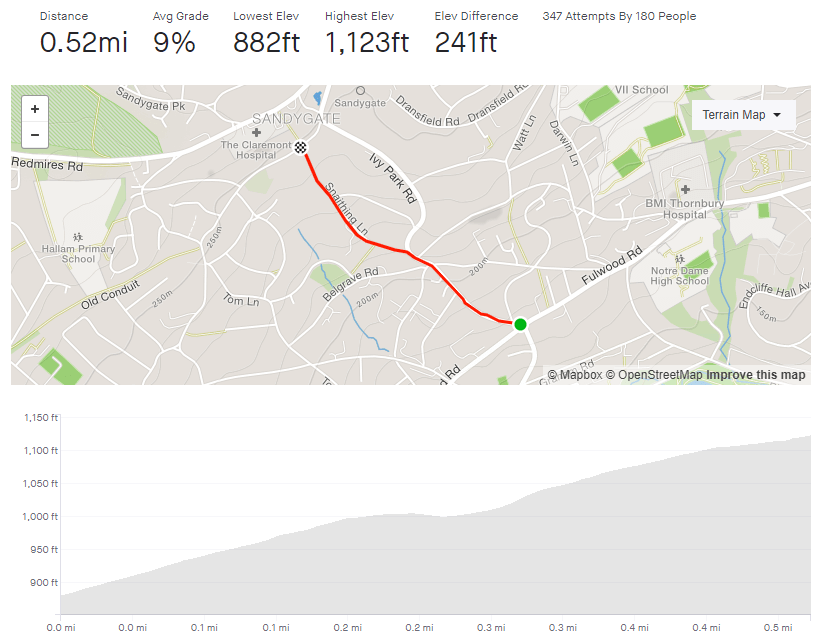
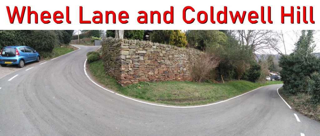
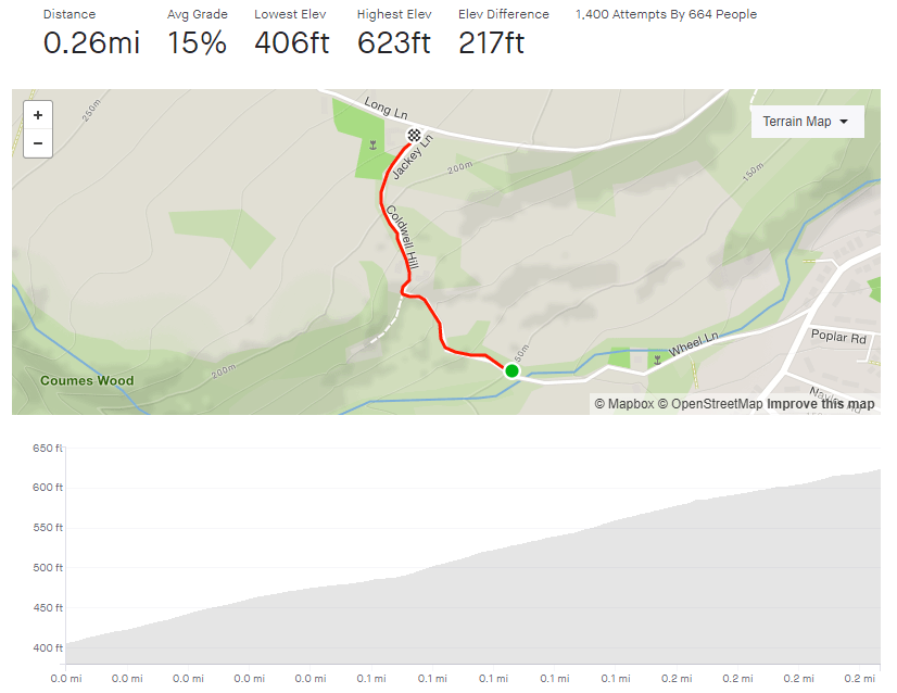
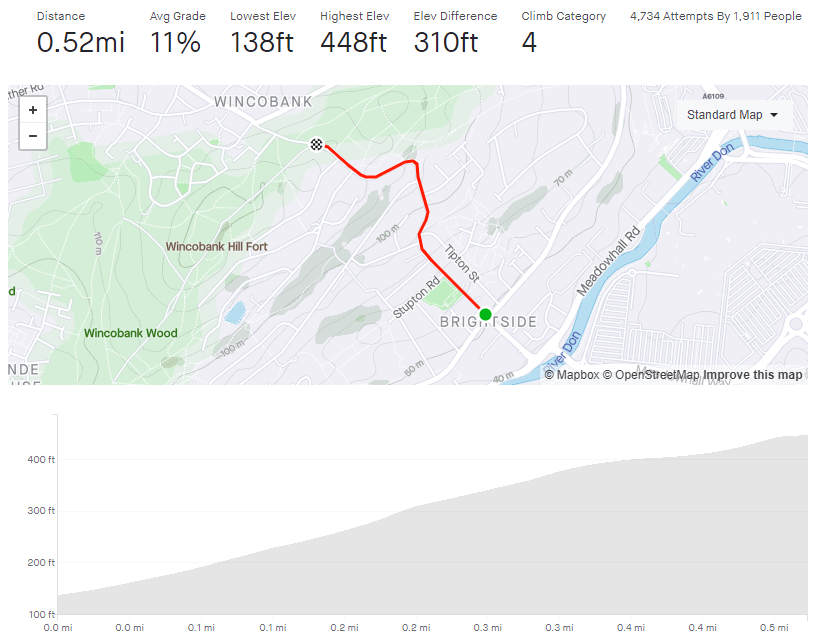
Tag: hills

Jenkin Road

  • Jenkin Road
  • Length: 0.52 miles
  • Avg gradient: 11%
  • Peak gradient: 17.2% (the sign at the bottom says 33% but I don’t believe that)
  • Difficulty: 4/5
  • Likelihood of encountering unpleasant motor-vehicles: 3/5
  • Elevation gain: 310 ft
  • Strava

Something special for the 25th hill on sheffieldcyclingclimbs.com.

Many of Sheffield’s hills are fairly anonymous, some have a little local notoriety and some have enough of a reputation to feature in the Tour de France. Jenkin Road (or the Côte de Wincobank Hill as it was renamed for The Grande Départ in 2014) is one of those hills.

As a result of its reputation, I’d been putting off attempting this climb for some time but finally relented during lockdown, figuring that I’d be delaying fewer cars as I plodded upwards. The fact that I do every climb at least twice (once to do the climb and a second time to take photos) just added to the trepidation.

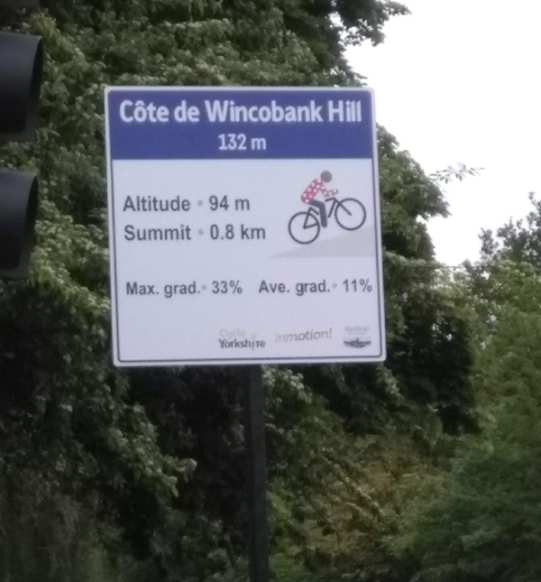
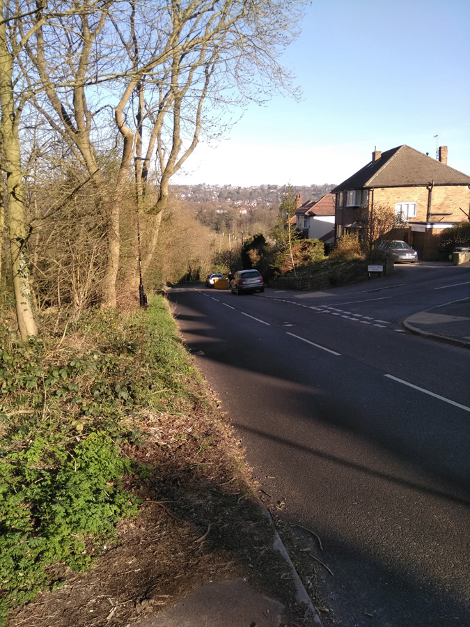
Starting from the junction with Holywell Road, you’re already at a disadvantage, having had to stop at the crossroads and therefore beginning from a standing start. It’s here that the sign, commemorating Jenkin Road’s role in the 2014 Tour, is placed. It states that the average gradient is a perfectly acceptable 11% but the maximum gradient is a formidable 33%. I think that’s an exaggeration and Strava and Veloviewer both agree, putting the peak gradient closer to 16.8%. Jenkin Road’s steepest segment is slightly wiggly, so maybe in a straight line it’s closer to 33%.

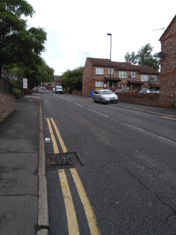
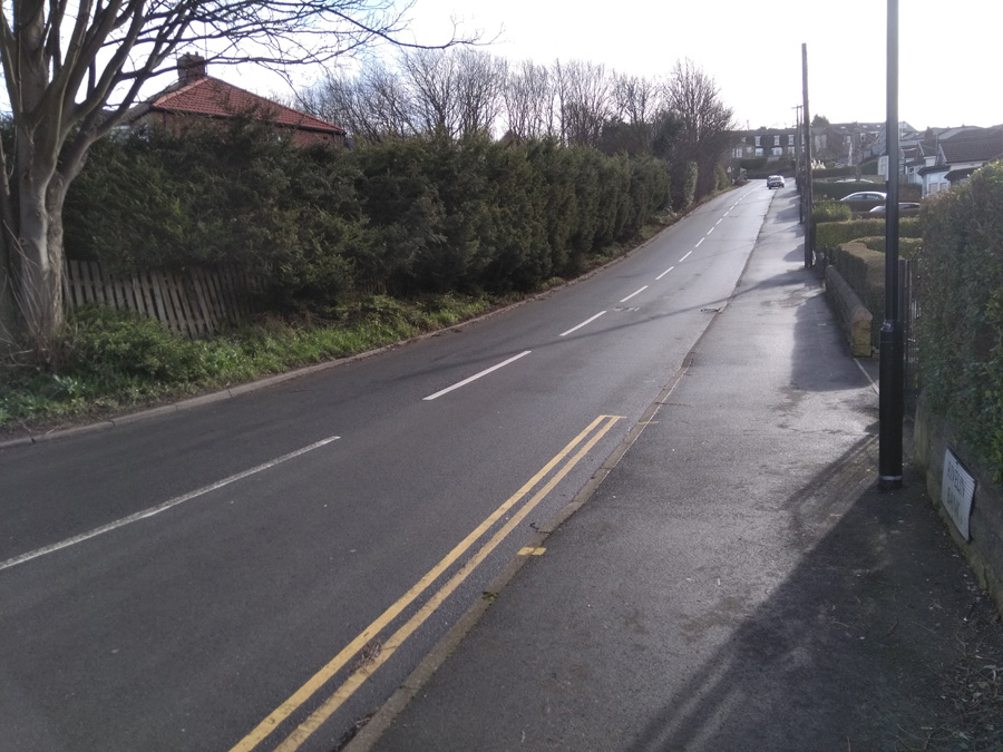
The hill begins at a fairly standard 10% as it stretches ahead of of you. With houses, playing fields and a church, there’s not much yet to mark this climb as distinct from the likes of Mertyle Road but, just after you pass the church, the road curves to the right, the gradient ramps up and, ahead of you, you can see why the hill made it into the Tour.

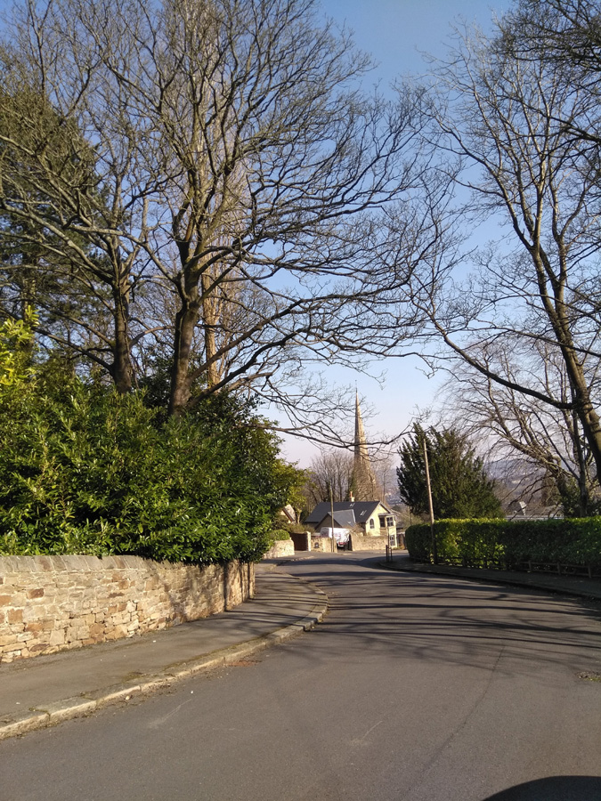
The road turns into a little S-bend here and the gradient hits 17.2% as it wiggles back and forth. Do your best here and don’t worry too much about any vehicles behind you, they’re as likely struggling up as much as you. As the hill relents a bit, down to about 12% as you pass Ridge View Road on your right, take a moment to regain a bit of strength (and have a look at the view behind you if you can) because you only about half way there.

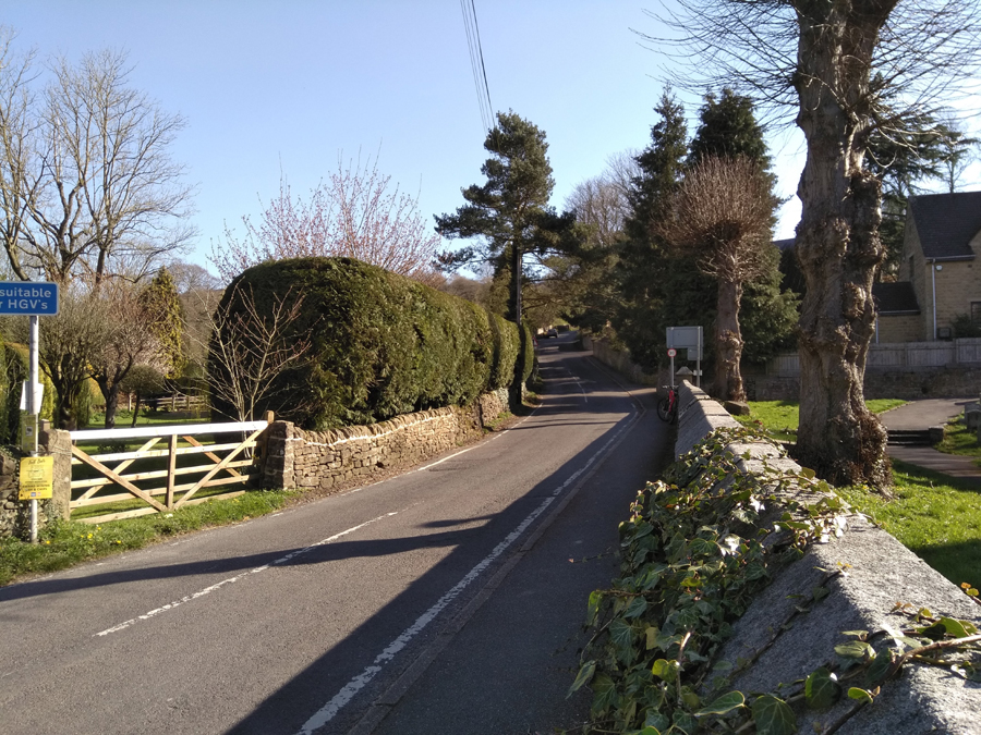
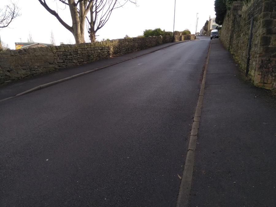
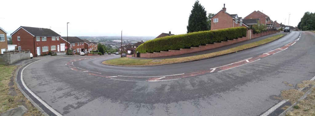
You’ll shortly reach a sweeping switchback, which starts easily enough but its a bit deceptive and you’ll notice the extra couple of percentage points on the gradient here. However, once you’re round the bend with Wincobank Common on your right, it’s the home stretch, even dropping down to a meagre 4.5% around the next corner. Once you’ve done that, you can see the final 9.5% hump approaching and shortly you’ll be at the top.  Well done.

You can see the pros on the 2014 Tour, climbing up the wiggly bit, below.

Now go and put on your yellow jersey and pretend you’ve just won the Tour De France.

Paradise Street

  • Paradise Street
  • Length: 0.04 miles
  • Avg gradient: 9%   Peak gradient: 9.2%
  • Difficulty: 1/5
  • Likelihood of encountering unpleasant motor-vehicles: 1/5
  • Elevation gain: 19 ft
  • Strava

A silly little climb in the city and a taste of the cobbled Paris Roubaix.

Recommended to me by a member of the CycleSheffield Chat forum, Paradise Street is a slightly ridiculous little cobbled hill just north of the cathedral.  Clocking in at a grand total of 0.04 miles, it’s not a foreboding challenge but don’t underestimate the impact of that cobbled surface and don’t get cocky like I did, try to sprint it, and end up more exhausted than climbing The Dale.

Starting at the junction of Queen Street, you can see the full extent of the consistent 9% hill in front of you. It’s not far. Normally, on short sharp hills you can blast it but the surface here really plays havoc with those plans. I’m glad that I’ve got suspension on mine, I can’t imagine what it’d be like on a fancy road bike. The only thing to be wary of is that, despite its single car width, Paradise Street is a two way road, so if you encounter a car coming the other direction, you’ll probably need to move out of the way. Still, it’s not far to return to the start and try again.

All you can really say for this road is head down, pedal away, see how quickly you can get up.

Whiteley Wood Road and Common Lane

  • Whiteley Woods Road and Common Lane
  • Length: 0.88 miles
  • Avg gradient: 6.6%   Peak gradient: 12%
  • Difficulty: 3/5
  • Likelihood of encountering unpleasant motor-vehicles: 3/5
  • Elevation gain: 308 ft
  • Strava

This is a utilitarian climb, in that it sole function is pretty much to get you out of suburbia, towards the Peak District. At the top, you’re on the edge of the countryside, ready to discover some absolutely lovely views.

The climb begins after a quick descent on Whitely Woods Road as it cuts through the woods themselves. The climb begins as you cross over the Porter Brook but it’s nothing serious here, as the gradient remains in the low single figures until you reach Wire Mill Dam. As the road curves left, the gradient creeps up but it still remains in single figures, where it stays for the short, straight section to the next bend.

The battle begins after you follow the road round the bend. It’s only 0.2 miles but it’s a slog. It gets slowly steeper as you grind up, hitting a peak of a 10.5% just before the cattery. However, the challenge here is more psychological than physical because the hill is so straight and with slightly boring fields either side there’s not much to look at on your way.

When you’re past the cattery, the road bends left once more and you’re well on your way to the apex as, shortly after, you turn onto Common Lane. From here, with every pedal, the gradient drops away and you find yourself at the start of Ringinglow Road, ready to get out to the Peaks.

Gladstone Grind / Snaithing Lane

  • Gladstone Grind and Snaithing Lane
  • Length: 0.52 miles
  • Avg gradient: 8.7%   Peak gradient: 13.5%
  • Difficulty: 3/5
  • Likelihood of encountering unpleasant motor-vehicles: 2/5
  • Elevation gain: 241 ft
  • Strava

Starting and finishing in similar locations and running fairly parallel to each other, the Gladstone Grind / Snaithing Lane climb is similar to – but easier than – Tom Lane. They’re both suitable tasters for some of the hills in the Peak District that these roads lead you towards.

Begin at the crossroads with Fulwood Road (the segment could begin at the bottom of Hangingwater Road but I’ve never managed to reach this crossroads without the lights turning red) and the hill is straight into double figures, hovering around the 11% mark. It’s a tree-lined road with a broad right hand curve that seems to stretch on and on. If you’re lucky, the yappy dog at number seven will come charging down the driveway at you but he’s stuck behind a gate, so you can pedal on safely.

Shortly after the road straightens out, Graham Road joins from the left. It’s heads down here and grind on as I find that there is something about this section that feels a real slog. It’s probably as it’s just a straight 10% line, with just a postbox near the crest to aim for.

A short distance past the postbox, you’re gifted a very brief downhill as you swing left off Gladstone Road, onto Snaithing Lane. The 2020 Magnificent 7 race continued up Ivy Park Road at this point but I think Snaithing Lane is a more interesting challenge, so stick with that. The downhill respite is short lived however, as the road spikes up and bends to the right. As you pass the Kings Foundation, you’re on the steepest section of the hill at around 13.5%, but it does feel steeper.

You’ll soon pass a large white house with a fancy balcony, on your right. That’s the sign that you’re over the worst, and the road drops to a more manageable 7% for the final 0.1 mile. Once you’ve reached the top, if you fancy an additional silly little challenge, turn left, then take the first right up Carsick View Road. A cheeky little spike that was not quite close enough to include as part of this entry.

Highcliffe Road

  • Highcliffe Road
  • Length: 0.39 miles
  • Avg gradient: 13%   Peak gradient: 20.6%
  • Difficulty: 4/5
  • Likelihood of encountering unpleasant motor-vehicles: 5/5
  • Elevation gain: 274 ft
  • Strava

To cut to the chase, this is not a pleasant climb. There’s always parked cars reducing the carriageway width, it’s not picturesque and you’re going to encounter at least one obnoxious motorist on your way up. However, getting to the top is a great achievement.

I’ll be honest , I’ve only ridden up this hill twice: once at 9.30am on New Years Day, the other during the coronavirus lockdown. Both of those times I knew that it would be quiet enough to do without too much trouble. At any normal time however, you are going to get an impatient driver up your backside or attempt an uphill close pass. Be warned.

The climb begins as the road crosses the Porter Brook (much the same as Woodcliffe) and begins a steep S-bend. If you’re not on a road bike, you could avoid the carriageway and instead ride alongside the steps in the park. Be aware however, that’s actually steeper than the road itself. The Strava segment’s recording is a bit skew-whiff here but it probably averages about 10-12% on this bit, up to the junction with Greystones Road.

After that, the road can get clogged with parked cars, so there is nowhere for vehicles behind you to pass safely before the blind bend ahead. Be prepared to annoy some people as you slowly grind up this tree-lined section, which briefly pops above 20%.

On the approach to the Highcliffe Drive junction the gradient does begin to reduce slightly but still remains in double figures. You can, at last, see the end of the climb though. You’ll find that all the vehicles are now parked on the opposite side of the road, creating a bit of a slalom for the line of traffic coming downhill. This is the one time it might be acceptable to ride on the pavement, if only to avoid the dirty stares from people waiting in their cars. Shortly after this you’ll be at the top of the hill, so well done for that but there are so many nicer hills to climb in the city. Go and find one of them instead.

Curbar Edge

  • Length: 1.1 miles
  • Avg gradient: 10%   Peak gradient: 15.2%
  • Difficulty: 4/5
  • Likelihood of encountering unpleasant motor-vehicles: 1/5
  • Elevation gain: 598 ft
  • Strava

There is pretty much nothing that I can say about Curbar Edge that hasn’t already been said in greater detail and with more authority elsewhere, not least Simon Warren’s 100 Greatest Cycling Climbs and James Allen’s 50 Classic Cycle Climbs but as it is what I’d consider a headline hill, it would be remiss of me to not include it here.

I’d driven up to Curbar Gap many times before, heading for family walks along the edge, so I was familiar with the hill, its two sweeping bends and the towering gritstone rocks that give the hill its character. It’s an even more impressive climb when you’re on a bike.

You start in the village of Curbar itself, next to All Saint’s Church, and it’s from here that you head up the innocuous looking Curbar Lane. As you pass The Old Vicarage on your right, the gradient is immediately into double figures, reaching 14.5% as the road bends to the right. This is the steepest section of the whole climb, which is a good thought to keep in mind as you progress up the hill, eventually passing a red telephone box at a crossroads.

The climb now drops to a more pleasant 6-7% for a straight section, lined with rather nice looking houses with big gardens. You’ve pretty much reached the halfway mark when you pass the national speed limit sign, which sees the gradient return to around 10-11% and, more impressively, the countryside open up and the appearance of Curbar Edge, loom ominously above you.

The steepness remains fairly consistent around the first sweeping bend and then reaches 11.5% as you head towards the second, sharper corner. The views from here more than make up for the additional challenge though. Just try not to focus on the ridge of Curbar Gap which, at this point, still seems very high up and very far away.

Grind on around the next bend and, once you’ve passed a gate into a field on your right, I always feel like you’re pretty much there. You still have to cycle 0.3 miles and climb 130 ft but it’s broadly straight with a gradient of less than 10% and the views alone will keep your legs powered until you reach the car park at the peak.

Curbar Edge is a beautiful climb worth travelling for.

Ranmoor Crescent

  • Ranmmor Crescent
  • Length: 0.25 miles
  • Avg gradient: 9%   Peak gradient: 11.3%
  • Difficulty: 2/5
  • Likelihood of encountering unpleasant motor-vehicles: 1/5
  • Elevation gain: 124 ft
  • Strava

A short, little hill that featured in the 2017 Magnificent 7. Because the road has a broad S-shape, it’s not as steep as some of the other roads in the area.

You begin the climb at the crossroads with Ranmoor Road. The road curves around the the left as the gradient creeps to around 10-11%. This corner isn’t too challenging and soon the road bends back to the right, as you ride up the steepest section, which is only a brief 11.3%.

Admire the big houses here, as the road straightens out and drops to around 6%. You can see the junction with Ranmoor Cliffe Road in the distance, marked by a postbox on the right. As you take the left turn at the junction, you’re back to an 11% climb for the final short stretch until Watt Lane.

A pleasant enough climb but it’s not the challenge I was expecting. If you fancy something nearby that’s a bit trickier, try Ranmoor Park Road. A far straighter climb with fewer bends easing the gradient. I’ll save that one for a later date.

Wheel Lane & Coldwell Hill

  • Wheel Lane & Coldwell Hill
  • Length: 0.26 miles
  • Avg gradient: 15.4%   Peak gradient: 17.7%
  • Difficulty: 4/5
  • Likelihood of encountering unpleasant motor-vehicles: 1/5
  • Elevation gain: 217 ft 
  • Strava

A hidden gem of a hill climb, tucked away in the hills outside Oughtibridge. It’s just over a quarter of a mile long but look how close the average and peak gradients are.  That tells you that it’s a very unwavering climb all the way to the top.  And your reward for getting there?  Another hill.

As soon as you pass over the brook (which is liable to flooding in rainy periods) the hill begins with a little weave and a gradient of around 17%. Climb up this until the road makes a sharp right turn and a sign tells you that you’re now on Coldwell Hill. You’ll pass the first of the houses and a grit bin on your right, which makes you wonder how brave you’d have to be to drive up here in icy conditions.  It’s hard to believe but, at about 9%, this is the flattest section of the climb.

That’s soon forgotten however, as you wind round a dogleg bend with the steepest incline of the hill. As you curve past the row of quaint cottages you’ll be thinking that this must be it but you’re only about half way up. You’ve got a slightly straighter climb now but still averaging 15%. Shortly, the climb takes another sweep right and after a brief section of tree-lined road, another sign tells you that you’ve joined Jackey Lane for the final 600 ft.

Well done, you’ve just made it up one of my favourite Sheffield cycling climbs. From here, turn right and drop back into Oughtibridge or, if you fancy continuing the challenge, turn left onto Green Lane and tackle another mile or so of 8% out into the countryside.

Earldom Road

  • Earldom Road
  • Length: 0.14 miles
  • Avg gradient: 13.6%   Peak gradient: 17.5%
  • Difficulty: 2/5 (only because it’s so short).
  • Likelihood of encountering unpleasant motor-vehicles: 1/5
  • Elevation gain: 101 ft 
  • Strava

This is a very short blast up a very steep hill. Hidden in the suburbs of Burngreave lies this surprising little spike that will give your legs a bit of a testing.

Earldom Road is only 0.14 miles long and you can see the apex from the outset so there’s no surprises in store. Just remember to get into the correct gear from the off, not like me on my last attempt where I thought I’d show off and blitz it up on a middle gear before I quickly ground to a halt, unable to pedal. Shamefaced, I dropped down to a low gear an made it to the top.

Earldom Road begins at about 6% as you join from Ellesmere Road. However, between the pub and Earldom Drive it ramps up to around 13%. Once you’re past that junction, the gradient steadily increases to 17.5% at the peak.

This hill is definitely a sprint, not a marathon, so just put your all into it and see how quickly you can get up it.

Rivelin Bank & Walkley Bank Road

  • Rivelin Bank & Walkley Bank Road
  • Length: 0.32 miles
  • Avg gradient: 11.3%   Peak gradient: 14.9%
  • Difficulty: 3/5
  • Likelihood of encountering unpleasant motor-vehicles: 2/5
  • Elevation gain: 194 ft
  • Strava

The first time I tackled this climb I didn’t really know where I was going and thought this might have been a more direct route home. I might have been correct about it being more direct but it certainly wasn’t flatter.

Rivelin Bank’s gradient is very quickly into double figures with an average of 13% until the bend to the left and the junction with Racker Way. It’s a dead straight section, so it’s all about putting your head down and grinding. The first time I did the hill and its steepness took me by surprise, I had to take a turn around an apartment’s parking lot about half way up, just to get my breath back without having to actually stop pedaling.

The approach to the bend is the steepest section and, once you’re around it, the gradient does ease off, dropping to around 10.5% for the second half of the climb. You’re now on Walkley Bank Road, with the allotments on your left and a high wall on your right. Once you pass the junction of Hawthorne Road the steepness begins to peter out, until you trundle to the apex at Walkley Bank Close.

This was by no means the end of my route home and, as you’ll find if you explore Walkley, by no means the only challenging hill in the area.