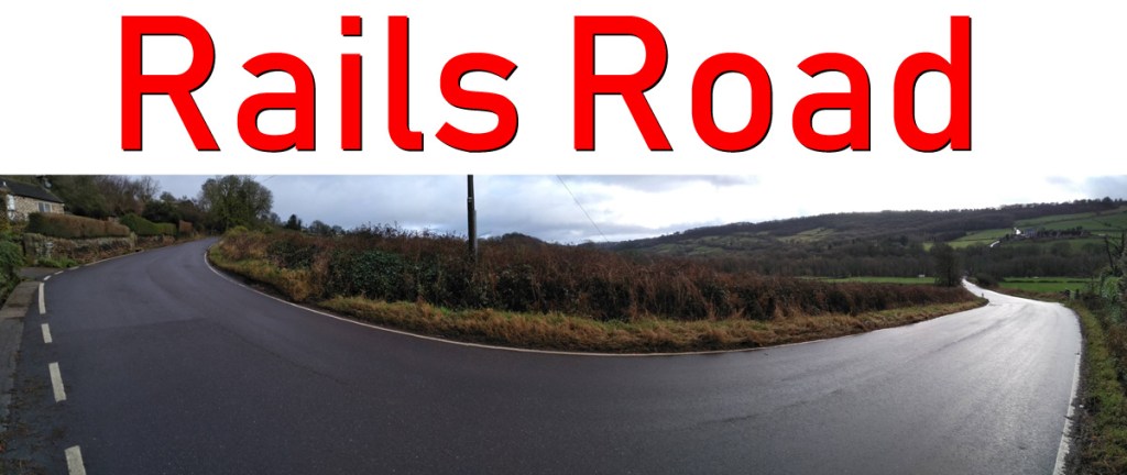
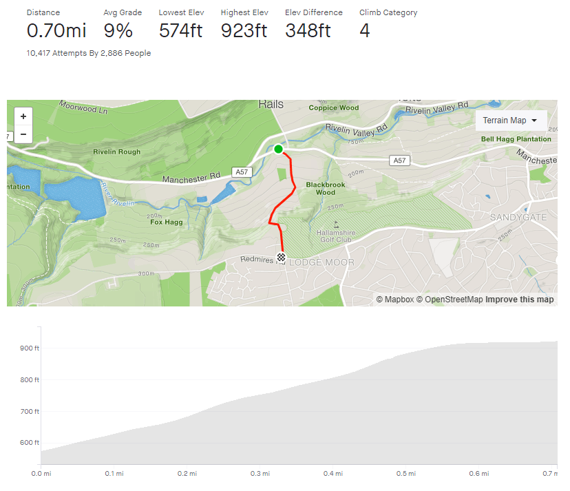
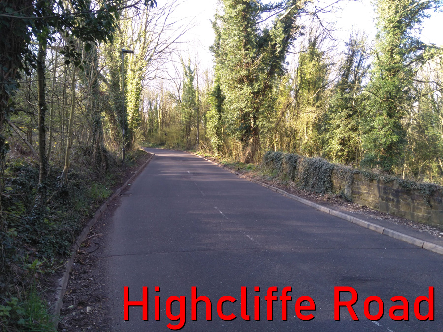
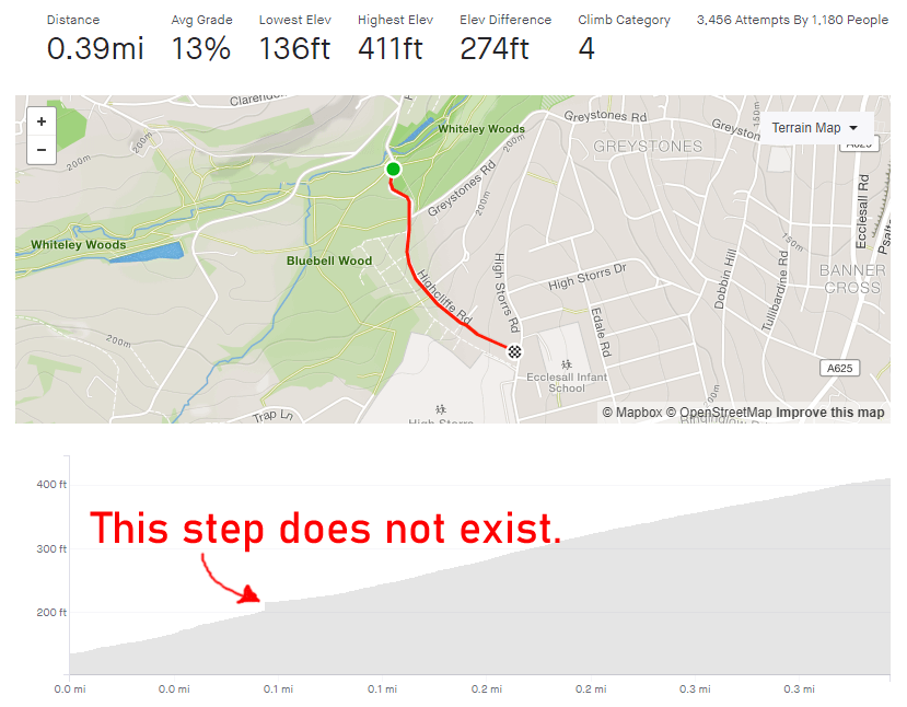
Tag: sheffield

Highcliffe Road

  • Highcliffe Road
  • Length: 0.39 miles
  • Avg gradient: 13%   Peak gradient: 20.6%
  • Difficulty: 4/5
  • Likelihood of encountering unpleasant motor-vehicles: 5/5
  • Elevation gain: 274 ft
  • Strava

To cut to the chase, this is not a pleasant climb. There’s always parked cars reducing the carriageway width, it’s not picturesque and you’re going to encounter at least one obnoxious motorist on your way up. However, getting to the top is a great achievement.

I’ll be honest , I’ve only ridden up this hill twice: once at 9.30am on New Years Day, the other during the coronavirus lockdown. Both of those times I knew that it would be quiet enough to do without too much trouble. At any normal time however, you are going to get an impatient driver up your backside or attempt an uphill close pass. Be warned.

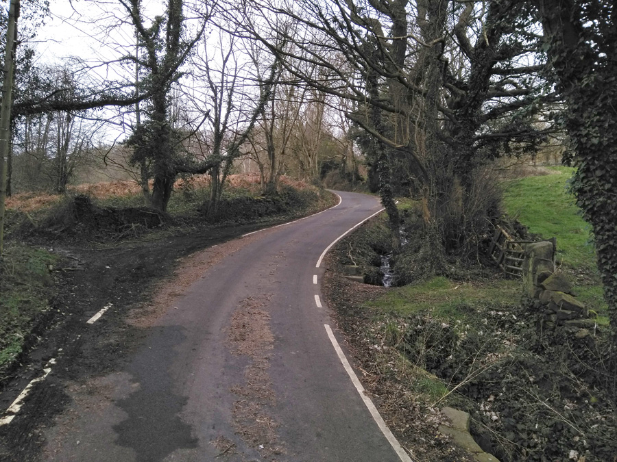
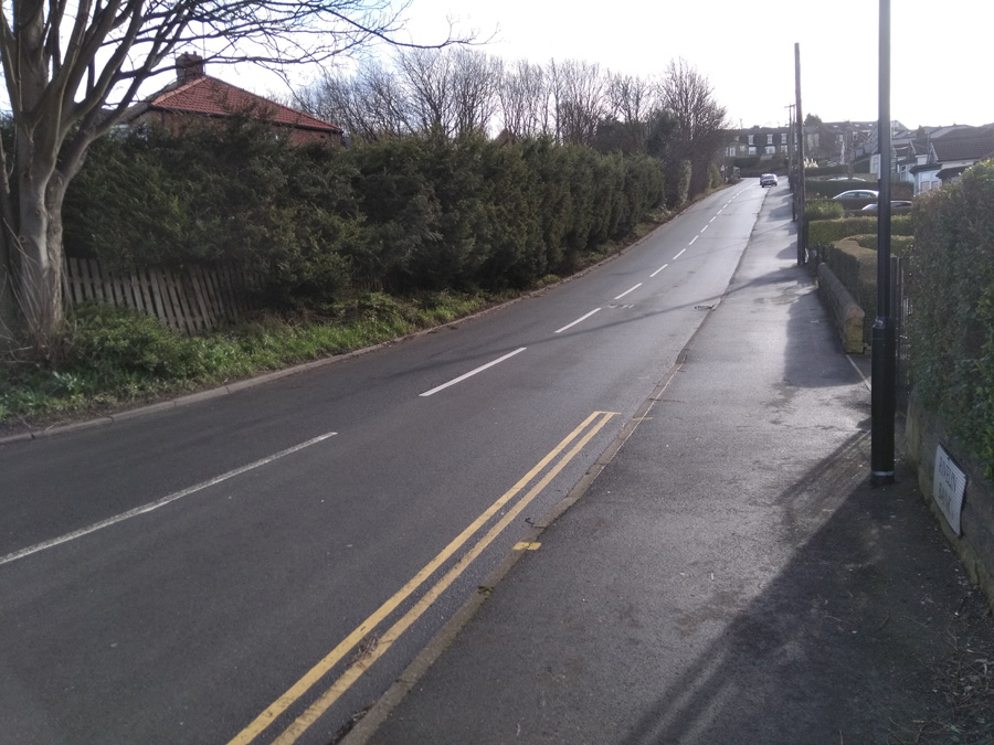
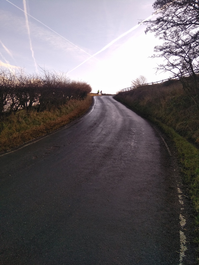
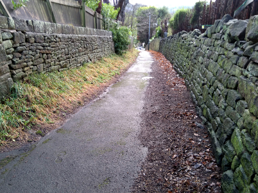
The climb begins as the road crosses the Porter Brook (much the same as Woodcliffe) and begins a steep S-bend. If you’re not on a road bike, you could avoid the carriageway and instead ride alongside the steps in the park. Be aware however, that’s actually steeper than the road itself. The Strava segment’s recording is a bit skew-whiff here but it probably averages about 10-12% on this bit, up to the junction with Greystones Road.

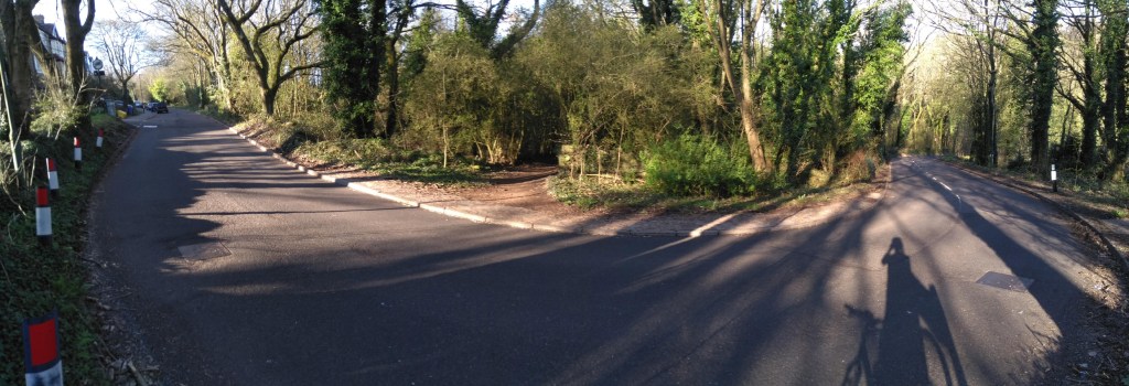
After that, the road can get clogged with parked cars, so there is nowhere for vehicles behind you to pass safely before the blind bend ahead. Be prepared to annoy some people as you slowly grind up this tree-lined section, which briefly pops above 20%.

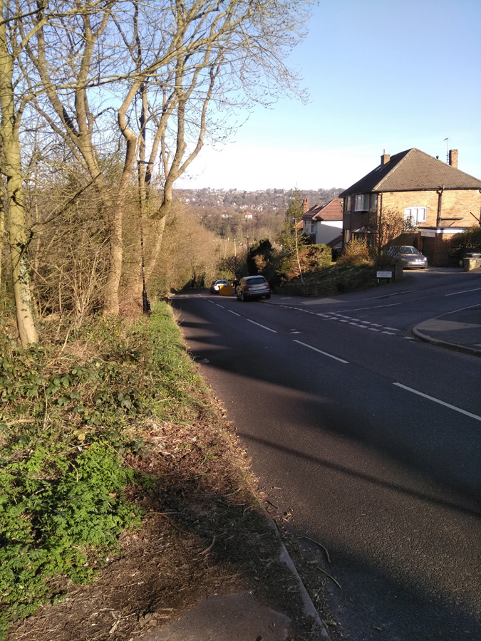
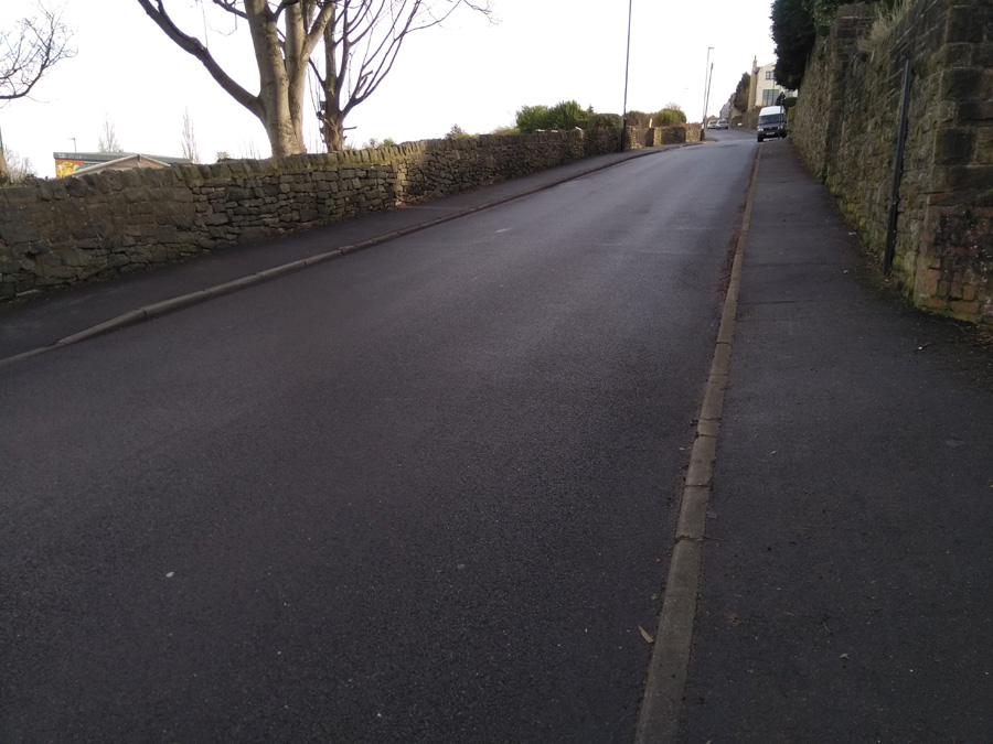
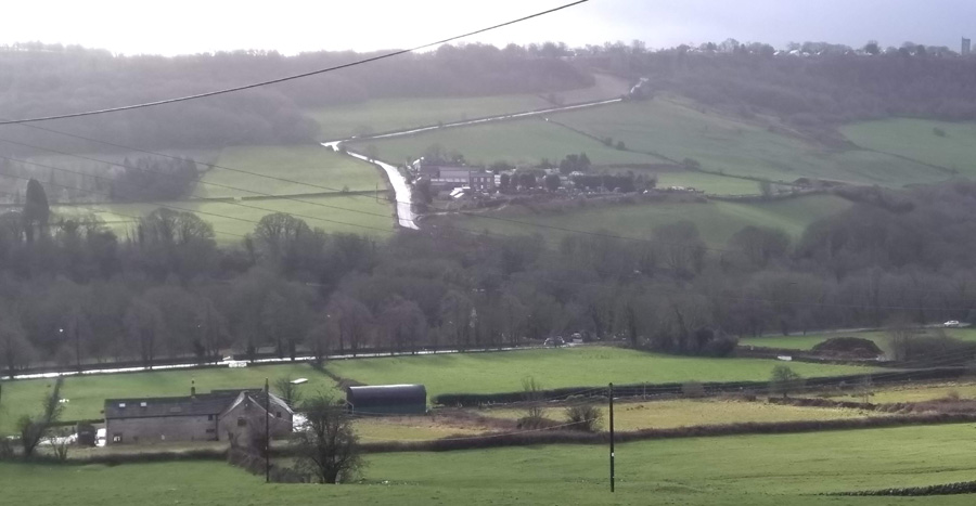
On the approach to the Highcliffe Drive junction the gradient does begin to reduce slightly but still remains in double figures. You can, at last, see the end of the climb though. You’ll find that all the vehicles are now parked on the opposite side of the road, creating a bit of a slalom for the line of traffic coming downhill. This is the one time it might be acceptable to ride on the pavement, if only to avoid the dirty stares from people waiting in their cars. Shortly after this you’ll be at the top of the hill, so well done for that but there are so many nicer hills to climb in the city. Go and find one of them instead.

Ranmoor Crescent

  • Ranmmor Crescent
  • Length: 0.25 miles
  • Avg gradient: 9%   Peak gradient: 11.3%
  • Difficulty: 2/5
  • Likelihood of encountering unpleasant motor-vehicles: 1/5
  • Elevation gain: 124 ft
  • Strava

A short, little hill that featured in the 2017 Magnificent 7. Because the road has a broad S-shape, it’s not as steep as some of the other roads in the area.

You begin the climb at the crossroads with Ranmoor Road. The road curves around the the left as the gradient creeps to around 10-11%. This corner isn’t too challenging and soon the road bends back to the right, as you ride up the steepest section, which is only a brief 11.3%.

Admire the big houses here, as the road straightens out and drops to around 6%. You can see the junction with Ranmoor Cliffe Road in the distance, marked by a postbox on the right. As you take the left turn at the junction, you’re back to an 11% climb for the final short stretch until Watt Lane.

A pleasant enough climb but it’s not the challenge I was expecting. If you fancy something nearby that’s a bit trickier, try Ranmoor Park Road. A far straighter climb with fewer bends easing the gradient. I’ll save that one for a later date.

Wheel Lane & Coldwell Hill

  • Wheel Lane & Coldwell Hill
  • Length: 0.26 miles
  • Avg gradient: 15.4%   Peak gradient: 17.7%
  • Difficulty: 4/5
  • Likelihood of encountering unpleasant motor-vehicles: 1/5
  • Elevation gain: 217 ft 
  • Strava

A hidden gem of a hill climb, tucked away in the hills outside Oughtibridge. It’s just over a quarter of a mile long but look how close the average and peak gradients are.  That tells you that it’s a very unwavering climb all the way to the top.  And your reward for getting there?  Another hill.

As soon as you pass over the brook (which is liable to flooding in rainy periods) the hill begins with a little weave and a gradient of around 17%. Climb up this until the road makes a sharp right turn and a sign tells you that you’re now on Coldwell Hill. You’ll pass the first of the houses and a grit bin on your right, which makes you wonder how brave you’d have to be to drive up here in icy conditions.  It’s hard to believe but, at about 9%, this is the flattest section of the climb.

That’s soon forgotten however, as you wind round a dogleg bend with the steepest incline of the hill. As you curve past the row of quaint cottages you’ll be thinking that this must be it but you’re only about half way up. You’ve got a slightly straighter climb now but still averaging 15%. Shortly, the climb takes another sweep right and after a brief section of tree-lined road, another sign tells you that you’ve joined Jackey Lane for the final 600 ft.

Well done, you’ve just made it up one of my favourite Sheffield cycling climbs. From here, turn right and drop back into Oughtibridge or, if you fancy continuing the challenge, turn left onto Green Lane and tackle another mile or so of 8% out into the countryside.

Earldom Road

  • Earldom Road
  • Length: 0.14 miles
  • Avg gradient: 13.6%   Peak gradient: 17.5%
  • Difficulty: 2/5 (only because it’s so short).
  • Likelihood of encountering unpleasant motor-vehicles: 1/5
  • Elevation gain: 101 ft 
  • Strava

This is a very short blast up a very steep hill. Hidden in the suburbs of Burngreave lies this surprising little spike that will give your legs a bit of a testing.

Earldom Road is only 0.14 miles long and you can see the apex from the outset so there’s no surprises in store. Just remember to get into the correct gear from the off, not like me on my last attempt where I thought I’d show off and blitz it up on a middle gear before I quickly ground to a halt, unable to pedal. Shamefaced, I dropped down to a low gear an made it to the top.

Earldom Road begins at about 6% as you join from Ellesmere Road. However, between the pub and Earldom Drive it ramps up to around 13%. Once you’re past that junction, the gradient steadily increases to 17.5% at the peak.

This hill is definitely a sprint, not a marathon, so just put your all into it and see how quickly you can get up it.

Rivelin Bank & Walkley Bank Road

  • Rivelin Bank & Walkley Bank Road
  • Length: 0.32 miles
  • Avg gradient: 11.3%   Peak gradient: 14.9%
  • Difficulty: 3/5
  • Likelihood of encountering unpleasant motor-vehicles: 2/5
  • Elevation gain: 194 ft
  • Strava

The first time I tackled this climb I didn’t really know where I was going and thought this might have been a more direct route home. I might have been correct about it being more direct but it certainly wasn’t flatter.

Rivelin Bank’s gradient is very quickly into double figures with an average of 13% until the bend to the left and the junction with Racker Way. It’s a dead straight section, so it’s all about putting your head down and grinding. The first time I did the hill and its steepness took me by surprise, I had to take a turn around an apartment’s parking lot about half way up, just to get my breath back without having to actually stop pedaling.

The approach to the bend is the steepest section and, once you’re around it, the gradient does ease off, dropping to around 10.5% for the second half of the climb. You’re now on Walkley Bank Road, with the allotments on your left and a high wall on your right. Once you pass the junction of Hawthorne Road the steepness begins to peter out, until you trundle to the apex at Walkley Bank Close.

This was by no means the end of my route home and, as you’ll find if you explore Walkley, by no means the only challenging hill in the area.

Loxley to Kirk Edge

  • Loxley to Kirk Edge
  • Length: 1 mile
  • Avg gradient: 10.4%   Peak gradient: 15.9%
  • Difficulty: 3/5
  • Likelihood of encountering unpleasant motor-vehicles: 1/5
  • Strava

I was introduced to this road, which featured in the 2017 Magnificent 7, when out with my pizza-and-beer cycling club. The usual ride leader wasn’t able to come so the ride was led by one of the riders who likes to do hill reps. He zoomed up here, the rest of us puffed and panted after him.

If you’re heading from the city, you’ll have probably already climbed almost 250ft up Loxley Road before you reach West Lane and the start of this hill. That’s not too much of challenge but it is a bit of a slog, so make sure you’re not blitzing it up there and not leaving enough in the tank for this climb.

Turning right, on to West Lane, you’re immediately on a 10-11% gradient for the first, dead-straight, 0.3 miles. Just dig in here as the road will eventually get a bit more interesting. Soon enough, you’ll reach the first bend, with a farmhouse on the left, and the one of the the climb’s steepest sections, at 15.9%, shortly after. At the halfway mark, as Meyers Lane joins from the right, the gradient reduces for a short distance before ramping right up again as you pass Green End Farm, and on into the hamlet of Holdsworth.

The road wiggles through farmhouses, barns, and the sounds and smells of the countryside and you’ll soon have fields on either side.  With 0.2 miles to go, the road has a bend to the right, then a straight section with an incline of around 7% (my three sources all disagree about the exact figure), followed by this climb’s sting-in-the-tail: a little dog-leg of about 15.9%, the end of which is marked by a telegraph pole.

Once you reach the pole, pootle to the end of the road and turn left towards Bradfield or right for an extremely enjoyable descent into Worrall and Wadsley.

Rails Road

  • Rails Road
  • Length: 0.42 miles 
  • Avg gradient: 8.5%   Peak gradient: 14.7%
  • Difficulty: 3/5
  • Likelihood of encountering unpleasant motor-vehicles: 2/5
  • Strava

If Lodge Lane is the bad cop, the Rails Road is the good cop. It might be slightly easier on you but you’re still in trouble.

Sitting practically opposite Lodge Lane, Rails Road takes you up towards Stannington and to the cusp of some absolutely beautiful country cycling. You’re immediately on a gradient of 5-7% as you pull away from the nasty main road and in the distance you can see your main target: the sweeping right-hand bend.  There’s not many distinguishing features to pick out from the fields either side of you at this point but passing a large gate on your left is the signal for the road to ramp up into double figures.

The gradient continues to increase the closer you get to the bend, hitting a peak of 14.7% (although Strava claims 18.2%) just before you turn. You’re on the left, so it’s not quite as tricky as it could be but you’re still feeling the effort. Once you’re around the bend, you’ll run alongside a trickling culvert, which feels like it’s taunting you on a hot, sweaty day and shortly pass a footpath on your left which is where the Strava segment incorrectly shows a short, flat section. Let’s be clear: there is no short, flat section on his hill. It’s a GPS anomaly.

There is a slight relent in steepness as you reach Woodbank Road (and a great alternative route to the countryside) but carry straight on. The ride is getting easier with every pedal now and soon flattens out as you pass farmhouses on either side of the road and a gorgeous view across the Rivelin Valley.

Lodge Lane, seen from Rails Road

You can either continue on to Stannington (after another bonus bump) and head out into the Peaks towards Dungworth and Bradfield, or zoom back down the hill and tackle Rails Road’s evil twin: Lodge Lane.

Roper Hill

  • Roper Hill
  • Length: 0.23 miles 
  • Avg gradient: 10.4%   Peak gradient: 15.2%
  • Difficulty: 3/5
  • Likelihood of encountering unpleasant motor-vehicles: 1/5
  • Strava

I came across this climb when I was route planning and wanted the most direct way from Redmires Reservoir to Ringinglow Road. I didn’t realise until riding that near the beginning of that direct route lay Roper Hill.

It’s less than a quarter of a mile long but, for the unsuspecting rider, its a kick in the teeth. However, I’m sure it’s a joy for hill climbers and perfect for your hill reps. Indeed, last time I rode here there was a club doing reps, with one of their number playing Andy Williams’ It’s The Most Wonderful Time of the Year to motivate them uphill.

For the rest of us mortals though, prepare to dig in for a short, sharp blast. Roper Hill starts innocently enough as you turn in from Brown Hills Lane but very quickly ramps to about 8% up as you approach the first bend. The gradient only increases as you climb up the brief, straight section to the switchback. Luckily, you’re on the left, so the turn is not as punishing as it could be.

As you climb the next chunk, Roper Hill is holding a steady 11% but take a moment to glance to your right and appreciate the beautiful landscape beneath you. Let that, and the sight of the next bend at the hill’s apex (unfortunately also the steepest section at 15.2%), spur your legs on and you’ll soon be at the top.

From here, you’ve got a pleasant mile and a half ride, past the alpaca farm, to join Ringinglow Road and the options that presents.

Tom Lane

  • Tom Lane
  • Length: 0.76 miles 
  • Avg gradient: 8%   Peak gradient: 12.9%
  • Difficulty: 3/5
  • Likelihood of encountering unpleasant motor-vehicles: 1/5
  • Strava 

A nondescript, residential road in the leafier end of Sheffield, I was surprised to see that, statistically this hill is actually not that different from the far more imposing Lodge Lane.  Tom Lane is not as hard as that but it does have a couple of spikes along the way and, for the sake of this segment, a surprising little twist in its tail.  I’ve worked around here quite a bit and would regularly see a mum cycling up here with a child on the back of her bike.  Strava kudos to her for that.

Tom Lane starts innocently enough, opposite the junior school, with a gradient fluctuating around the 4-5% mark, as you climb the first couple of bends.  As you pass house number 74, however, the road straightens up, gets steeper and the hill’s first challenge is laid in front of you.  The hill is now around 12% and you feel each percentage as you pedal up to a large stone cottage at the junction of Belgrave Drive.  It is slightly less steep now but you’re still plodding upwards.

Follow the road, ignoring any junctions and continue round, first a left bend and then a right.  This little section here, for me, feels the hardest part of the road section.  There isn’t a significant increase in gradient but the approach to the right-hand bend – and the bend itself – really makes you feel like you’re dragging your bike.

You’ll soon reach a T-junction, turn right and continue upwards on what, once again, feels steeper than it is.  Take the next left (the road you turn onto remains Tom Lane) and head up this narrower section of road, often with numerous parked cars on either side.  You’ll shortly come to a brief section of 5% as you round a few more bends and pass Hillcote Close on your left. It’s here that you’re going to find that surprising twist in Tom Lane’s tail.

As you pass the steps with a handrail, on the left, instead of sticking to the road, wiggle round onto what looks like a footpath (there are no signs saying cycling in prohibited and it even has a Tom Lane road sign at the bottom so I’m sure it’s legal).  It’s this brief bumpy section that pulls the average up and my recording of this part puts the gradient between 17-22%. However, your fancy road bike might not like the surface.  It’s only short, though, and you’ll soon reach Redmires Road and the golf club.

Well done, you’ve just made it up a modest yet surprisingly challenging hill. Which is exactly what a Sheffield cycling climb should be.

Lodge Lane

  • Lodge Lane
  • Length: 0.7 miles 
  • Avg gradient: 9.3%   Peak gradient: 15%
  • Difficulty: 4/5
  • Likelihood of encountering unpleasant motor-vehicles: 2/5
  • Strava

A few miles westward, out of the city, along the fairy nasty A57 Manchester Road you’ll find a couple of cheeky challenging climbs, escalating either side of the Rivelin Valley: Rails Road and Lodge Lane.  Rails Road will take you north up to Stannington, and Lodge Lane, south, to the green and pleasant lands of Lodge Moor.

Like many of the roads that climb the Rivelin valley wall (see also: Hagg Hill), unless you’re lucky with oncoming traffic, you’re pretty much going to lose all of your momentum turning 90 degrees onto the hill.  Lodge Lane isn’t quite as a brutal start as Hagg Hill but you are straight into a 10% incline and a sharp left corner to begin.  The steepness gradually increases as you follow the road round a right-hand bend and are presented with a straight stretch open in front of you.

As you pass the campsite, the incline drops to around 7%, which feels comparatively flat, so use this section to ease off a bit before you prepare to dig in again. As the road heads to the next bend the gradient is back in double figures and although it’s only 0.1 mile I find this part tough because I know what’s around the next corner.  Since you’re now well above the valley with some lovely views towards the Peaks, it’s tempting to think you’re almost at the top.  You are not.

As the tree line returns and you round the next bend, I always expect to see the top of the hill, when all Lodge Lane offers you is more of the same.  In the distance, it’s not the end of the hill you can see but, at 15%, the hardest of the climb’s numerous bends. If you get round that, once you reach the roadside bollards you’ve made it and just need to pant on a few more feet to the end.

Now turn around, drop down at speed, and tackle Rails Road on the other side of the valley.